
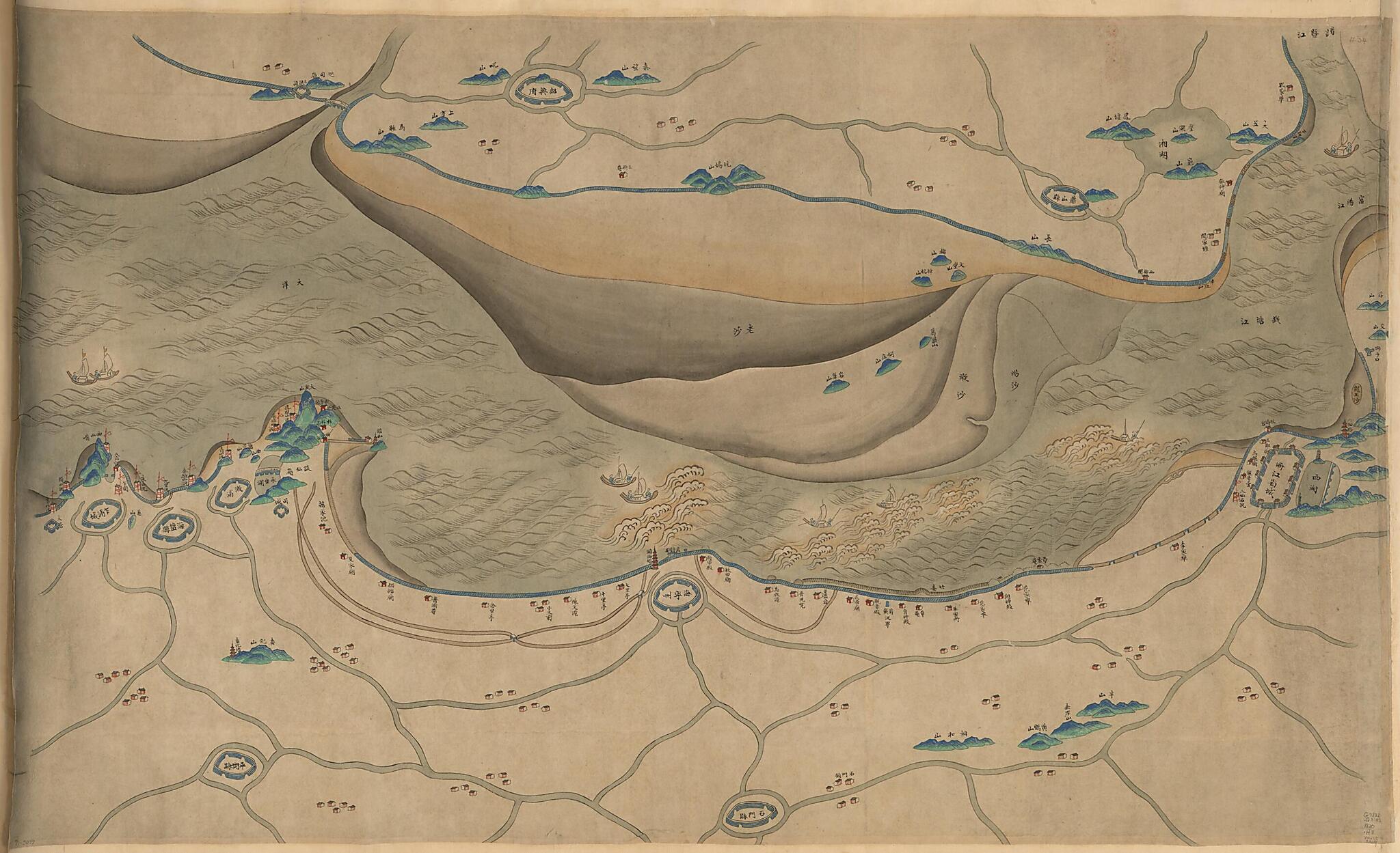
Qiantang Jiang Yan an Tu (钱塘江沿岸圖, Hangzhou Wan Tu, Coastal Map of the Qiantang River) 1775
- Regular price
-
$115.95 - Regular price
-
$110.95 - Sale price
-
$115.95
Shipping calculated at checkout.
Buy one map, get any other map in our collection for 50% OFF! Add to cart to see discount.
Couldn't load pickup availability
About This Map
Old pictorial map / manuscript map of China, Qiantang River.
Created by Arthur W. (Arthur William) Hummel in 1775.
Created by Arthur W. (Arthur William) Hummel in 1775.
- Scale ca. 1:120,000.
- Title supplied.
- Oriented with north to the bottom.
- Relief shown pictorially.
- Pictorial map.
- Hummel purchase 1930, no. 34.
- Shows area along Qiantang River, especially the section of Hangzhou Bay in Zhejiang Province.
- Previous call number: G7822.Q3A5 1820 .H3 Vault Shelf
Map Subjects
China
Manuscript Maps
Pictorial Maps
Qiantang River
Qiantang River (China)
Pictorial Maps
Manuscript Maps
Arthur W. (Arthur William) Hummel
1775
Map Sizing Information
- For the best legibility, order your map in the original size or larger. Most maps have intricate detail and small text that is best appreciated when the print size hasn't been reduced.
- Sizes labeled "Fits a Standard Frame" will drop right into any frame that you purchase in that size. The sizes that we offer are commonly available online and at most retail stores.
- Our standard sizes are recommendations based on the aspect ratio of the original map, but still may require some added "white space" in one dimension to fit.
- Non-standard sizes will require custom framing, and we suggest taking your print to the frame shop of your choice after you receive it for the best results.
- Custom sizes are available, simply contact us for a quote.
Below is an approximation of the scale of a few standard sizes, and how they might appear in your space.
