
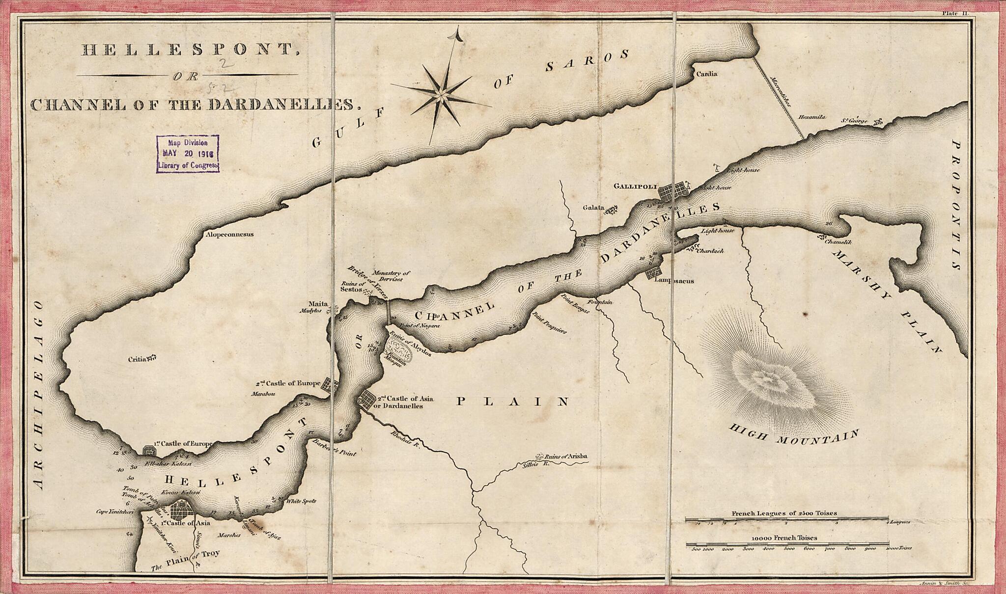
Hellespont Or Channel of the Dardanelles 1830
- Regular price
-
$49.95 - Regular price
-
$29.95 - Sale price
-
$49.95
Buy one map, get any other map in our collection for 50% OFF! Add to cart to see discount.
Couldn't load pickup availability
About This Map
Discover the timeless beauty of our fine art quality printed reproduction of this antique map. Perfect for history enthusiasts, collectors, and interior decorators.
Restored with meticulous attention to detail by our team with over a decade of experience, this stunning reproduction captures the intricate artistry and historical significance of the original map.
Whether you're a collector or seeking a unique decor piece, this archival-quality map reproduction is a timeless addition to any space. Order now to bring history to life!
Old map of Dardanelles Strait, Turkey.Created by Annin & Smith, Millard Fillmore in 1830.
- Relief shown by hachures; depths shown by soundings.
- When affixed to the cloth backing the map sheet was sectioned to 3 panels to enable folding.
- Handwritten signature of Millard Fillmore is not present.
- This map has some imperfections: lightly foxed, additionally fold-lined, hemmed by pink fabric. We'll do our best to restore the image before printing.
- Includes 2 bar scales: French leagues of 2500 toises -- 10000 French toises.
- Filing title in ink script on cover verso: Hellespont or Dardanells [thus], No. 156.
- Paper tab with ink script affixed to cover verso: Hellespont of Dardanells [thus] in Turkey--No.156.
- In upper margin at right: Plate II.
Map Subjects
Dardanelles Strait
Dardanelles Strait (Turkey)
Turkey
Annin & Smith
Millard Fillmore
1830
- For the best legibility, order your map in the original size or larger. Most maps have intricate detail and small text that is best appreciated when the print size hasn't been reduced.
- Sizes labeled "Fits a Standard Frame" will drop right into any frame that you purchase in that size. The sizes that we offer are commonly available online and at most retail stores.
- Our standard sizes are recommendations based on the aspect ratio of the original map, but still may require some added "white space" in one dimension to fit.
- Non-standard sizes will require custom framing, and we suggest taking your print to the frame shop of your choice after you receive it for the best results.
- Custom sizes are available, simply contact us for a quote.
Below is an approximation of the scale of a few standard sizes, and how they might appear in your space.
