

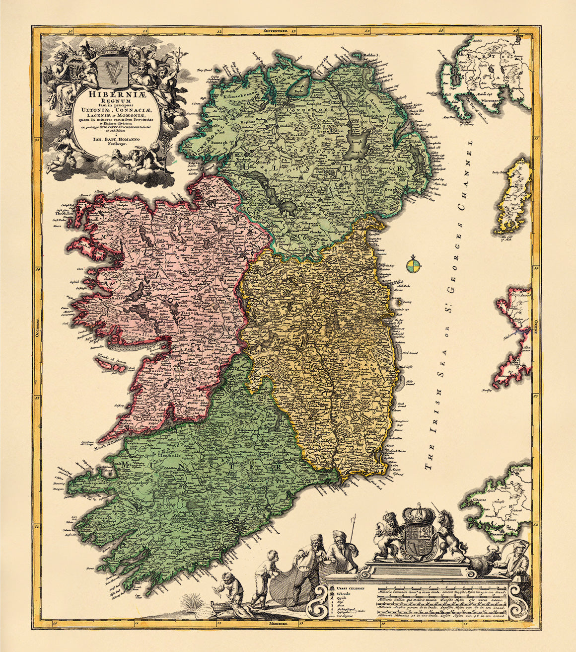
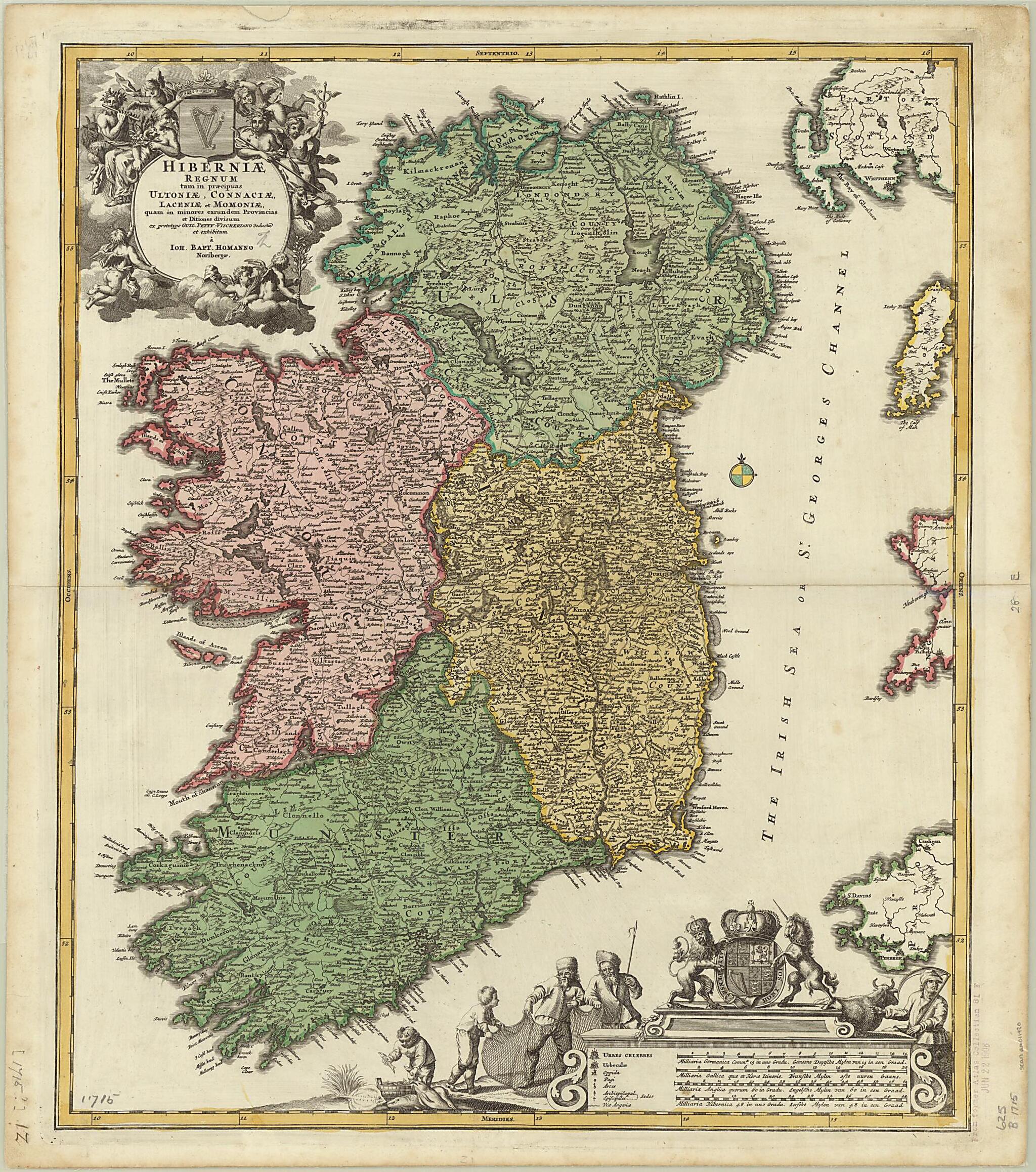
The Kingdom of Ireland, Divided As Much Into the Main Regions of Ulster, Connacht, Leinster and Munster. (Hiberniæ Regnum Tam In Præcipuas Ultoniæ, Connaciæ, Laceniæ Et Momoniæ, Quam In Minores Earundem Provincias Et Ditiones Divisum) 1715
- Regular price
-
$61.95 - Regular price
-
$56.95 - Sale price
-
$61.95
Buy one map, get any other map in our collection for 50% OFF! Add to cart to see discount.
Couldn't load pickup availability
About This Map
Discover the timeless beauty of our fine art quality printed reproduction of this antique map. Perfect for history enthusiasts, collectors, and interior decorators.
Restored with meticulous attention to detail by our team with over a decade of experience, this stunning reproduction captures the intricate artistry and historical significance of the original map.
Whether you're a collector or seeking a unique decor piece, this archival-quality map reproduction is a timeless addition to any space. Order now to bring history to life!
Old map of Ireland, Northern Ireland, United Kingdom of Great Britain and Northern Ireland.colored map of Ireland was published in 1715 by the firm of Nuremberg engraver and publisher Johann Baptist Homann (1663--1724). It is based on earlier works by Nicolaes Visscher (1649-1702), of the second of three generations of Visschers who were art dealers and map publishers in Amsterdam, and Sir William Petty (1623--87), the pioneering English political economist who directed the nationwide cadastral survey of Ireland carried out under Oliver Cromwell in 1656--58. The map is in Latin, but place-names are in English and the original Celtic renderings into English. It has a decorative title cartouche and a scale cartouche. Four distance scales are provided: German, French, English, and Irish miles. Different colors are used to show the four historic provinces of Ireland: Connaught, Leinster, Munster, and Ulster. The map shows the counties and baronies within the provinces, archbishoprics, cities and towns, major roads, and other geographic features. The decorative cartouche in the lower right containing the distance scales shows men engaged in two forms of economic activity, fishing and agriculture. The cartouche is crowned by the British royal coat of arms, consisting of a shield supported by a lion and a unicorn and surrounded by a garter with the Anglo-Norman maxim honi soit qui mal y pense (shamed be he who thinks evil of it).
Created by Johann Baptist Homann, William Petty, Nicolaes Visscher in 1715.
- Title devised, in English, by Library staff.
- Original resource extent: 1 map : color ; 54.4 x 46 centimeters.
- Original resource at: University of Wisconsin-Milwaukee Libraries.
- Content in English and Latin.
- Description based on data extracted from World Digital Library, which may be extracted from partner institutions.
Map Subjects
Administrative And Political Divisions
Ireland
Islands
Northern Ireland
United Kingdom Of Great Britain And Northern Ireland
Johann Baptist Homann
William Petty
Nicolaes Visscher
1715
- For the best legibility, order your map in the original size or larger. Most maps have intricate detail and small text that is best appreciated when the print size hasn't been reduced.
- Sizes labeled "Fits a Standard Frame" will drop right into any frame that you purchase in that size. The sizes that we offer are commonly available online and at most retail stores.
- Our standard sizes are recommendations based on the aspect ratio of the original map, but still may require some added "white space" in one dimension to fit.
- Non-standard sizes will require custom framing, and we suggest taking your print to the frame shop of your choice after you receive it for the best results.
- Custom sizes are available, simply contact us for a quote.
Below is an approximation of the scale of a few standard sizes, and how they might appear in your space.

