


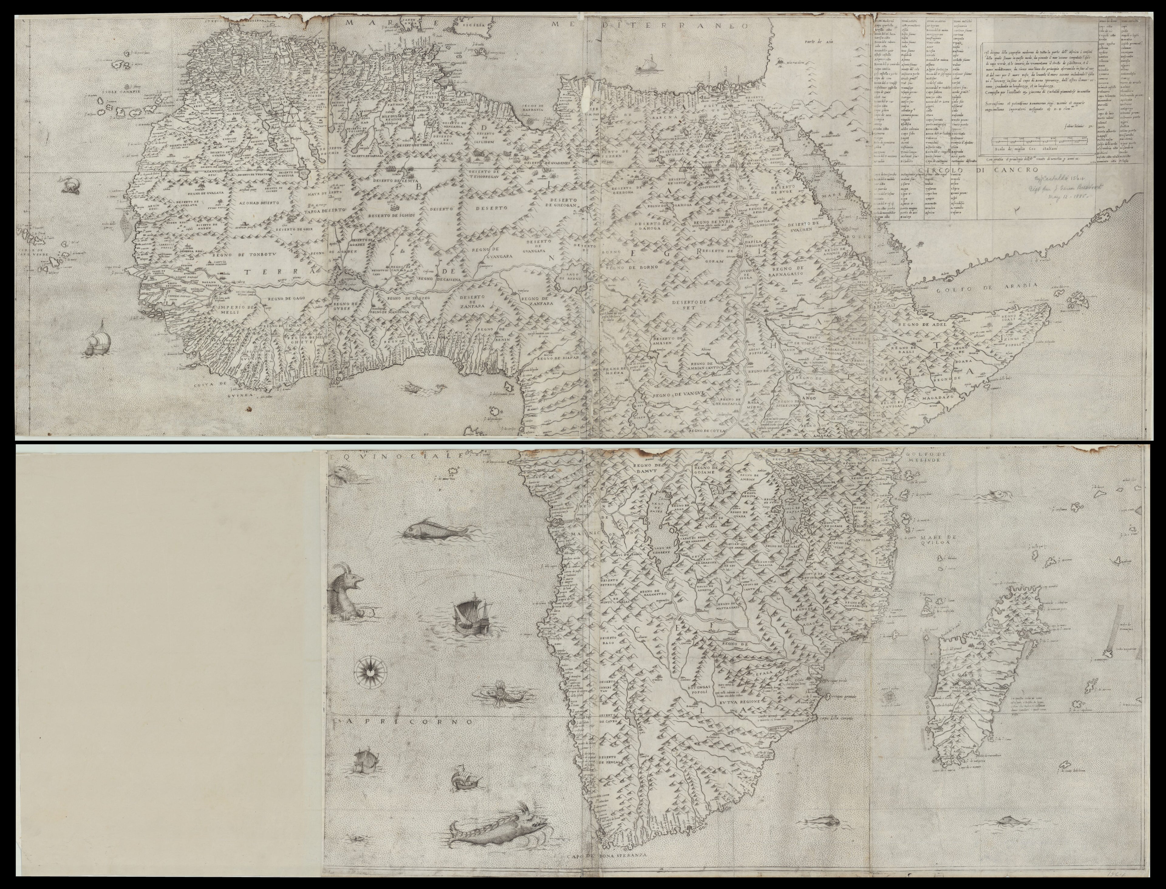
The Drawing of the Modern Geography of the Whole Africa. (Il Disegno Della Geografia Moderna De Tutta La Parte Dell'Africa) 1564
- Regular price
-
$232.95 - Regular price
-
$227.95 - Sale price
-
$232.95
Buy one map, get any other map in our collection for 50% OFF! Add to cart to see discount.
Couldn't load pickup availability
About This Map
Discover the timeless beauty of our fine art quality printed reproduction of this antique map. Perfect for history enthusiasts, collectors, and interior decorators.
Restored with meticulous attention to detail by our team with over a decade of experience, this stunning reproduction captures the intricate artistry and historical significance of the original map.
Whether you're a collector or seeking a unique decor piece, this archival-quality map reproduction is a timeless addition to any space. Order now to bring history to life!
scale map of Africa produced in the 16th century. Earlier maps were mostly printed from woodcuts; copperplates allowed the engraver to reproduce much more detail and finesse. The map was made by the Italian cartographer, engineer, and astronomer Giacomo Gastaldi (circa 1500--66) and engraved by Fabricius Licinus (circa 1521--65). The map depicts a stippled sea, ships, and sea creatures, both real and mythical. The interior is covered by mountains that are shaded on the western edges to indicate perpetual sunshine. Place-names are abundant; cape and bay names are from Portuguese and Arab sources. Gastaldi, who was cosmographer to the Republic of Venice, is regarded by many scholars as the greatest cartographer of the Italian school. This map was used as an important source by later 16th and 17th century cartographers, including Ortelius, de Jode, Magini, and Mercator. Eight other copies have been reported to exist over the years, including one in the British Museum and another in the Bibliothèque nationale de France.Created by Giacomo Gastaldi, Fabricius Licinus in 1564.
- Title devised, in English, by Library staff.
- "Includes a three-column table comparing contemporary and ancient place names. Map originally on 8 sheets. Bottom left sheet missing from AGS Library copy; missing sheet depicts ocean and sea creatures."--Note extracted from World Digital Library.
- Original resource extent: 1 map ; 108 x 142 centimeters.
- Original resource at: University of Wisconsin-Milwaukee Libraries.
- Content in Italian.
- Description based on data extracted from World Digital Library, which may be extracted from partner institutions.
- For the best legibility, order your map in the original size or larger. Most maps have intricate detail and small text that is best appreciated when the print size hasn't been reduced.
- Sizes labeled "Fits a Standard Frame" will drop right into any frame that you purchase in that size. The sizes that we offer are commonly available online and at most retail stores.
- Our standard sizes are recommendations based on the aspect ratio of the original map, but still may require some added "white space" in one dimension to fit.
- Non-standard sizes will require custom framing, and we suggest taking your print to the frame shop of your choice after you receive it for the best results.
- Custom sizes are available, simply contact us for a quote.
Below is an approximation of the scale of a few standard sizes, and how they might appear in your space.

