
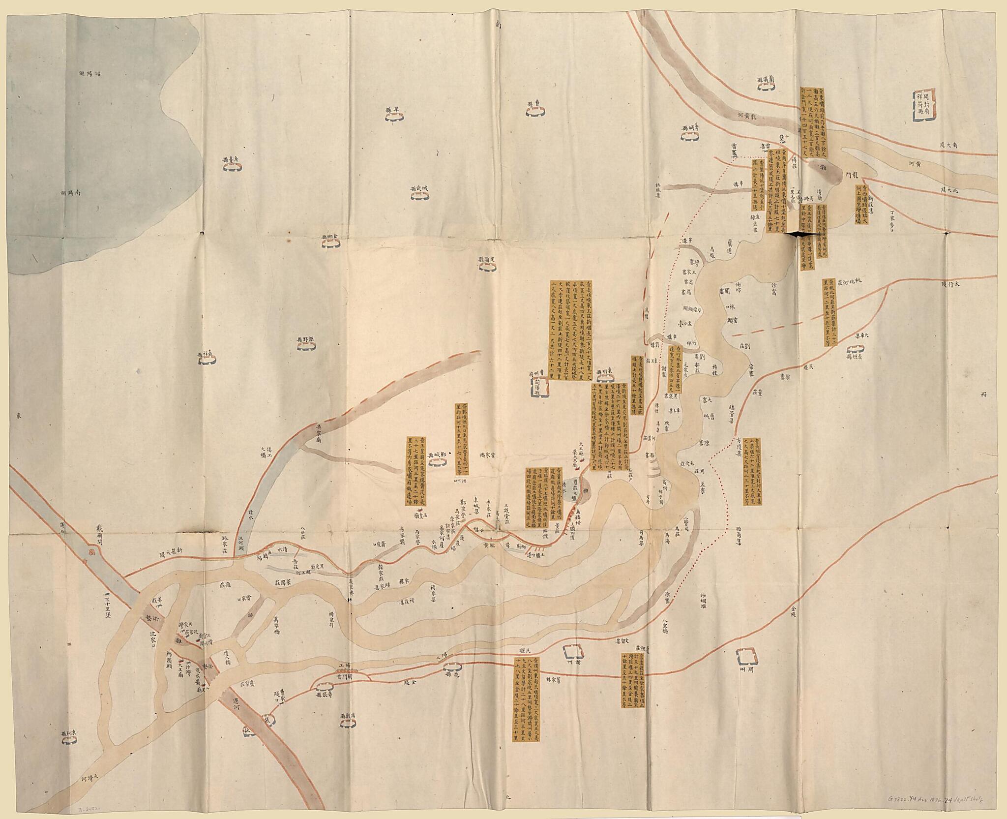
Tongwaxiang Yi Xia Huang He Chuan Yun Di Gong Tu Tie Shuo (銅瓦廂以下黃河穿運隄工圖貼说, Illustrated Map of the Yellow River's Embankment Project In Tongwaxiang) 1875
- Regular price
-
$116.95 - Regular price
-
$111.95 - Sale price
-
$116.95
Buy one map, get any other map in our collection for 50% OFF! Add to cart to see discount.
Couldn't load pickup availability
About This Map
Discover the timeless beauty of our fine art quality printed reproduction of this antique map. Perfect for history enthusiasts, collectors, and interior decorators.
Restored with meticulous attention to detail by our team with over a decade of experience, this stunning reproduction captures the intricate artistry and historical significance of the original map.
Whether you're a collector or seeking a unique decor piece, this archival-quality map reproduction is a timeless addition to any space. Order now to bring history to life!
Old map of China, Yellow River.Created by Arthur W. (Arthur William) Hummel, Guoquan Zeng in 1875.
- Shows the dike system along the section of the Yellow River between Tongwaxiang and the Grand Canal, the most frequently flooded section of the river.
- Title supplied.
- Oriented with north to the bottom.
- Includes text on labels pasted on.
- Gift; Arthur William Hummel; 1962, no. 10.
Map Subjects
China
Flood Control
Maps Manuscript
Yellow River
Yellow River (China)
Arthur W. (Arthur William) Hummel
Guoquan Zeng
1875
- For the best legibility, order your map in the original size or larger. Most maps have intricate detail and small text that is best appreciated when the print size hasn't been reduced.
- Sizes labeled "Fits a Standard Frame" will drop right into any frame that you purchase in that size. The sizes that we offer are commonly available online and at most retail stores.
- Our standard sizes are recommendations based on the aspect ratio of the original map, but still may require some added "white space" in one dimension to fit.
- Non-standard sizes will require custom framing, and we suggest taking your print to the frame shop of your choice after you receive it for the best results.
- Custom sizes are available, simply contact us for a quote.
Below is an approximation of the scale of a few standard sizes, and how they might appear in your space.

