
Image 22 of Sketch Book of Jed. Hotchkiss, Capt. & Top. Eng., Hd. Qrs., 2nd Corps, Army of N. Virginia : Virginia from Sketch Book of Jed. Hotchkiss, Capt. & Top. Eng., Hd. Qrs., 2nd Corps, Army of N. Virginia : Virginia 1862
- Regular price
-
$49.95 - Regular price
-
$18.95 - Sale price
-
$49.95
Buy one map, get any other map in our collection for 50% OFF! Add to cart to see discount.
Couldn't load pickup availability
About This Map
Discover the timeless beauty of our fine art quality printed reproduction of this antique map. Perfect for history enthusiasts, collectors, and interior decorators.
Restored with meticulous attention to detail by our team with over a decade of experience, this stunning reproduction captures the intricate artistry and historical significance of the original map.
Whether you're a collector or seeking a unique decor piece, this archival-quality map reproduction is a timeless addition to any space. Order now to bring history to life!
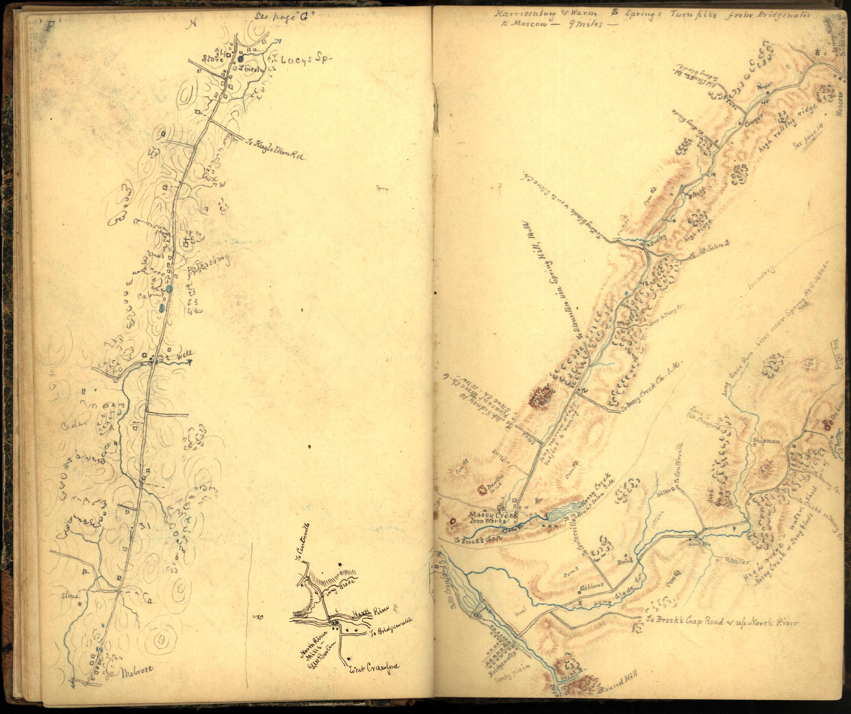
Old manuscript map / atlas of Maryland, Montgomery County, , Virginia.Created by 1899 in 1862.
- Shows general maps of northwestern Virginia and parts of Montgomery County, Maryland, with some showing roads, troop movements, and the names of some residents.
- Relief shown by hachures.
- "This volume is my field sketch book that I used during the Civil War. Most of the sketches were made on horseback just as they now appear. The colored pencils used were kept in the places fixed on the outside of the other cover. These topographical sketches were often used in conferences with Generals Jackson, Ewell and Early. The cover of this book is a blank Federal commission found in Gen. Milroy's quarters at Winchester, Jed. Hotchkiss"--Parchment Cover.
- On sticker on end papers: If not delivered in 3 days, return to Jed. Hotchkiss, consulting mining engineer, ... .
- Pencil (some col.).
- Brown leather spine with marbled boards. Covered by a parchment book cover with a five compartment pencil pocket sewn to the back.
- Leaves [1-3] on tipped in yellow paper. Leaf inserted between leaves 85 and 86.
- Accompanied by: Three sheets of manuscript notes attributed to Thomas Jonathan (Stonewall) Jackson.
- Includes notes.
- This map has some imperfections: leaf 38 wanting. 1 leaf wanting from 40 blank leaves. approximately 20 sheets wanting at end. We'll do our best to restore the image before printing.
Map Subjects
Atlases
Civil War
History
Landowners
Manuscript Maps
Maps Manuscript
Maryland
Montgomery County
Montgomery County (Md.)
Roads
United States
Virginia
1899
1862
Image 22 Of Sketch Book Of Jed. Hotchkiss Capt. & Top. Eng. Hd. Qrs. 2nd Corps Army Of N. Virginia : [Virginia]
Sketch Book Of Jed. Hotchkiss Capt. & Top. Eng. Hd. Qrs. 2nd Corps Army Of N. Virginia : [Virginia]
- For the best legibility, order your map in the original size or larger. Most maps have intricate detail and small text that is best appreciated when the print size hasn't been reduced.
- Sizes labeled "Fits a Standard Frame" will drop right into any frame that you purchase in that size. The sizes that we offer are commonly available online and at most retail stores.
- Our standard sizes are recommendations based on the aspect ratio of the original map, but still may require some added "white space" in one dimension to fit.
- Non-standard sizes will require custom framing, and we suggest taking your print to the frame shop of your choice after you receive it for the best results.
- Custom sizes are available, simply contact us for a quote.
Below is an approximation of the scale of a few standard sizes, and how they might appear in your space.

