
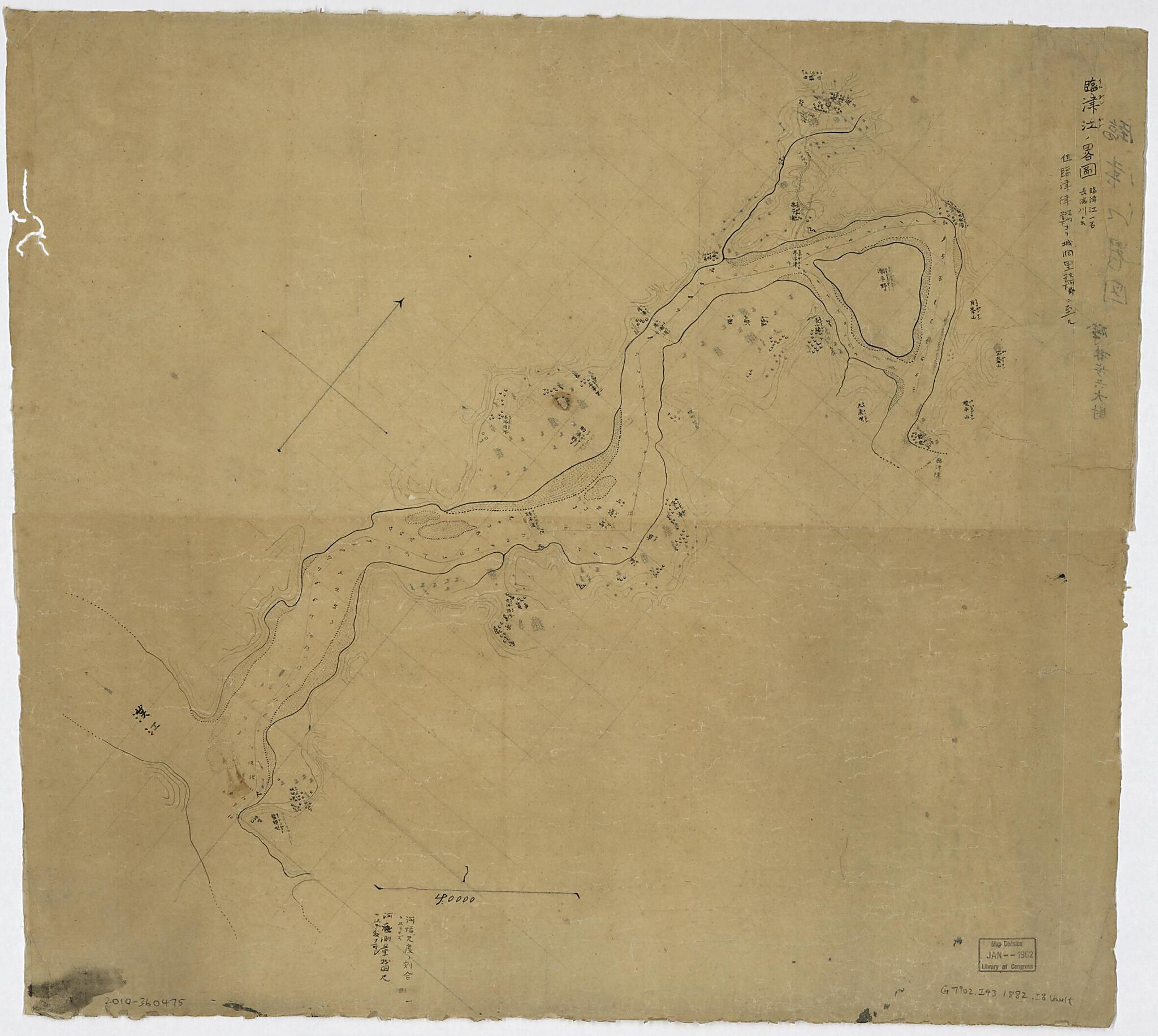
Gun Kanka Ni Itaru (臨津江ノ畧圖 : 臨津江一名長湍川ト云 : 但臨津津坡州管下ヨリ城洞里交河郡管下ニ至ル /, Imujingagu No Ryakuzu furigana, Reading Given) 1882
- Regular price
-
$62.95 - Regular price
-
$57.95 - Sale price
-
$62.95
Buy one map, get any other map in our collection for 50% OFF! Add to cart to see discount.
Couldn't load pickup availability
About This Map
Discover the timeless beauty of our fine art quality printed reproduction of this antique map. Perfect for history enthusiasts, collectors, and interior decorators.
Restored with meticulous attention to detail by our team with over a decade of experience, this stunning reproduction captures the intricate artistry and historical significance of the original map.
Whether you're a collector or seeking a unique decor piece, this archival-quality map reproduction is a timeless addition to any space. Order now to bring history to life!
Old manuscript map of Imjim River Region, Imjin River Region, Korea.Created by Shinzō Isobayashi in 1882.
- Relief shown by form lines. Depths shown by soundings.
- "朝紀三十号・第四棚" --Written in red on verso.
- "河幅ハ尺度ノ割合ヲ以テセズ・河底測量我国尺ヲ以テ数フ可シ"--At bottom.
Map Subjects
Imjim River Region
Imjin River Region (Korea)
Korea
Manuscript Maps
Imjin River Region
Manuscript Maps
Shinzō Isobayashi
1882
- For the best legibility, order your map in the original size or larger. Most maps have intricate detail and small text that is best appreciated when the print size hasn't been reduced.
- Sizes labeled "Fits a Standard Frame" will drop right into any frame that you purchase in that size. The sizes that we offer are commonly available online and at most retail stores.
- Our standard sizes are recommendations based on the aspect ratio of the original map, but still may require some added "white space" in one dimension to fit.
- Non-standard sizes will require custom framing, and we suggest taking your print to the frame shop of your choice after you receive it for the best results.
- Custom sizes are available, simply contact us for a quote.
Below is an approximation of the scale of a few standard sizes, and how they might appear in your space.

