
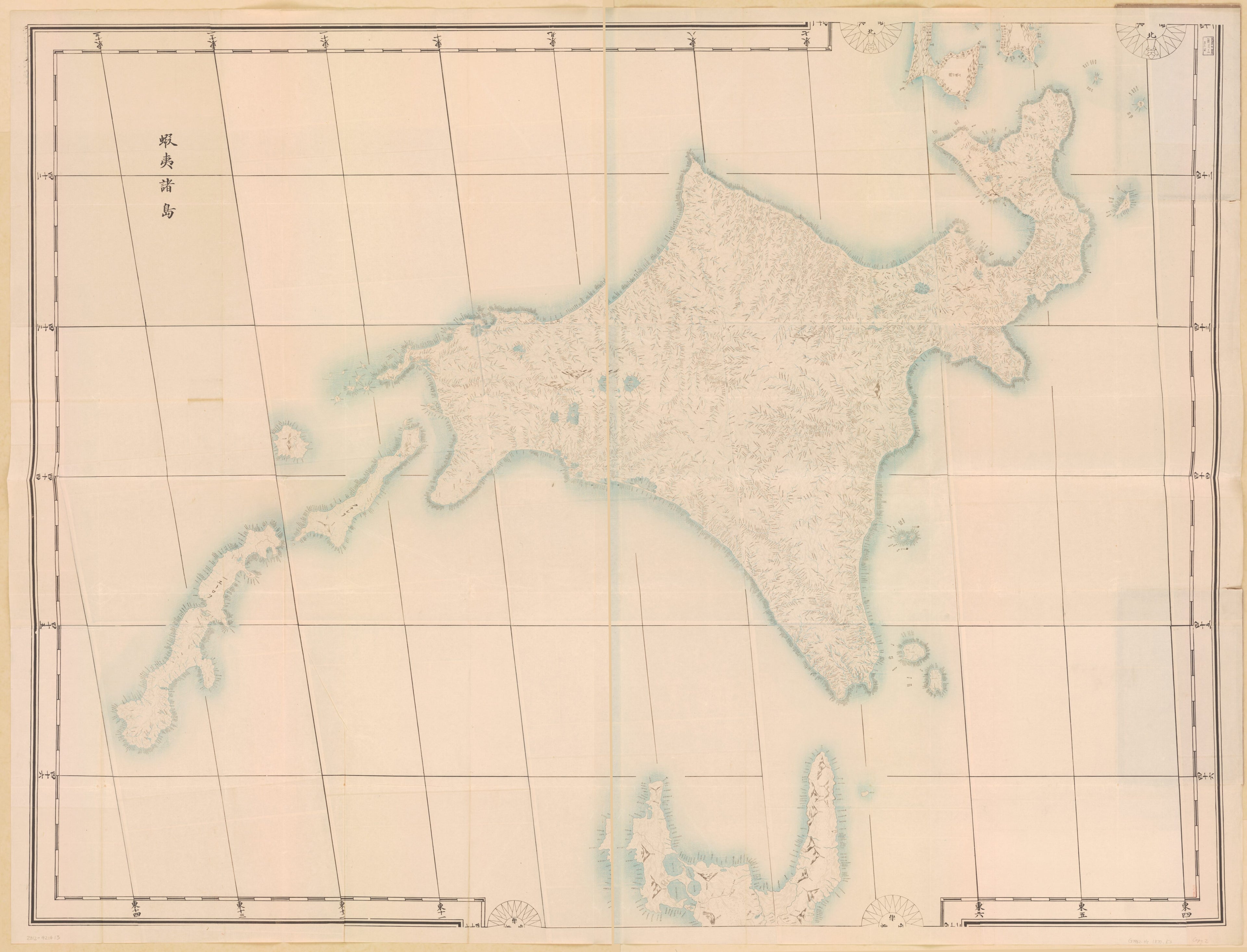
官板・實測日本地圖, Jissoku Nihon Chizu, Ezo Shotō in 1870
- Regular price
-
$227.95 - Regular price
-
$222.95 - Sale price
-
$227.95
Shipping calculated at checkout.
Buy one map, get any other map in our collection for 50% OFF! Add to cart to see discount.
Couldn't load pickup availability
About This Map
Old map of Hokkaido, Japan.
Created by Tadataka Inō in 1870.
Created by Tadataka Inō in 1870.
- Relief shown pictorially and by hachures.
- Title from cover pasted on verso.
- Includes Etorofu and Kunashiri islands.
- "大學南校"--Stamped on copy 2.
- NACSIS Webcat, 2012-09-11 (實測日本地圖 ... 著者名: 伊能忠敬).
Map Sizing Information
- For the best legibility, order your map in the original size or larger. Most maps have intricate detail and small text that is best appreciated when the print size hasn't been reduced.
- Sizes labeled "Fits a Standard Frame" will drop right into any frame that you purchase in that size. The sizes that we offer are commonly available online and at most retail stores.
- Our standard sizes are recommendations based on the aspect ratio of the original map, but still may require some added "white space" in one dimension to fit.
- Non-standard sizes will require custom framing, and we suggest taking your print to the frame shop of your choice after you receive it for the best results.
- Custom sizes are available, simply contact us for a quote.
Below is an approximation of the scale of a few standard sizes, and how they might appear in your space.

