
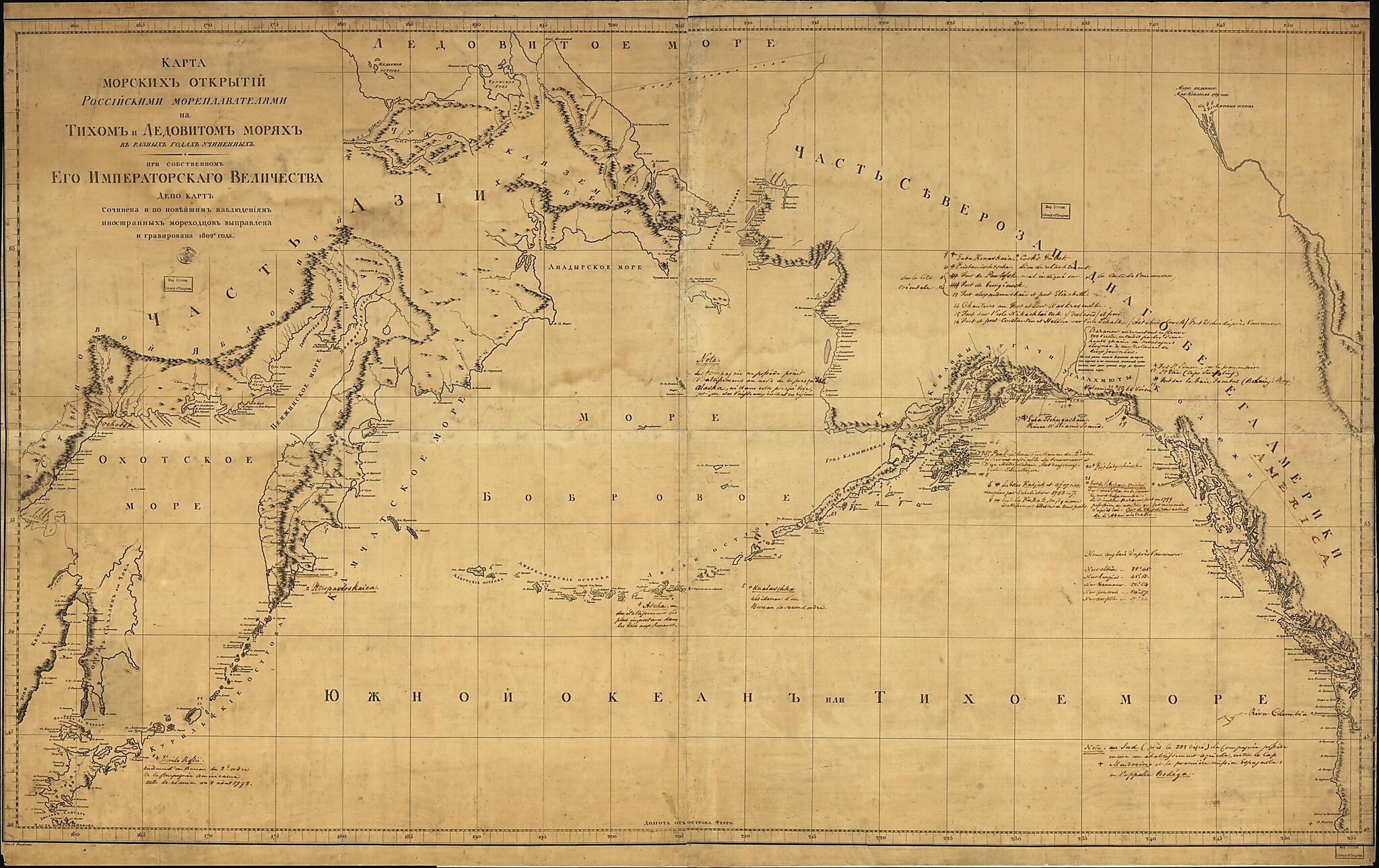
Karta Morskikh Otkrytīĭ Rosīĭskimi Moreplavateli︠a︡mi Na Tikhom I Ledovitom Mori︠a︡kh : V Raznykh Godakh Uchinennykh in 1802
- Regular price
-
$139.95 - Regular price
-
$134.95 - Sale price
-
$139.95
Buy one map, get any other map in our collection for 50% OFF! Add to cart to see discount.
Couldn't load pickup availability
About This Map
Discover the timeless beauty of our fine art quality printed reproduction of this antique map. Perfect for history enthusiasts, collectors, and interior decorators.
Restored with meticulous attention to detail by our team with over a decade of experience, this stunning reproduction captures the intricate artistry and historical significance of the original map.
Whether you're a collector or seeking a unique decor piece, this archival-quality map reproduction is a timeless addition to any space. Order now to bring history to life!
Old map of Alaska, Arctic Ocean, North Pacific Ocean, Russia (Federation), Russian Far East, Russian Federation, United States.Created by Russia. Depo Kart, Alexander Wilbrecht in 1802.
- General map covering North Pacific Ocean, small part of Arctic Ocean north of Bering Strait, and the adjacent coastal regions of Russian Far East and Alaska. Printed map does not show specifically identified discoveries or explorers' routes.
- Relief shown pictorially.
- Title and place-names in old-orthography Russian; added notes in French.
- Facsim. reproductions (5 copies) of this map are separately cataloged under the class. no. G9236.S12 1802 .R8 1898; control no. 99-447844.
- Prime meridian: Ferro.
- Originally printed on 4 sheets (conjoined to form single sheet).
- Includes handwritten notes in French describing specific later discoveries and latitude/longitude positions of place-names.
Map Subjects
Alaska
Arctic Ocean
Coasts
Discovery And Exploration
North Pacific Ocean
Russia (Federation)
Russian Far East
United States
Russian Federation
Russia. Depo Kart
Alexander Wilbrecht
1802
- For the best legibility, order your map in the original size or larger. Most maps have intricate detail and small text that is best appreciated when the print size hasn't been reduced.
- Sizes labeled "Fits a Standard Frame" will drop right into any frame that you purchase in that size. The sizes that we offer are commonly available online and at most retail stores.
- Our standard sizes are recommendations based on the aspect ratio of the original map, but still may require some added "white space" in one dimension to fit.
- Non-standard sizes will require custom framing, and we suggest taking your print to the frame shop of your choice after you receive it for the best results.
- Custom sizes are available, simply contact us for a quote.
Below is an approximation of the scale of a few standard sizes, and how they might appear in your space.
