
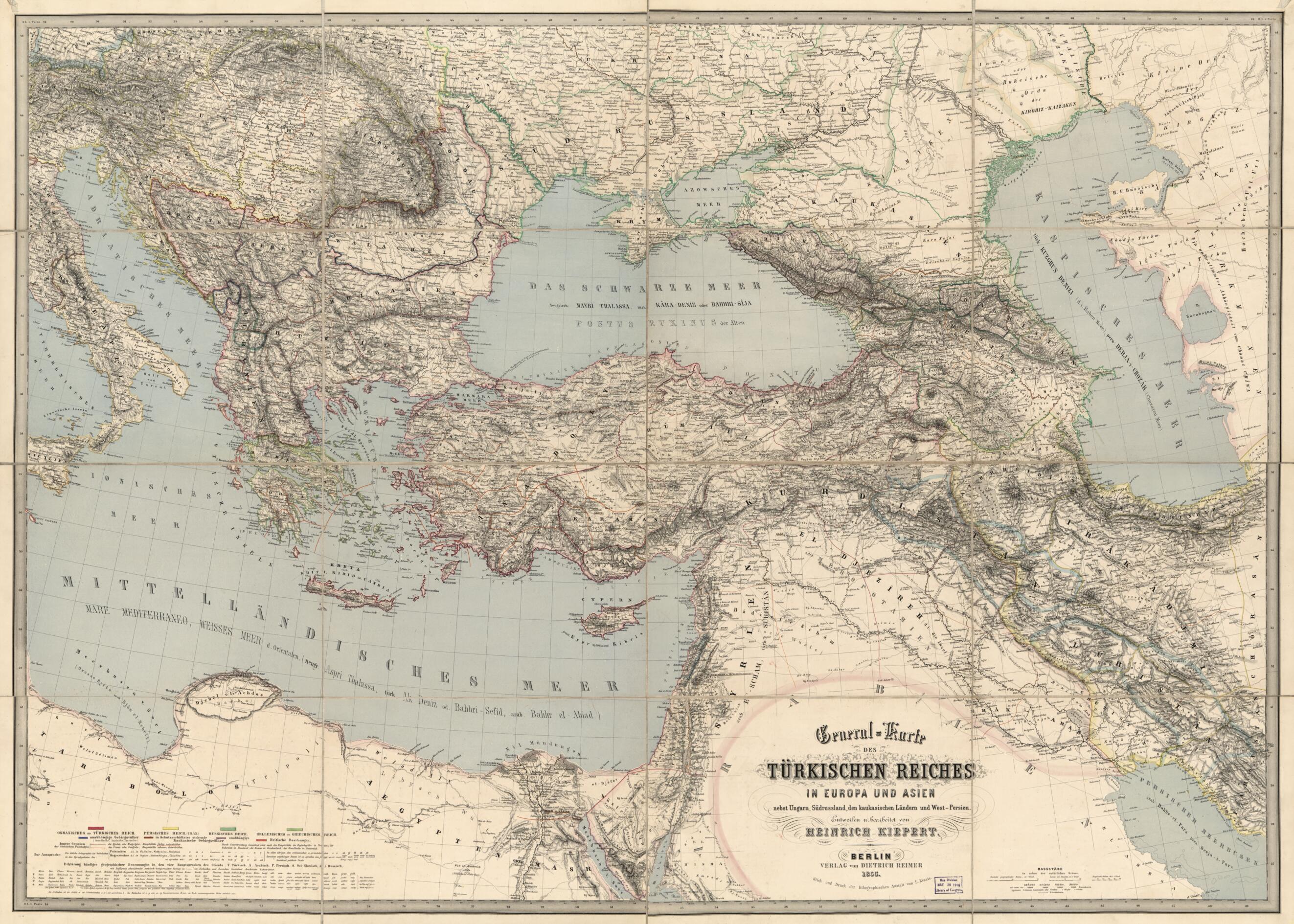
Karte Des Türkischen Reiches In Europa Und Asien : Nebst Ungarn, Südrussland, Den Kaukasischen Ländern Und West-Persien 1855
- Regular price
-
$168.95 - Regular price
-
$163.95 - Sale price
-
$168.95
Buy one map, get any other map in our collection for 50% OFF! Add to cart to see discount.
Couldn't load pickup availability
About This Map
Discover the timeless beauty of our fine art quality printed reproduction of this antique map. Perfect for history enthusiasts, collectors, and interior decorators.
Restored with meticulous attention to detail by our team with over a decade of experience, this stunning reproduction captures the intricate artistry and historical significance of the original map.
Whether you're a collector or seeking a unique decor piece, this archival-quality map reproduction is a timeless addition to any space. Order now to bring history to life!
Old wall map of Balkan Peninsula, Middle East, Turkey.Created by Germany) Dietrich Reimer Verlag (Berlin, Millard Fillmore, Heinrich Kiepert in 1855.
- General-content wall map of the Ottoman Empire (which included much of the Middle East and part of the Balkan Peninsula).
- Relief shown by hachures.
- Title from map area and from blue printed title sheet affixed to cloth backing verso (identical titles).
- Prime meridians: Greenwich, Ferro, and Paris.
- Hand colored to emphasize boundaries and coastlines.
- When affixed to the cloth backing the map sheet was sectioned to 16 panels to enable folding.
- Handwritten (cursive script) inked identification slip affixed to cloth backing verso: Millard Fillmore, Bo't at Berlin, Oct. 20, 1855, $2.50.
- For the best legibility, order your map in the original size or larger. Most maps have intricate detail and small text that is best appreciated when the print size hasn't been reduced.
- Sizes labeled "Fits a Standard Frame" will drop right into any frame that you purchase in that size. The sizes that we offer are commonly available online and at most retail stores.
- Our standard sizes are recommendations based on the aspect ratio of the original map, but still may require some added "white space" in one dimension to fit.
- Non-standard sizes will require custom framing, and we suggest taking your print to the frame shop of your choice after you receive it for the best results.
- Custom sizes are available, simply contact us for a quote.
Below is an approximation of the scale of a few standard sizes, and how they might appear in your space.

