
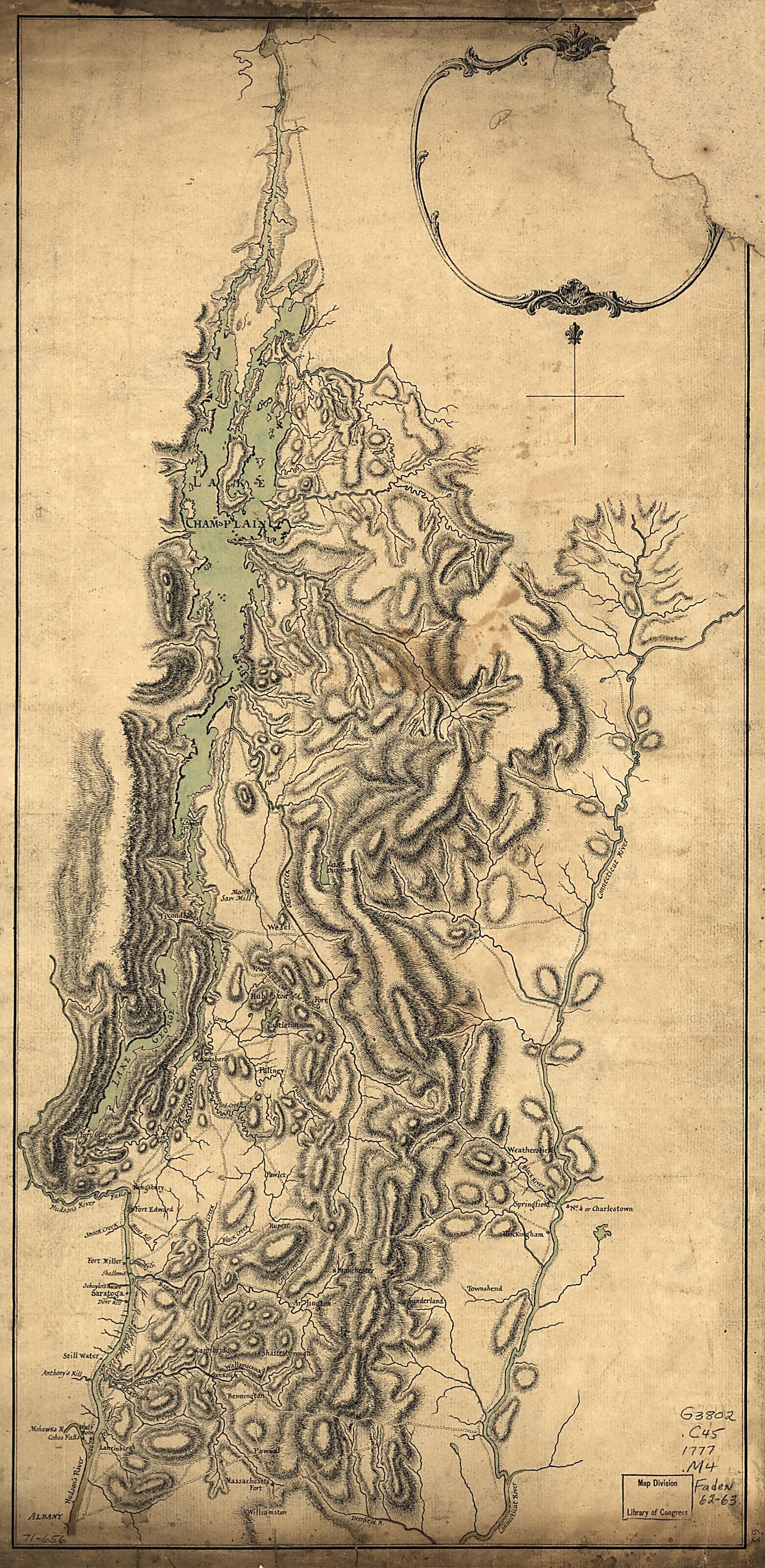
Lake Champlain and Lake George, and the Country Between the Hudson and the Lakes On the West, and Connecticut River On the East in 1777
- Regular price
-
$49.95 - Regular price
-
$29.95 - Sale price
-
$49.95
Buy one map, get any other map in our collection for 50% OFF! Add to cart to see discount.
Couldn't load pickup availability
About This Map
Discover the timeless beauty of our fine art quality printed reproduction of this antique map. Perfect for history enthusiasts, collectors, and interior decorators.
Restored with meticulous attention to detail by our team with over a decade of experience, this stunning reproduction captures the intricate artistry and historical significance of the original map.
Whether you're a collector or seeking a unique decor piece, this archival-quality map reproduction is a timeless addition to any space. Order now to bring history to life!
Old map of Champlain, Champlain, Lake, Region, Lake, Region, United States.Created by Medcalfe in 1777.
- Scale ca. 1:640,000.
- Title from William Faden's Catalogue of a curious and valuable collection of original maps and plans.
- Manuscript, pen-and-ink and watercolor.
- Has watermarks.
- This map has some imperfections: right upper corner is missing. We'll do our best to restore the image before printing.
- Base map from "A map of the country in which the army under Lt. General Burgoyne acted in the campaign of 1777, shewing the marches of the army & places of the principal actions. Drawn by Mr. Medcalfe & engraved by Wm. Faden" which was published in 1780 in Burgoyne's A state of the expedition from Canada, and in Faden's Atlas of the battles of the American Revolution. The manuscript lacks "the marches of the army & the places of the principal actions."
Map Subjects
Champlain Lake Region
Early Works To 1800
Maps Manuscript
United States
Champlain
Lake
Region
Medcalfe
1777
- For the best legibility, order your map in the original size or larger. Most maps have intricate detail and small text that is best appreciated when the print size hasn't been reduced.
- Sizes labeled "Fits a Standard Frame" will drop right into any frame that you purchase in that size. The sizes that we offer are commonly available online and at most retail stores.
- Our standard sizes are recommendations based on the aspect ratio of the original map, but still may require some added "white space" in one dimension to fit.
- Non-standard sizes will require custom framing, and we suggest taking your print to the frame shop of your choice after you receive it for the best results.
- Custom sizes are available, simply contact us for a quote.
Below is an approximation of the scale of a few standard sizes, and how they might appear in your space.

