
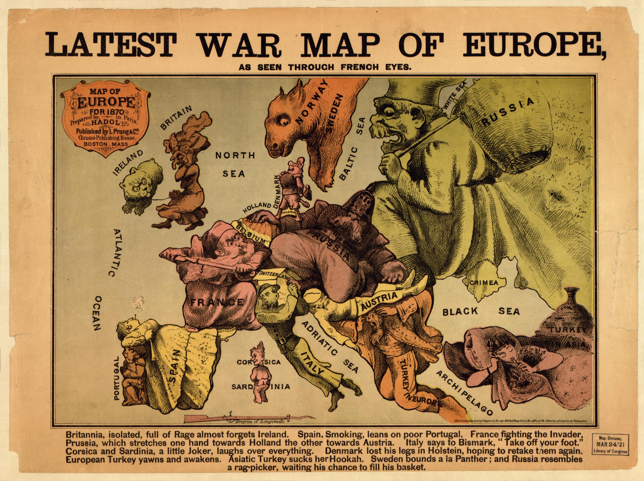
Latest War Map of Europe : As Seen Through French Eyes (Map of Europe :) 1870
- Regular price
-
$49.95 - Regular price
-
$29.95 - Sale price
-
$49.95
Buy one map, get any other map in our collection for 50% OFF! Add to cart to see discount.
Couldn't load pickup availability
About This Map
Discover the timeless beauty of our fine art quality printed reproduction of this antique map. Perfect for history enthusiasts, collectors, and interior decorators.
Restored with meticulous attention to detail by our team with over a decade of experience, this stunning reproduction captures the intricate artistry and historical significance of the original map.
Whether you're a collector or seeking a unique decor piece, this archival-quality map reproduction is a timeless addition to any space. Order now to bring history to life!
Old map of Europe.Created by Paul Hadol, L. Prang & Co in 1870.
- "Entered according to act of Congress in the year 1870 by L. Prang & Co., in the office of the Librarian of Congress of Washington."
- In lower margin: Britannia, full of Rage almost forgets Ireland. Spain, smoking, leans on poor Portugal. France fighting the invader, Prussia, which stretches one hand towards Holland the other towards Austria. Italy says to Bismark, "Take off your foot." Corsica and Sardinia, a little joker, laughs over everything. Denmark lost his legs in Holstein, hoping to retake them again. European Turkey yawns and awakens. Asiatic Turkey sucks her hookah. Sweden bounds a la panther; and Russia resembles a rag-picker, waiting his chance to fill his basket.
- For the best legibility, order your map in the original size or larger. Most maps have intricate detail and small text that is best appreciated when the print size hasn't been reduced.
- Sizes labeled "Fits a Standard Frame" will drop right into any frame that you purchase in that size. The sizes that we offer are commonly available online and at most retail stores.
- Our standard sizes are recommendations based on the aspect ratio of the original map, but still may require some added "white space" in one dimension to fit.
- Non-standard sizes will require custom framing, and we suggest taking your print to the frame shop of your choice after you receive it for the best results.
- Custom sizes are available, simply contact us for a quote.
Below is an approximation of the scale of a few standard sizes, and how they might appear in your space.

