
Ryōkō So Seki Goshō Kōrozu (Liang Jiang Chu Zhe Wu Sheng Xing Lu Tu) 1884
- Regular price
-
$107.95 - Regular price
-
$102.95 - Sale price
-
$107.95
Shipping calculated at checkout.
Buy one map, get any other map in our collection for 50% OFF! Add to cart to see discount.
Couldn't load pickup availability
About This Map
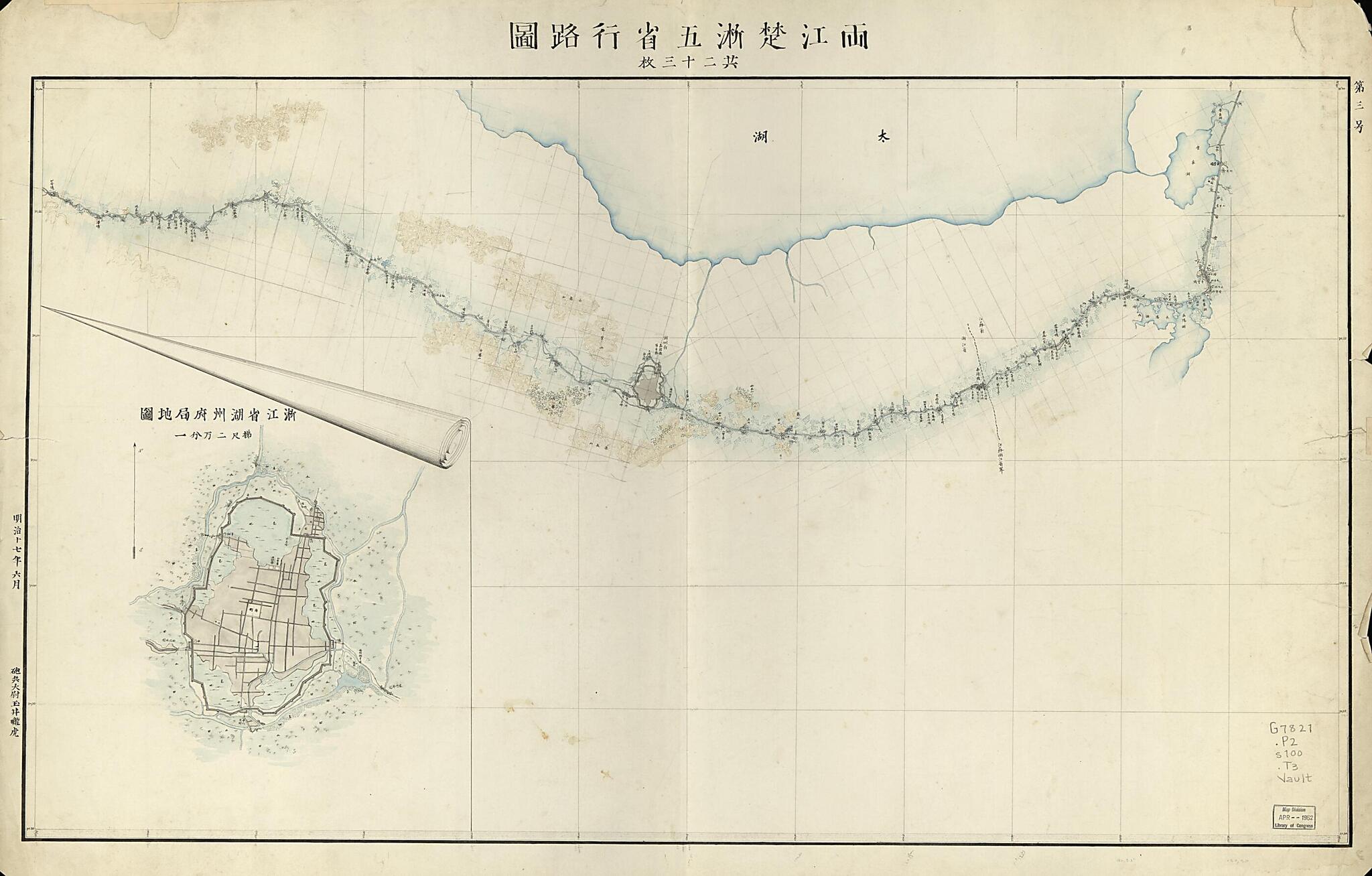
Old map of China.
Created by Rōko Tamai in 1884.
Created by Rōko Tamai in 1884.
- Shows cities, towns, villages, pavilions, stores, bridges, and weirs.
- Also shows type of road capable for usage of military vehicles.
- Covers 5 provinces of eastern China, including Zhejiang, Anhui, Jiangxi, Hubei, and Jiangsu.
- Relief shown by form lines.
- Pen-and-ink and watercolor.
- Includes notes, city insets, legend on map 1, maps of Suzhou Cheng and Chaozhou Cheng.
- Index map on verso.
- Set This map has some imperfections: wanting maps 6, 7, 9, 10, 11 and 14. We'll do our best to restore the image before printing.
- ARP
Map Subjects
China
Maps Manuscript
Roads
Strategic Aspects
Rōko Tamai
1884
Map Sizing Information
- For the best legibility, order your map in the original size or larger. Most maps have intricate detail and small text that is best appreciated when the print size hasn't been reduced.
- Sizes labeled "Fits a Standard Frame" will drop right into any frame that you purchase in that size. The sizes that we offer are commonly available online and at most retail stores.
- Our standard sizes are recommendations based on the aspect ratio of the original map, but still may require some added "white space" in one dimension to fit.
- Non-standard sizes will require custom framing, and we suggest taking your print to the frame shop of your choice after you receive it for the best results.
- Custom sizes are available, simply contact us for a quote.
Below is an approximation of the scale of a few standard sizes, and how they might appear in your space.
