
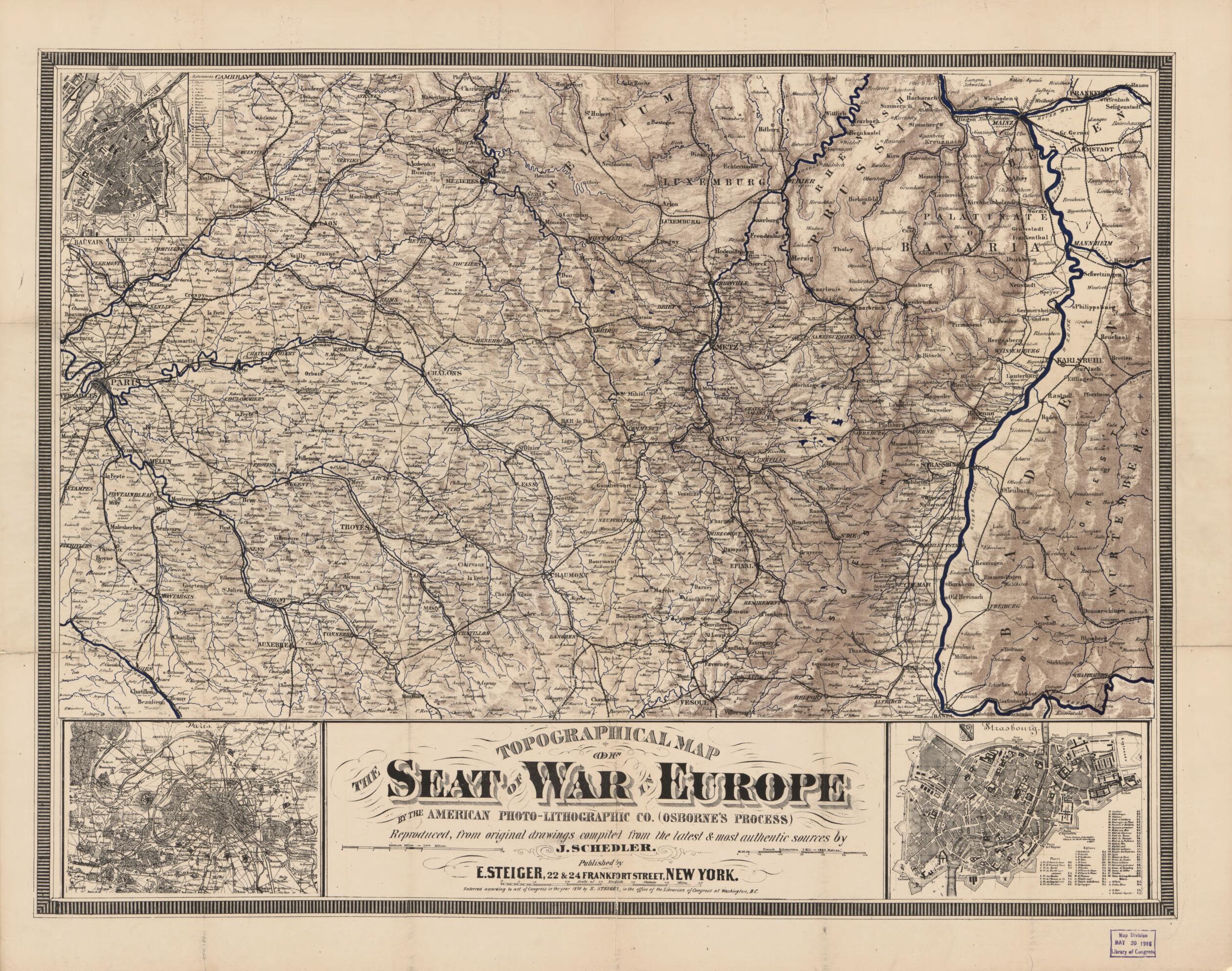
Lithographic Co. (Osborne's Process) ; Reproduced from Original Drawings Compiled from the Latest & Most Authentic Sources by J. Schedler. (Schedler's Topographical Map of the Seat of War :) 1870
- Regular price
-
$71.95 - Regular price
-
$66.95 - Sale price
-
$71.95
Buy one map, get any other map in our collection for 50% OFF! Add to cart to see discount.
Couldn't load pickup availability
About This Map
Discover the timeless beauty of our fine art quality printed reproduction of this antique map. Perfect for history enthusiasts, collectors, and interior decorators.
Restored with meticulous attention to detail by our team with over a decade of experience, this stunning reproduction captures the intricate artistry and historical significance of the original map.
Whether you're a collector or seeking a unique decor piece, this archival-quality map reproduction is a timeless addition to any space. Order now to bring history to life!
Old topographic map / military map of France, Metz, Metz Region, Paris Metropolitan Area, Paris Region, Strasbourg, Strasbourg Region.Created by Lithographic Company, Millard Fillmore, J. (Joseph) Schedler, Ernst Steiger in 1870.
- Shows the area of northeastern France where the Franco-Prussian War (1870-71) was in progress.
- Does not show battle/troop positions or military features.
- Covers the regions of Paris, Metz, Strasbourg, and the Rhine Valley.
- Relief shown by shading.
- Text on cover in English and German.
- Title from bottom of sheet recto.
- "Enterred [thus] according to act of Congress in the year 1870 by E. Steiger, in the office of the Librarian of Congress at Washington, D.C."
- Signed in ink script on cover: Millard Fillmore, Sept. 9, 1870, No. 110. T. [and] Millard Fillmore, Sep't 9, 1870, .75.
- Includes index to Strasbourg points-of-interest and city coat-of-arms.
- City insets: Metz [with city wall] -- Paris [metro-area including ring of fortresses] -- Strasbourg [with city wall].
- Texts, title panel, and publisher's advertisements on cover.
- For the best legibility, order your map in the original size or larger. Most maps have intricate detail and small text that is best appreciated when the print size hasn't been reduced.
- Sizes labeled "Fits a Standard Frame" will drop right into any frame that you purchase in that size. The sizes that we offer are commonly available online and at most retail stores.
- Our standard sizes are recommendations based on the aspect ratio of the original map, but still may require some added "white space" in one dimension to fit.
- Non-standard sizes will require custom framing, and we suggest taking your print to the frame shop of your choice after you receive it for the best results.
- Custom sizes are available, simply contact us for a quote.
Below is an approximation of the scale of a few standard sizes, and how they might appear in your space.

