
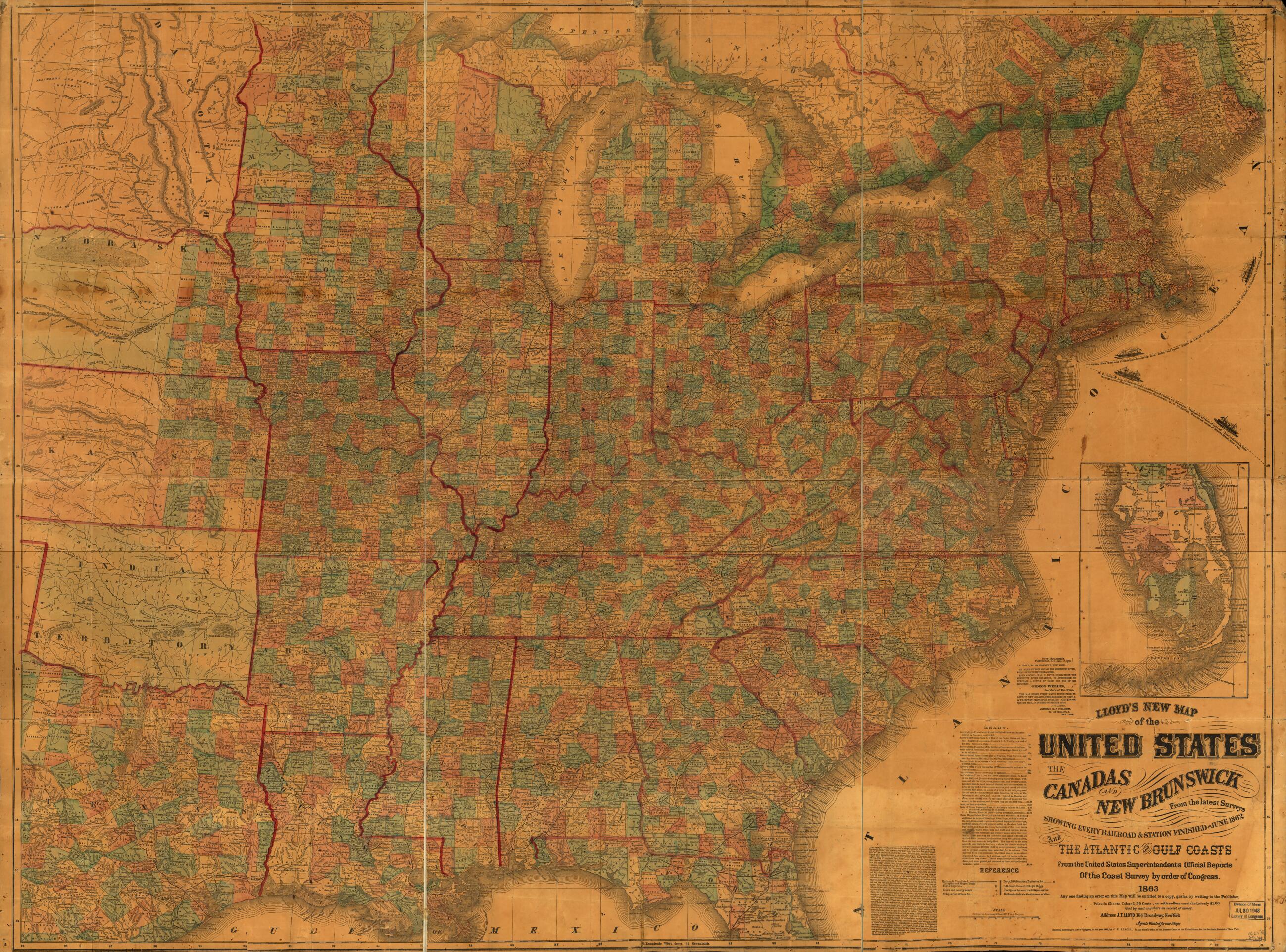
Lloyd's New Map of the United States, the Canadas, and New Brunswick, from the Latest Surveys Showing Every Railroad & Station Finished to June 1862 and the Atlantic and Gulf Coasts from the United States Superintendent's Official Reports of the Coast...
- Regular price
-
$194.95 - Regular price
-
$189.95 - Sale price
-
$194.95
Buy one map, get any other map in our collection for 50% OFF! Add to cart to see discount.
Couldn't load pickup availability
About This Map
Discover the timeless beauty of our fine art quality printed reproduction of this antique map. Perfect for history enthusiasts, collectors, and interior decorators.
Restored with meticulous attention to detail by our team with over a decade of experience, this stunning reproduction captures the intricate artistry and historical significance of the original map.
Whether you're a collector or seeking a unique decor piece, this archival-quality map reproduction is a timeless addition to any space. Order now to bring history to life!
Old map of United States.Created by James T. Lloyd in 1863.
- Scale ca. 1:2,250,000.
- Civil War Map
- "Entered according to Act of Congress, in the year 1862, by J. T. Lloyd."
- General map of the eastern United States showing state and county boundaries, cities and towns, forts, roads, and railroads.
- This map was in the possession of Jedediah Hotchkiss at the time of his death. Major Hotchkiss served as topographic engineer with the Army of Northern Virginia. In July 1948, the Library of Congress purchased his map collection.
- Handwritten note on the verso reads "Lloyd's [sic] map of the United States, 1863 captured and used as part of my collection of maps, during the Civil War, 1861-5. Jed. Hotchkiss, Top. Eng., 2nd. Corps, Army N. Va."
- For the 1864 edition see Civil War Maps entry no. 50.
- Description derived from published bibliography.
- For the best legibility, order your map in the original size or larger. Most maps have intricate detail and small text that is best appreciated when the print size hasn't been reduced.
- Sizes labeled "Fits a Standard Frame" will drop right into any frame that you purchase in that size. The sizes that we offer are commonly available online and at most retail stores.
- Our standard sizes are recommendations based on the aspect ratio of the original map, but still may require some added "white space" in one dimension to fit.
- Non-standard sizes will require custom framing, and we suggest taking your print to the frame shop of your choice after you receive it for the best results.
- Custom sizes are available, simply contact us for a quote.
Below is an approximation of the scale of a few standard sizes, and how they might appear in your space.

