
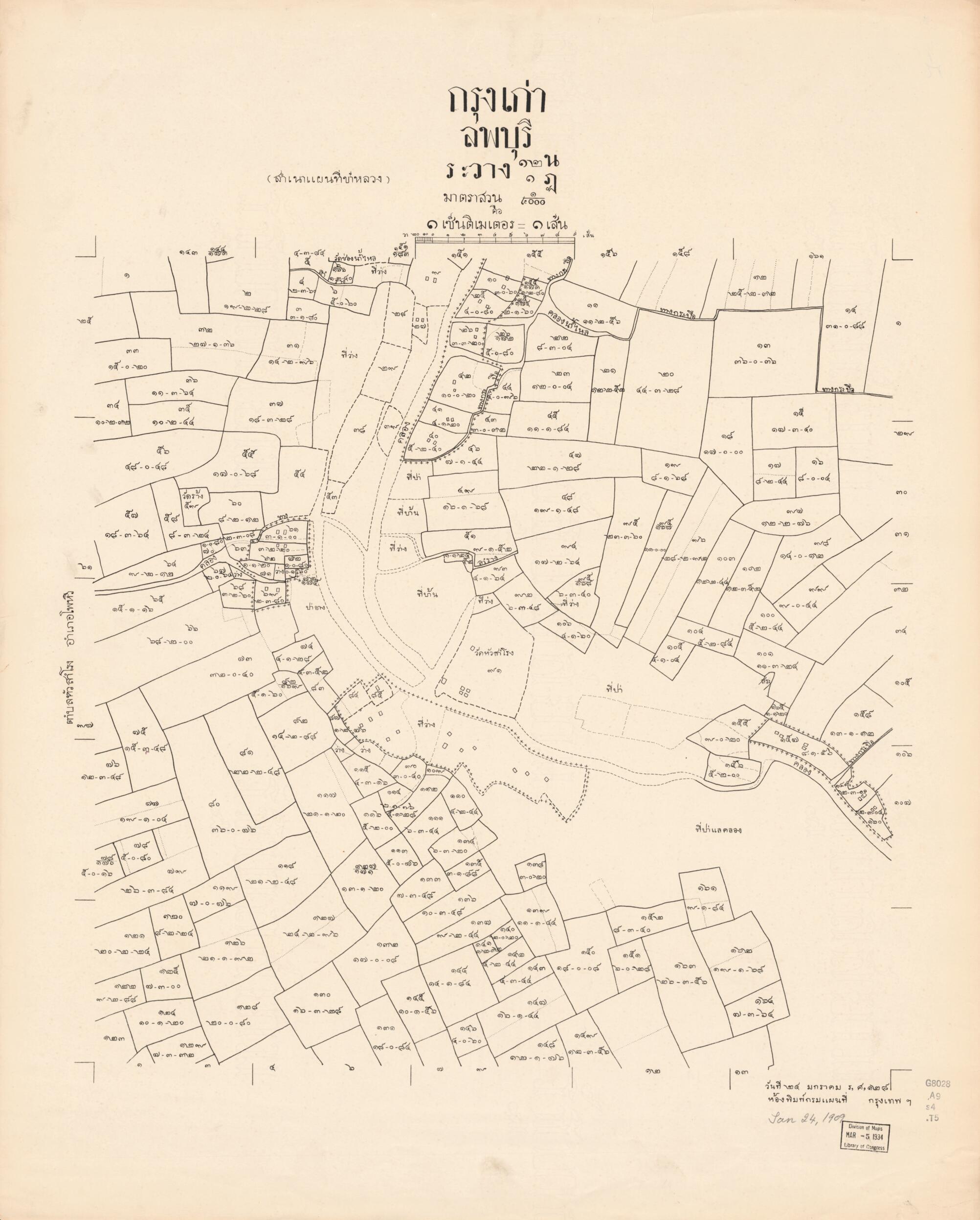
Lop Burī : Krung Kao (Krung Kao : Lop Burī) 1906
- Regular price
-
$130.95 - Regular price
-
$125.95 - Sale price
-
$130.95
Buy one map, get any other map in our collection for 50% OFF! Add to cart to see discount.
Couldn't load pickup availability
About This Map
Discover the timeless beauty of our fine art quality printed reproduction of this antique map. Perfect for history enthusiasts, collectors, and interior decorators.
Restored with meticulous attention to detail by our team with over a decade of experience, this stunning reproduction captures the intricate artistry and historical significance of the original map.
Whether you're a collector or seeking a unique decor piece, this archival-quality map reproduction is a timeless addition to any space. Order now to bring history to life!
Old cadastral map of Lop Burī, Lop Burī (Thailand : Province), Thailand.Created by Thailand. Krom Phǣnthī Thahān in 1906.
- Some maps dated as Rō̜. Sō̜. 125 for Phō̜. Sō̜. 2449 or 1906.
- Relief shown by hachures on some maps.
- Maps of Lop Burī Province published by Thai Royal Survey Department in the central region of Thailand. Lop Burī is on the east side of the Chao Phraya River valley. It is between the Lopburi River and Pa Sak Rivers, most of the land is mixed plains and hills. Maps show boundaries by jurisdiction names of districts and subdivided into subdistricts and villages. Also includes cadatral maps of specific land parcels, with lots, and lot numbers.
- Romanized; maps in Thai scripts.
- Predominant scale 1:4,000.
- For the best legibility, order your map in the original size or larger. Most maps have intricate detail and small text that is best appreciated when the print size hasn't been reduced.
- Sizes labeled "Fits a Standard Frame" will drop right into any frame that you purchase in that size. The sizes that we offer are commonly available online and at most retail stores.
- Our standard sizes are recommendations based on the aspect ratio of the original map, but still may require some added "white space" in one dimension to fit.
- Non-standard sizes will require custom framing, and we suggest taking your print to the frame shop of your choice after you receive it for the best results.
- Custom sizes are available, simply contact us for a quote.
Below is an approximation of the scale of a few standard sizes, and how they might appear in your space.

