
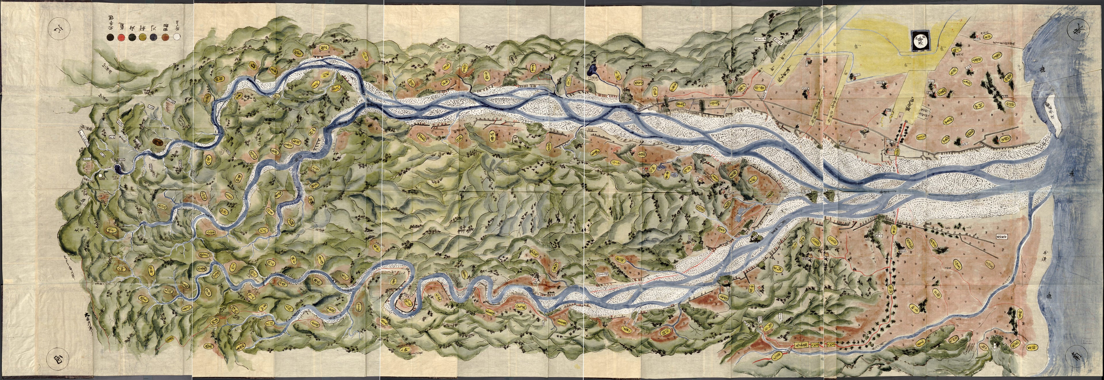
安部川通山中一圓繪圖 /, / in 1862
- Regular price
-
$402.95 - Regular price
-
$397.95 - Sale price
-
$402.95
Shipping calculated at checkout.
Buy one map, get any other map in our collection for 50% OFF! Add to cart to see discount.
Couldn't load pickup availability
About This Map
Old map of Abe River, Abe River Region, Japan, Shizuoka, Sunpujō.
Created by Ichiryūtei Shoraku Dōjin in 1862.
Created by Ichiryūtei Shoraku Dōjin in 1862.
- Relief shown pictorially.
- Map shows villages along Abe River and Sunpu Castle.
- Cover title.
- Manuscript; watercolor and ink.
- Manuscript for an official map began Feb. 2, Enkyō 5 [1748].
- Oriented with north toward the upper left.
- Pictorial map.
- Text on verso.
- Prev. call no. G7962.A32 1862 .I3 Vault Shelf
- "筑後久留米城主・有馬中務 ... 傳代"---On cover.
Map Sizing Information
- For the best legibility, order your map in the original size or larger. Most maps have intricate detail and small text that is best appreciated when the print size hasn't been reduced.
- Sizes labeled "Fits a Standard Frame" will drop right into any frame that you purchase in that size. The sizes that we offer are commonly available online and at most retail stores.
- Our standard sizes are recommendations based on the aspect ratio of the original map, but still may require some added "white space" in one dimension to fit.
- Non-standard sizes will require custom framing, and we suggest taking your print to the frame shop of your choice after you receive it for the best results.
- Custom sizes are available, simply contact us for a quote.
Below is an approximation of the scale of a few standard sizes, and how they might appear in your space.
