
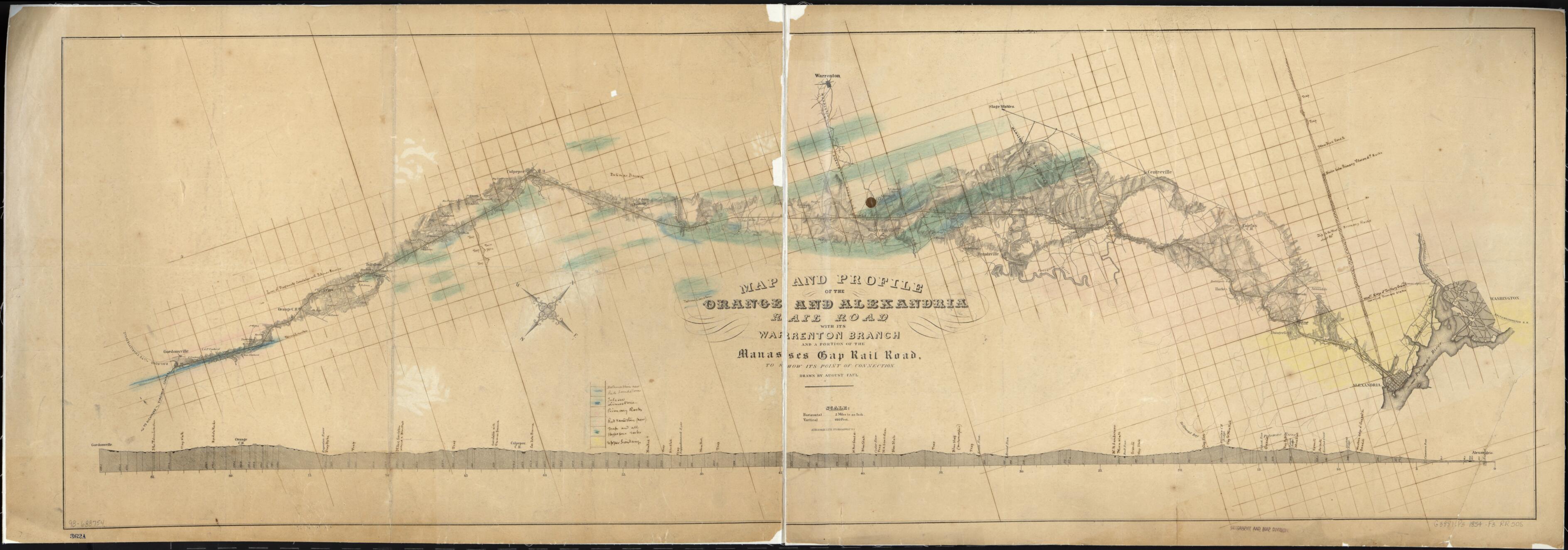
Map and Profile of the Orange and Alexandria Rail Road With Its Warrenton Branch and a Portion of the Manasses sic Gap Rail Road, to Show Its Point of Connection 1854
- Regular price
-
$89.95 - Regular price
-
$84.95 - Sale price
-
$89.95
Buy one map, get any other map in our collection for 50% OFF! Add to cart to see discount.
Couldn't load pickup availability
About This Map
Discover the timeless beauty of our fine art quality printed reproduction of this antique map. Perfect for history enthusiasts, collectors, and interior decorators.
Restored with meticulous attention to detail by our team with over a decade of experience, this stunning reproduction captures the intricate artistry and historical significance of the original map.
Whether you're a collector or seeking a unique decor piece, this archival-quality map reproduction is a timeless addition to any space. Order now to bring history to life!
Old map of United States, Virginia.Printed topographic strip map with manuscript annotations to show the geologic structure along the route of the railroad. The Alexandria and the Chesapeake and Ohio canals and stage stable for horses used on the Piedmont stage route to North Carolina are also indicated. The Orange and Alexandria Railroad Company was founded in 1848 to divert hinterland products away from Baltimore and Richmond to Alexandria, Va. Construction was begun in 1850 and was completed to Culpeper in 1852 and to Gordonsville in 1854, from where the rail line connected with the Virginia Central. Warrenton, originally on a proposed earlier route, was linked by a branch line in 1853. The Manassas Gap Railroad, the first rail line to cross the Blue Ridge Mountains, was completed to Strasburg in 1854 and joined Alexandria with the upper Piedmont Valley.
Created by August Faul, Orange and Alexandria Railroad Company in 1854.
- Scale 1:126,720.
- Description derived from published bibliography.
- For the best legibility, order your map in the original size or larger. Most maps have intricate detail and small text that is best appreciated when the print size hasn't been reduced.
- Sizes labeled "Fits a Standard Frame" will drop right into any frame that you purchase in that size. The sizes that we offer are commonly available online and at most retail stores.
- Our standard sizes are recommendations based on the aspect ratio of the original map, but still may require some added "white space" in one dimension to fit.
- Non-standard sizes will require custom framing, and we suggest taking your print to the frame shop of your choice after you receive it for the best results.
- Custom sizes are available, simply contact us for a quote.
Below is an approximation of the scale of a few standard sizes, and how they might appear in your space.
