
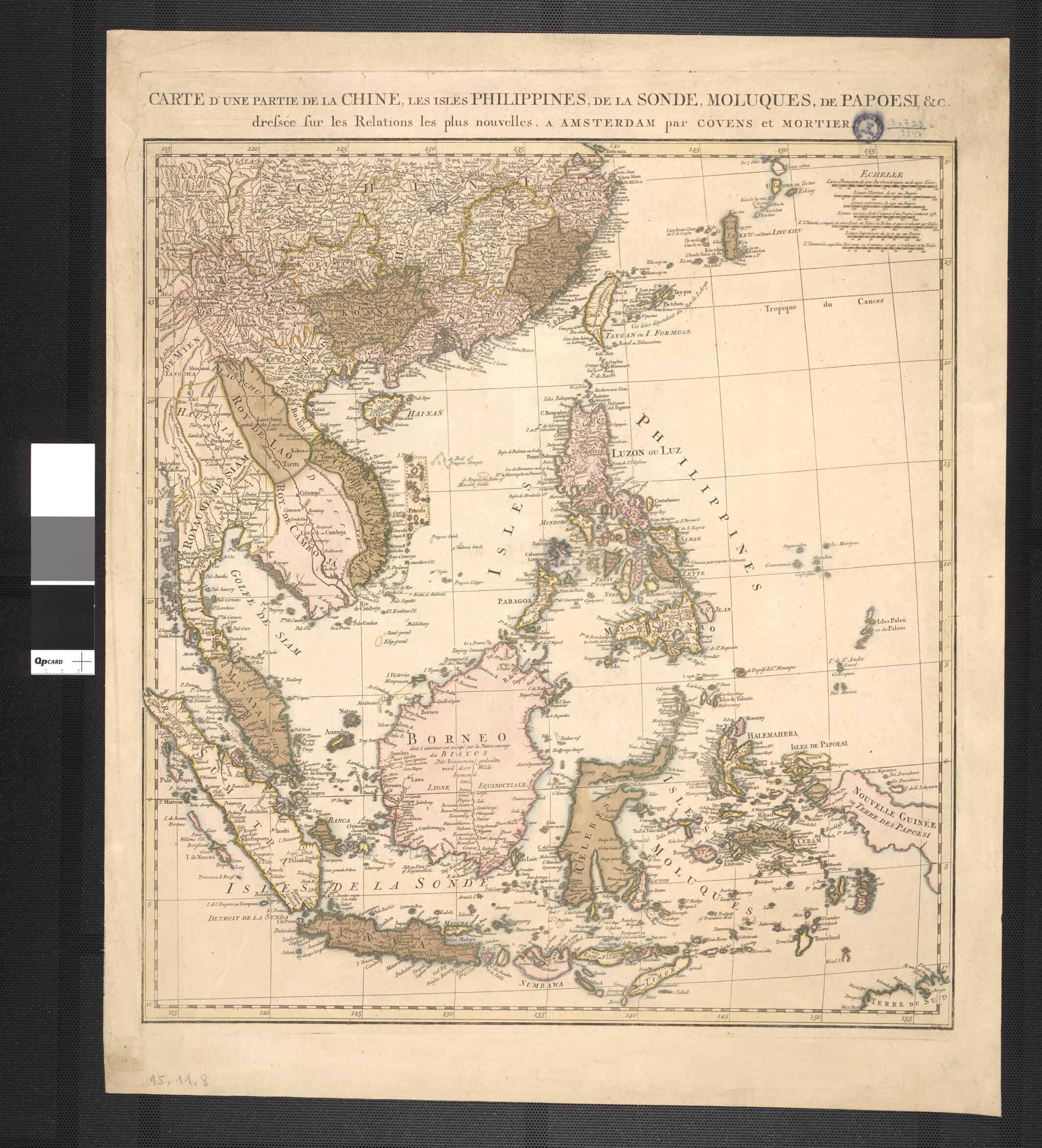
Map of a Part of China, the Philippine Islands, the Isles of Sunda, the Moluccas, the Papuans. (Carte D'une Partie De La Chine, Les Isles Philippines, De La Sonde, Molusques, De Papoesi) 1760
- Regular price
-
$82.95 - Regular price
-
$77.95 - Sale price
-
$82.95
Buy one map, get any other map in our collection for 50% OFF! Add to cart to see discount.
Couldn't load pickup availability
About This Map
Discover the timeless beauty of our fine art quality printed reproduction of this antique map. Perfect for history enthusiasts, collectors, and interior decorators.
Restored with meticulous attention to detail by our team with over a decade of experience, this stunning reproduction captures the intricate artistry and historical significance of the original map.
Whether you're a collector or seeking a unique decor piece, this archival-quality map reproduction is a timeless addition to any space. Order now to bring history to life!
Old map of China, Indonesia, Philippines.century map of southeast Asia and parts of China was published in Amsterdam by the firm of Covens and Mortier. Pieter Mortier (1661-1711) built up a business that prospered by publishing new editions of atlases by Alexis Hubert Jaillot, Nicolas de Fer, and other French mapmakers. Mortier also acquired the stock of the Dutch mapmaker Frederik de Wit and the right to reprint his maps. When Mortier died, the business passed to his son Cornelis (1699-1783). In 1721, Cornelis married the sister of Johannes Covens (1697-1774). In the same year, Cornelis Mortier and his brother-in-law founded the firm of Covens and Mortier. Their maps and atlases were among the best known cartographic publications of the century. The title of this map is in French, but many of the place names and notes have been translated into Dutch.
- Title devised, in English, by Library staff.
- Original resource extent: 1 hand colored engraved map; 55.6 x 50.2 centimeters.
- Original resource at: National Library of Brazil.
- Content in French.
- Description based on data extracted from World Digital Library, which may be extracted from partner institutions.
- For the best legibility, order your map in the original size or larger. Most maps have intricate detail and small text that is best appreciated when the print size hasn't been reduced.
- Sizes labeled "Fits a Standard Frame" will drop right into any frame that you purchase in that size. The sizes that we offer are commonly available online and at most retail stores.
- Our standard sizes are recommendations based on the aspect ratio of the original map, but still may require some added "white space" in one dimension to fit.
- Non-standard sizes will require custom framing, and we suggest taking your print to the frame shop of your choice after you receive it for the best results.
- Custom sizes are available, simply contact us for a quote.
Below is an approximation of the scale of a few standard sizes, and how they might appear in your space.

