Skip to product information
1 of 1

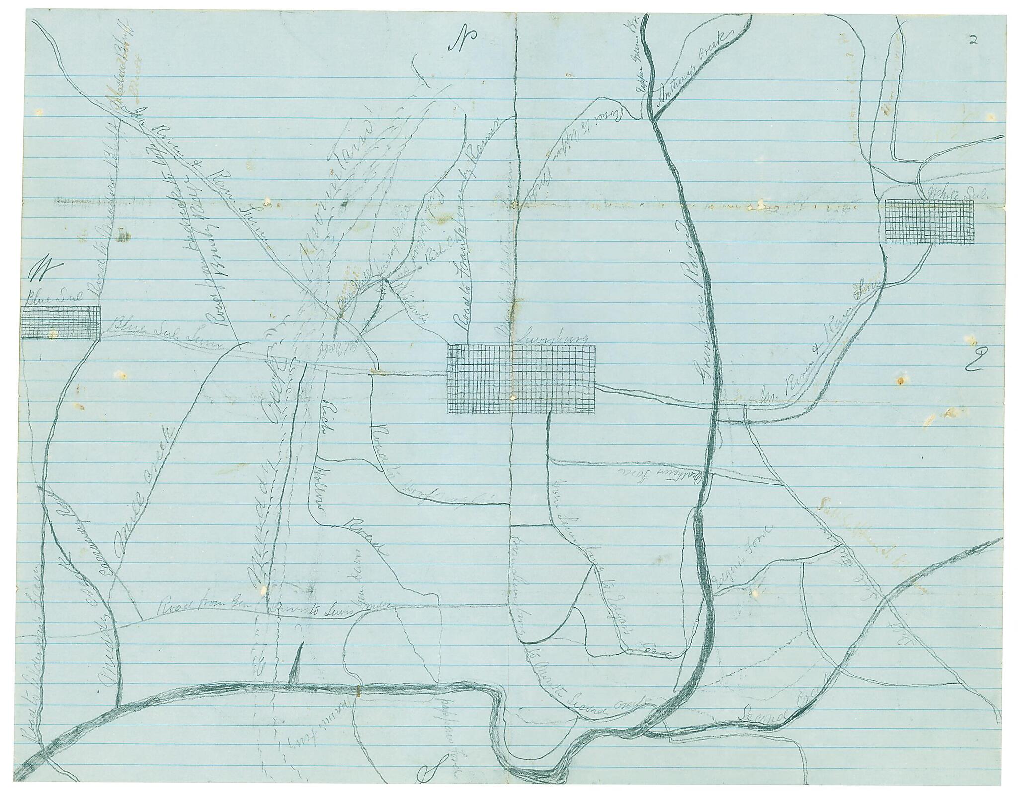
Map of a Part of Greenbrier County, West Va 1862

Regular price
$22.95
Regular price
$35.95
Sale price
$22.95
Help with Choosing a Map Size

90-Day Satisfaction Guarantee & Free Returns

About This Map

Discover the timeless beauty of our fine art quality printed reproduction of this antique map. Perfect for history enthusiasts, collectors, and interior decorators.

Restored with meticulous attention to detail by our team with over a decade of experience, this stunning reproduction captures the intricate artistry and historical significance of the original map.

Whether you're a collector or seeking a unique decor piece, this archival-quality map reproduction is a timeless addition to any space. Order now to bring history to life!

Old map of Greenbrier County, United States, West Virginia.

Created by William Wing Loring in 1862.
  • Drawn with pencil and ink on blue-lined paper. Shows towns, roads, rivers and mountains.
  • Not drawn to scale.
  • One of a series of eight maps of southwestern Virginia and West Virginia. Originally in envelope with notations: "Maps of various kinds by residents of western Virginia. Found among a few books &c which had belonged to Genl. Loring. This statement made by Mr. John Hart."
  • Oriented with north to the top.
  • Relief shown by shading.
  • Shows Lewisburg, W. Va. and the surrounding area.
  • This item is in the Map Collection of the Library of Virginia; please contact the Library's Archives Research Services department for more information.
  • Title and statement of responsibility derived from Swem's Maps relating to Virginia.
  • Swem, E.G. Maps relating to Virginia, 954
  • Jan. 1912, J. Hart, exchange; May 2003, Map Cataloging Team.
  • Civil War project no.: lva00137.
  • Conservation: Etherington Conservation Center, May 2003.
  • Digital image available: 12.5 x 16 in.
  • Map accession no.44 (1912)g.
  • Previously filed as: 754.M6 1861-1865 ca.1862 (2)

Map Subjects

Civil War

Greenbrier County

Greenbrier County (W. Va.)

History

Maps Manuscript

United States

West Virginia

William Wing Loring

1862

Map Tags

1862

Civil War

Greenbrier County

Greenbrier County (W. Va.)

History

Map

Maps Manuscript

United States

West Virginia

William Wing Loring

Secure Checkout
Lifetime Warranty
Money-Back Guarantee
This old map of Map of a Part of Greenbrier County, West Va from 1862 was created by William Wing Loring in 1862