
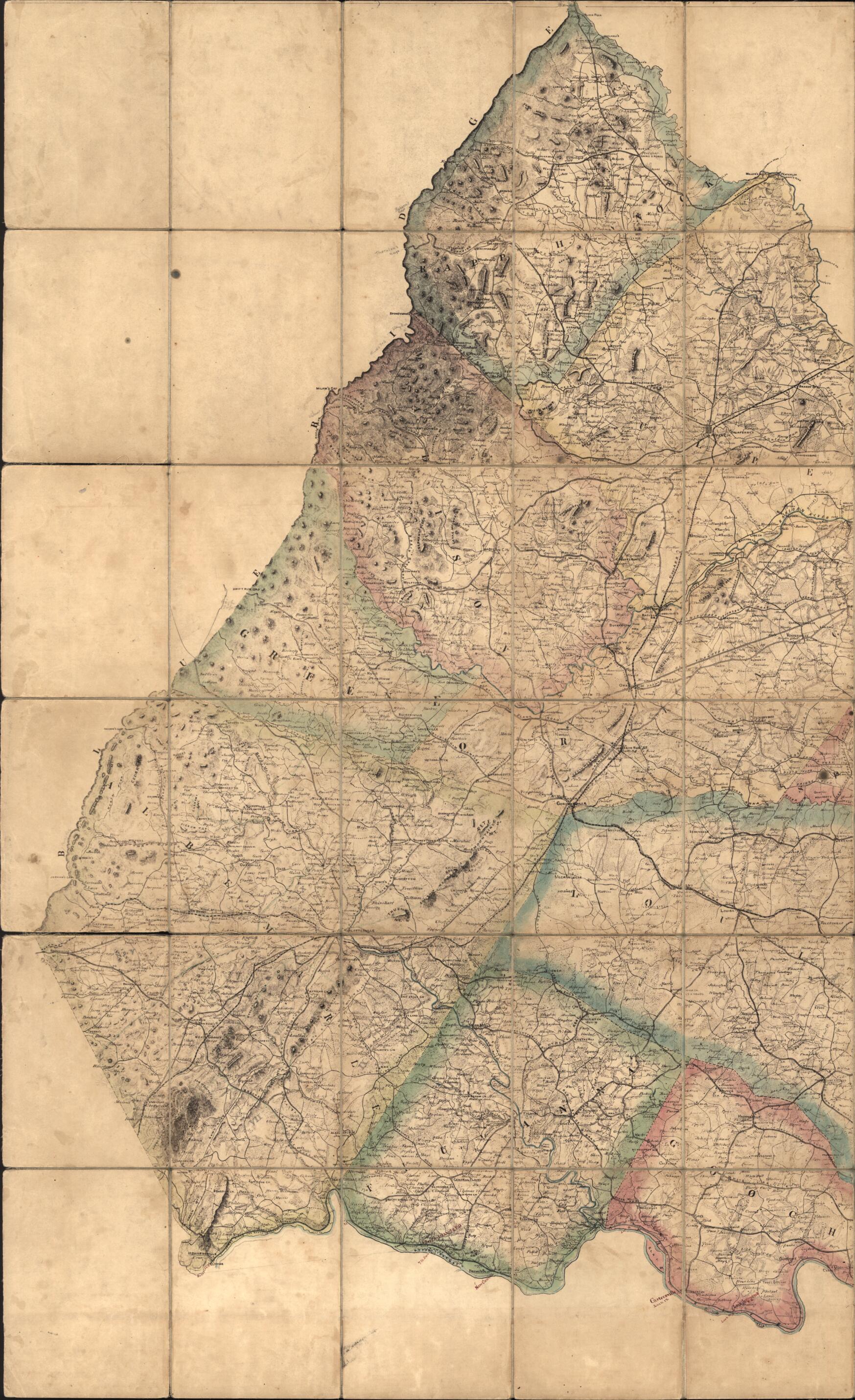
Map of a Portion of Eastern Virginia, from a Map In Progress 1864
- Regular price
-
$63.95 - Regular price
-
$58.95 - Sale price
-
$63.95
Buy one map, get any other map in our collection for 50% OFF! Add to cart to see discount.
Couldn't load pickup availability
About This Map
Discover the timeless beauty of our fine art quality printed reproduction of this antique map. Perfect for history enthusiasts, collectors, and interior decorators.
Restored with meticulous attention to detail by our team with over a decade of experience, this stunning reproduction captures the intricate artistry and historical significance of the original map.
Whether you're a collector or seeking a unique decor piece, this archival-quality map reproduction is a timeless addition to any space. Order now to bring history to life!
Old map of United States, Virginia.Created by Albert H. (Albert Henry) Campbell, Confederate States of America. Army. Department of Northern Virginia. Chief Engineer's Office, Jeremy Francis Gilmer, J. Houston Patton in 1864.
- Shows names of some residents.
- Relief shown by hachures.
- Sun print with annotations. Mounted on cloth in 48 sections.
- At head of title: Chief Engineer's Office, D.N.V. Maj. Genl. J.F. Gilmer Chief Eng'r.
- "Sanxay and Gomert's patent."
- "Approved April 22nd, 1864 Albert H. Campbell ..."
- Annotated on verso: This map was often used by Generals R.E. Lee, R.S. Ewell, J.A. Early, and others in command during the campaigns of A.N.Va. in 1864 and 1865. Jed. Hotchkiss, Top. Eng. 2nd Corps, A.N.Va.
- Civil War salted paper maps. AL 96.1
- Civil War Map
- Later version of Hotch 18b showing additional residents' names in the base map.
- For the best legibility, order your map in the original size or larger. Most maps have intricate detail and small text that is best appreciated when the print size hasn't been reduced.
- Sizes labeled "Fits a Standard Frame" will drop right into any frame that you purchase in that size. The sizes that we offer are commonly available online and at most retail stores.
- Our standard sizes are recommendations based on the aspect ratio of the original map, but still may require some added "white space" in one dimension to fit.
- Non-standard sizes will require custom framing, and we suggest taking your print to the frame shop of your choice after you receive it for the best results.
- Custom sizes are available, simply contact us for a quote.
Below is an approximation of the scale of a few standard sizes, and how they might appear in your space.

