
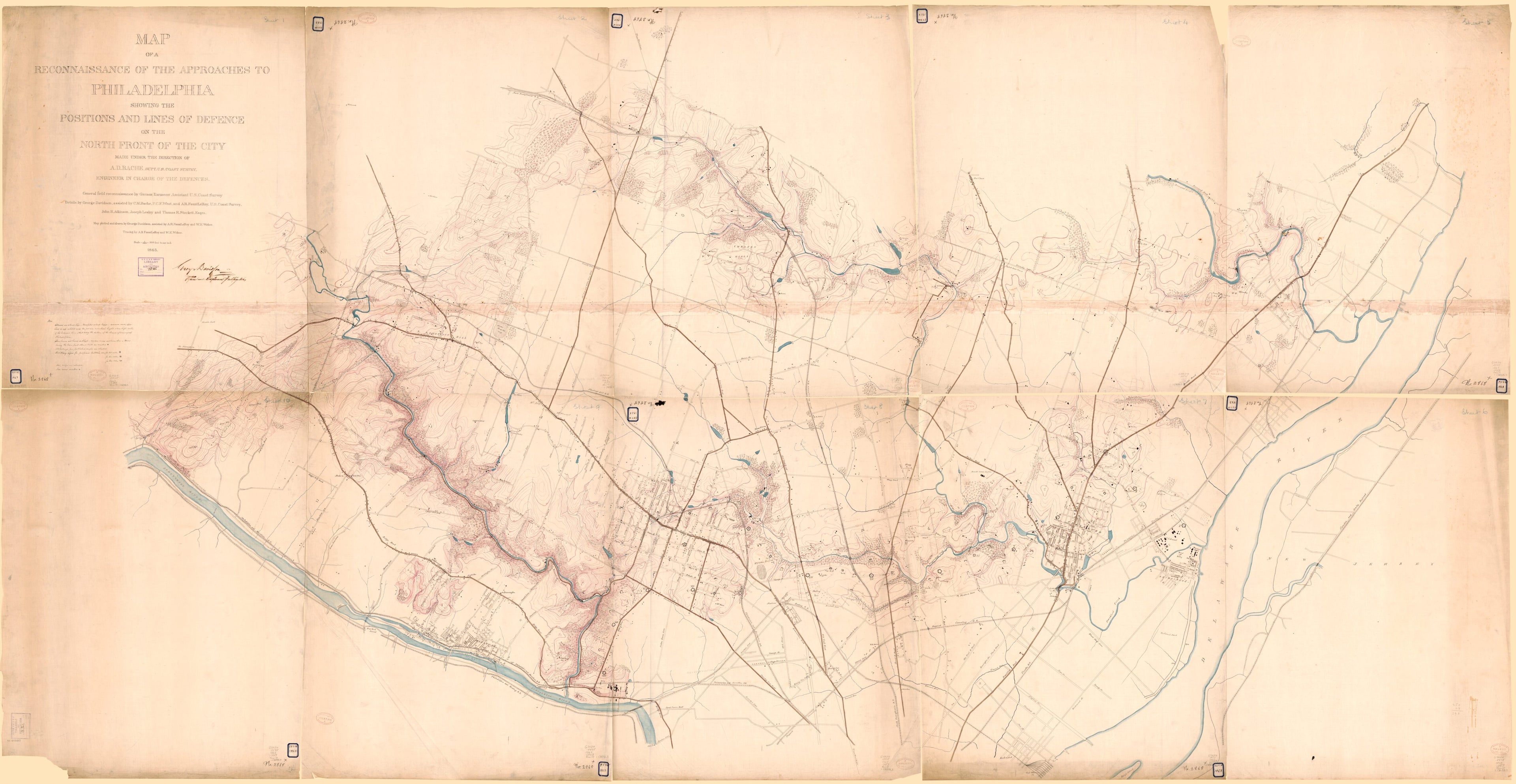
Map of a Reconnaissance of the Approaches to Philadelphia Showing the Positions and Lines of Defence On the North Front of the City in 1863
- Regular price
-
$306.95 - Regular price
-
$301.95 - Sale price
-
$306.95
Buy one map, get any other map in our collection for 50% OFF! Add to cart to see discount.
Couldn't load pickup availability
About This Map
Discover the timeless beauty of our fine art quality printed reproduction of this antique map. Perfect for history enthusiasts, collectors, and interior decorators.
Restored with meticulous attention to detail by our team with over a decade of experience, this stunning reproduction captures the intricate artistry and historical significance of the original map.
Whether you're a collector or seeking a unique decor piece, this archival-quality map reproduction is a timeless addition to any space. Order now to bring history to life!
Old manuscript map / topographic map of Pennsylvania, Philadelphia, Philadelphia Metropolitan Area, United States.Created by A. D. (Alexander Dallas) Bache, George Davidson, A. R. Fauntleroy, United States Coast Survey in 1863.
- Topographic map of northern Philadelphia and small adjacent part of Montgomery County showing Civil War earthworks and batteries.
- Relief shown by contours and hachures.
- Signed in handwriting (brown ink): George Davidson, Assistant Engineer Fortifications.
- Pen-and-ink, red ink (contours), and watercolors.
- Former ownership rubber-stamping at foot of title: U.S.C. & G. Survey, Library and Archives, no. 126.
- "No. 2868X" and "854W 1863" (former Coast Survey numbers) are handwritten in ink on each sheet and on adhesive label at corner of sheets.
- Sheet numbered in blue pencil at top: Sheet 1 [thru] Sheet 10.
- This map has some imperfections: missing small internal and edge sections. We'll do our best to restore the image before printing.
- Includes notes.
- Civil War Map
- For the best legibility, order your map in the original size or larger. Most maps have intricate detail and small text that is best appreciated when the print size hasn't been reduced.
- Sizes labeled "Fits a Standard Frame" will drop right into any frame that you purchase in that size. The sizes that we offer are commonly available online and at most retail stores.
- Our standard sizes are recommendations based on the aspect ratio of the original map, but still may require some added "white space" in one dimension to fit.
- Non-standard sizes will require custom framing, and we suggest taking your print to the frame shop of your choice after you receive it for the best results.
- Custom sizes are available, simply contact us for a quote.
Below is an approximation of the scale of a few standard sizes, and how they might appear in your space.
