
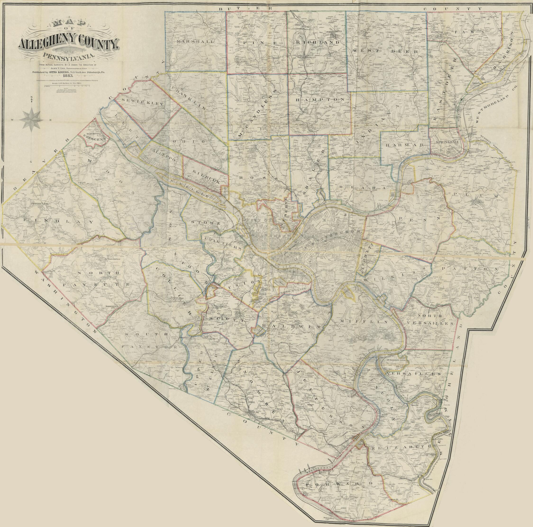
Map of Allegheny County, Pennsylvania : From Actual Surveys in 1883
- Regular price
-
$205.95 - Regular price
-
$200.95 - Sale price
-
$205.95
Buy one map, get any other map in our collection for 50% OFF! Add to cart to see discount.
Couldn't load pickup availability
About This Map
Discover the timeless beauty of our fine art quality printed reproduction of this antique map. Perfect for history enthusiasts, collectors, and interior decorators.
Restored with meticulous attention to detail by our team with over a decade of experience, this stunning reproduction captures the intricate artistry and historical significance of the original map.
Whether you're a collector or seeking a unique decor piece, this archival-quality map reproduction is a timeless addition to any space. Order now to bring history to life!
Old map of Allegheny County, Pennsylvania, Pittsburgh Metropolitan Area, United States.Created by Otto Krebs, Alex. Y. Lee in 1883.
- General-content county map showing roads, railroads, place-names, individual buildings in rural areas, and householders' names in rural areas. Does not show property lines or cadastral data.
- Also covers the Pittsburgh metropolitan area.
- Hand col. to emphasize township, borough, and city boundaries.
- Relief shown by hachures.
- "Entered according to act of Congress in the year 1883 by Otto Krebs in the office of the Librarian of Congress at Washington."
- Originally printed on 3 sheets now conjoined.
- Southern half of map sheet irregularly cut to match the geometrical shape of the county.
- This map has some imperfections: variously fold-lined, halved, annotated in ink on verso. We'll do our best to restore the image before printing.
- Land Ownership Map
- Includes note.
- 2 copies
- For the best legibility, order your map in the original size or larger. Most maps have intricate detail and small text that is best appreciated when the print size hasn't been reduced.
- Sizes labeled "Fits a Standard Frame" will drop right into any frame that you purchase in that size. The sizes that we offer are commonly available online and at most retail stores.
- Our standard sizes are recommendations based on the aspect ratio of the original map, but still may require some added "white space" in one dimension to fit.
- Non-standard sizes will require custom framing, and we suggest taking your print to the frame shop of your choice after you receive it for the best results.
- Custom sizes are available, simply contact us for a quote.
Below is an approximation of the scale of a few standard sizes, and how they might appear in your space.

