

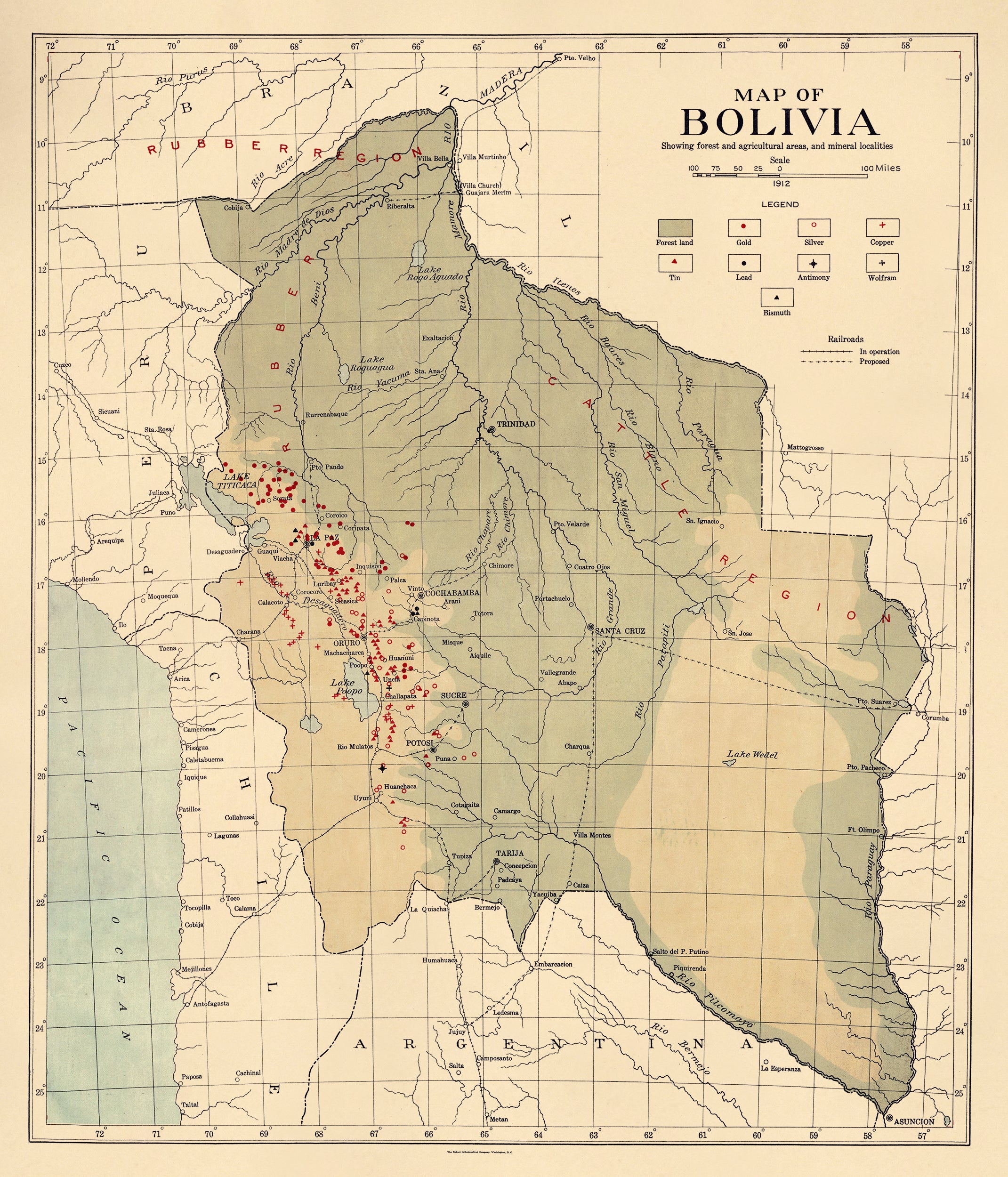
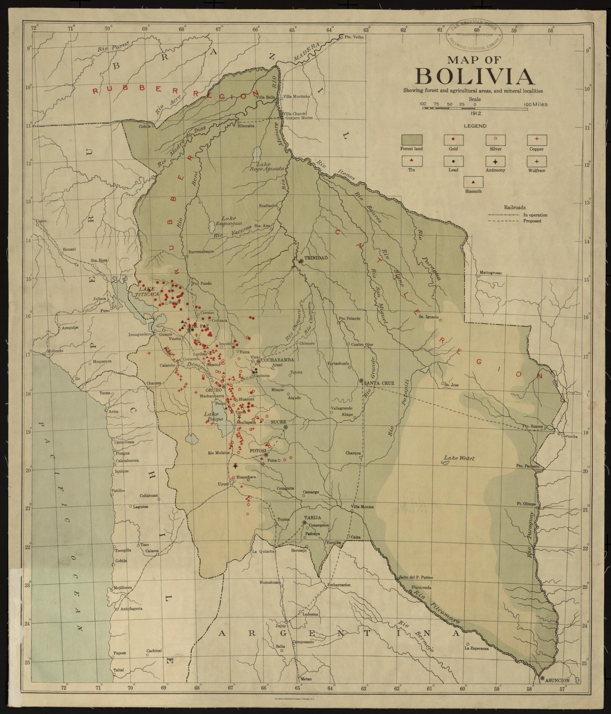
Map of Bolivia, Showing Forest and Agriculture Areas, and Mineral Localities 1912
- Regular price
-
$77.95 - Regular price
-
$72.95 - Sale price
-
$77.95
Buy one map, get any other map in our collection for 50% OFF! Add to cart to see discount.
Couldn't load pickup availability
About This Map
Discover the timeless beauty of our fine art quality printed reproduction of this antique map. Perfect for history enthusiasts, collectors, and interior decorators.
Restored with meticulous attention to detail by our team with over a decade of experience, this stunning reproduction captures the intricate artistry and historical significance of the original map.
Whether you're a collector or seeking a unique decor piece, this archival-quality map reproduction is a timeless addition to any space. Order now to bring history to life!
Old map of Bolivia.19th century--early 20th century, as the extension of the rail line to Oruro made possible the export of large amounts of ore to Europe. By 1912, the year this map was made, 115 tin mines were operating in Bolivia, annually producing more than 38,000 metric tons of ore. The heavily forested parts of the country east of the mountains are identified as rubber-producing regions, while cattle production is concentrated in the lowlands near the border with Brazil. Completed and proposed railroads are indicated, including the lines running south from the capital city of La Paz to the Chilean Pacific ports of Arica and Antofagasta.
- Title devised, in English, by Library staff.
- "Scale 1 inch to 4,224,000 feet"--Note extracted from World Digital Library.
- Original resource extent: 1 map : color ; 51 x 46 centimeters.
- Original resource at: Columbus Memorial Library, Organization of American States.
- Content in English.
- Description based on data extracted from World Digital Library, which may be extracted from partner institutions.
- For the best legibility, order your map in the original size or larger. Most maps have intricate detail and small text that is best appreciated when the print size hasn't been reduced.
- Sizes labeled "Fits a Standard Frame" will drop right into any frame that you purchase in that size. The sizes that we offer are commonly available online and at most retail stores.
- Our standard sizes are recommendations based on the aspect ratio of the original map, but still may require some added "white space" in one dimension to fit.
- Non-standard sizes will require custom framing, and we suggest taking your print to the frame shop of your choice after you receive it for the best results.
- Custom sizes are available, simply contact us for a quote.
Below is an approximation of the scale of a few standard sizes, and how they might appear in your space.

