
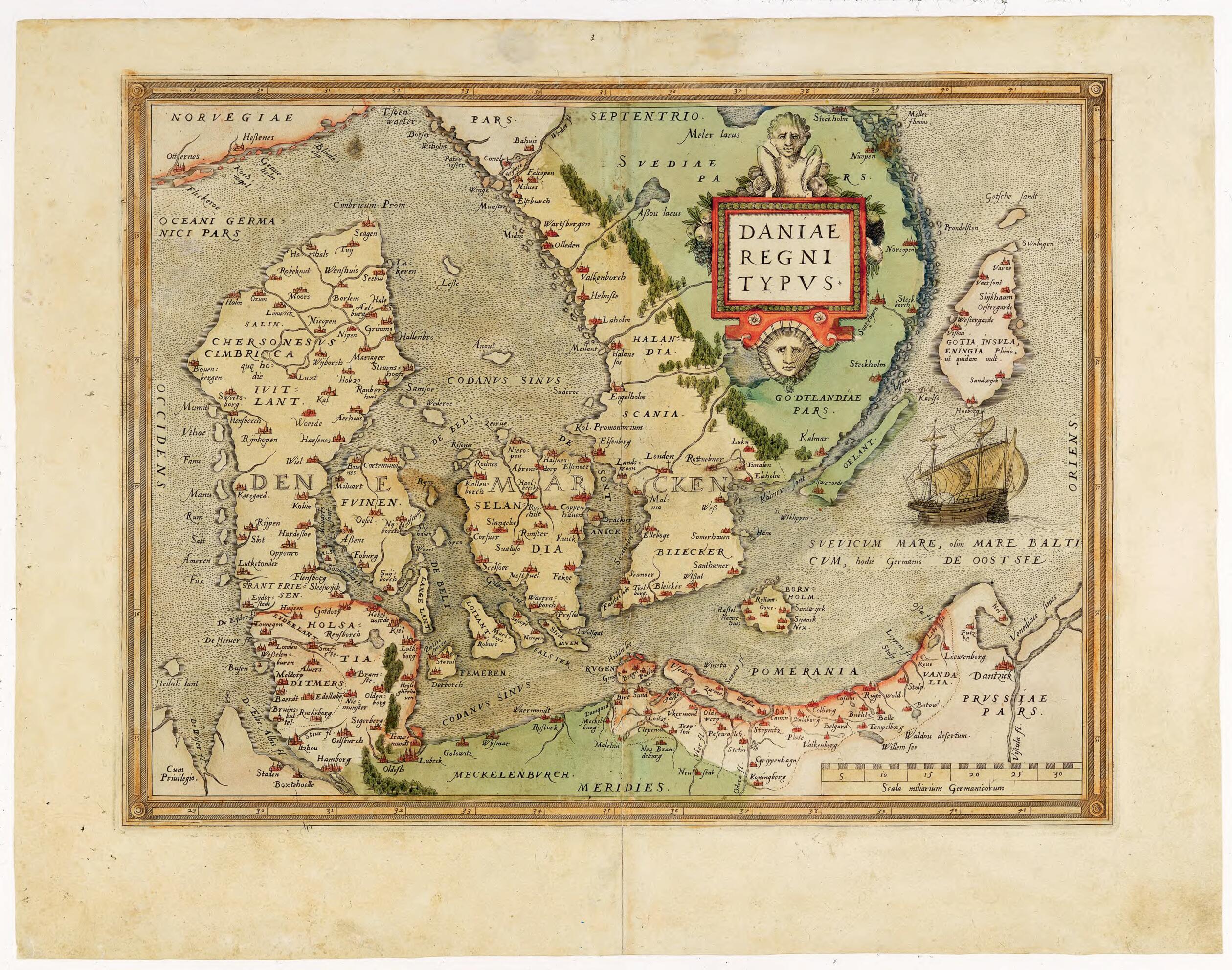
Map of Denmark from the Atlas Theatrum Orbis Terrarum. (Daniae Regni Typus) 1570
- Regular price
-
$49.95 - Regular price
-
$34.95 - Sale price
-
$49.95
Buy one map, get any other map in our collection for 50% OFF! Add to cart to see discount.
Couldn't load pickup availability
About This Map
Discover the timeless beauty of our fine art quality printed reproduction of this antique map. Perfect for history enthusiasts, collectors, and interior decorators.
Restored with meticulous attention to detail by our team with over a decade of experience, this stunning reproduction captures the intricate artistry and historical significance of the original map.
Whether you're a collector or seeking a unique decor piece, this archival-quality map reproduction is a timeless addition to any space. Order now to bring history to life!
Old map of Denmark.-98) published the first edition of his Theatrum orbis terrarum (Theater of the world) in 1570. Containing 53 maps, each with a detailed commentary, it is considered the first true atlas in the modern sense: a collection of uniform map sheets and accompanying text bound to form a book for which copper printing plates were specifically engraved. The 1570 edition was followed by editions in Latin, Dutch, French, German, and Spanish, with an ever-increasing number of maps. Shown here is the first known printed map of Denmark, which appeared in the 1570 edition. The map was based on a 1552 map of the same title by the Danish cartographer Marcus Jordan, with other features taken from a 1543 map by the Dutch printmaker, painter, and cartographer Cornelis Anthonizoon (1505--53).
Created by Cornelis Antoniszoon, Marcus Jordan, Abraham Ortelius in 1570.
- Title devised, in English, by Library staff.
- Original resource extent: 1 printed map ; 50 x 39 centimeters.
- Original resource at: Royal Library (The), Denmark.
- Content in Latin.
- Description based on data extracted from World Digital Library, which may be extracted from partner institutions.
- For the best legibility, order your map in the original size or larger. Most maps have intricate detail and small text that is best appreciated when the print size hasn't been reduced.
- Sizes labeled "Fits a Standard Frame" will drop right into any frame that you purchase in that size. The sizes that we offer are commonly available online and at most retail stores.
- Our standard sizes are recommendations based on the aspect ratio of the original map, but still may require some added "white space" in one dimension to fit.
- Non-standard sizes will require custom framing, and we suggest taking your print to the frame shop of your choice after you receive it for the best results.
- Custom sizes are available, simply contact us for a quote.
Below is an approximation of the scale of a few standard sizes, and how they might appear in your space.

