Skip to product information
1 of 1

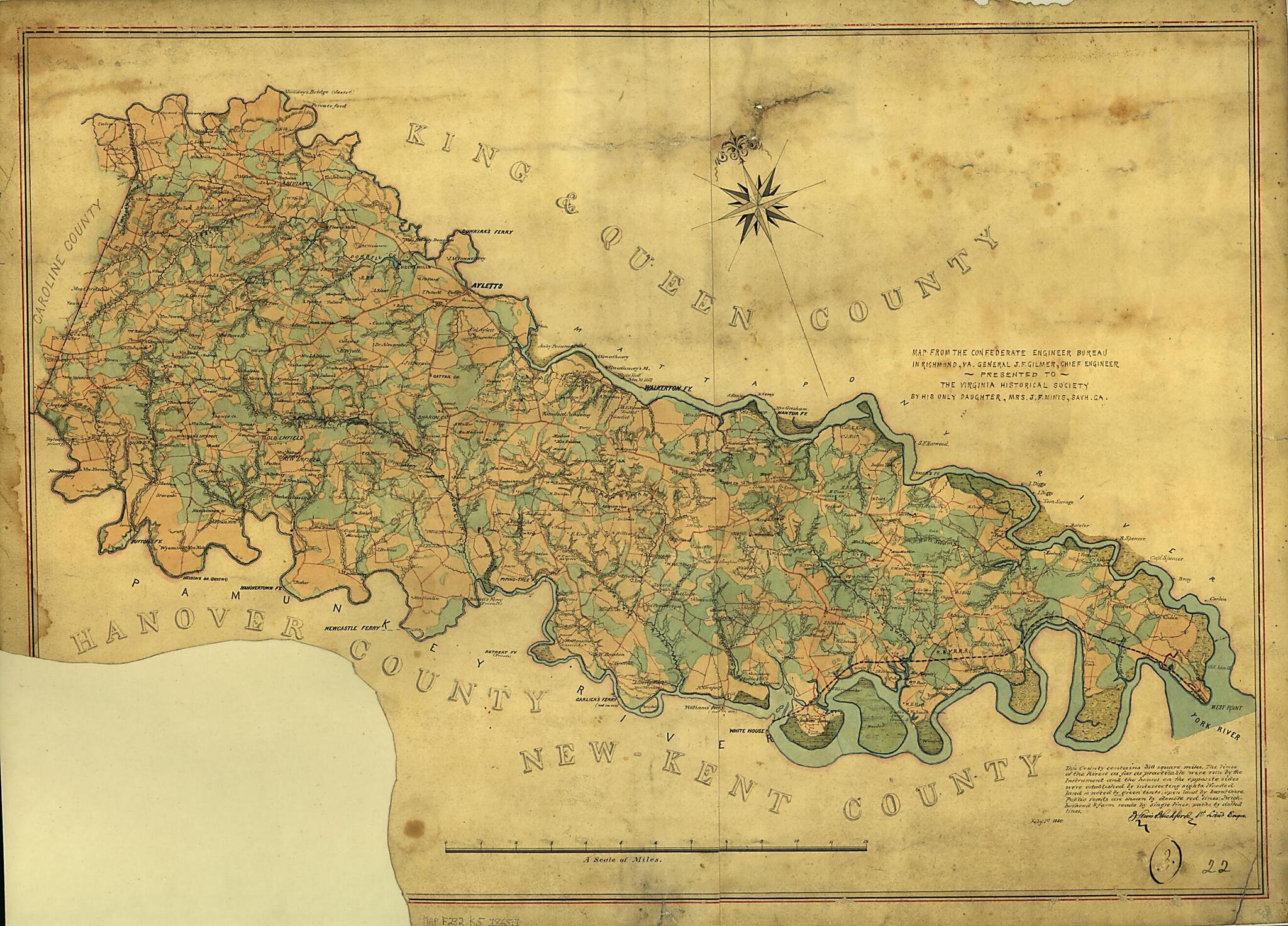
Map of King William County, Va. 1865

Regular price
$66.95
Regular price
$97.95
Sale price
$66.95
Map Description
Old map of King William County, United States, Virginia.

Created by B. L. (Benjamin Lewis) Blackford, Confederate States of America. Army. Dept. Of Northern Virginia. Chief Engineer's Office in 1865.
  • "Map from the Confederate Engineer Bureau in Richmond, Va. General J.F. Gilmer, Chief Engineer[.] Presented to the Virginia Historical Society by his only daughter, Mrs. J.F. Minis, Sav[ana]h, Ga."--Hanwritten note on map.
  • "This county contains 310 square miles. The lines of the rivers as far as practicable were run by the instrument and the houses on the opposite sides were established by intersecting sights. Wooded land is noted by green tints; open land by burnt ochre. Public roads are shown by double red lines. Neighborhood and farm roads by single lines, paths by dotted lines."--handwritten note on map.
  • Forms part of the Gilmer Map Collection.
  • Relief shown by hachures.
  • Gift of Mrs. Louisa Porter (Gilmer) Minis (i.e., Mrs. J. F. Minis), Savannah, Ga., in 1911.
  • Manuscripts o.s.

Map Subjects

Civil War

Gilmer Jeremy Francis

History

King William County

King William County (Va.)

Map Collection

United States

Virginia

B. L. (Benjamin Lewis) Blackford

Confederate States Of America. Army. Dept. Of Northern Virginia. Chief Engineer's Office

1865

Map Tags

1865

B. L. (Benjamin Lewis) Blackford

Civil War

Confederate States Of America. Army. Dept. Of Northern Virginia. Chief Engineer's Office

Gilmer Jeremy Francis

History

King William County

King William County (Va.)

Map

Map Collection

Maps

United States

Virginia

Fine Art Quality Printed on heavyweight (230 gsm) archival paper with a classic matte finish
Professionally Restored For the best presentation, your map will be carefully retouched by our experienced team
Free Shipping Orders of $75 or more ship for free and arrive in 3-5 business days
Proudly Made in the USA All of our maps are custom printed to order in Portland, Maine
Help with Choosing a Map Size
Secure Checkout
Lifetime Warranty
Money-Back Guarantee
This old map of Map of King William County, Va. from 1865 was created by B. L. (Benjamin Lewis) Blackford,  Confederate States of America. Army. Dept. Of Northern Virginia. Chief Engineer&