

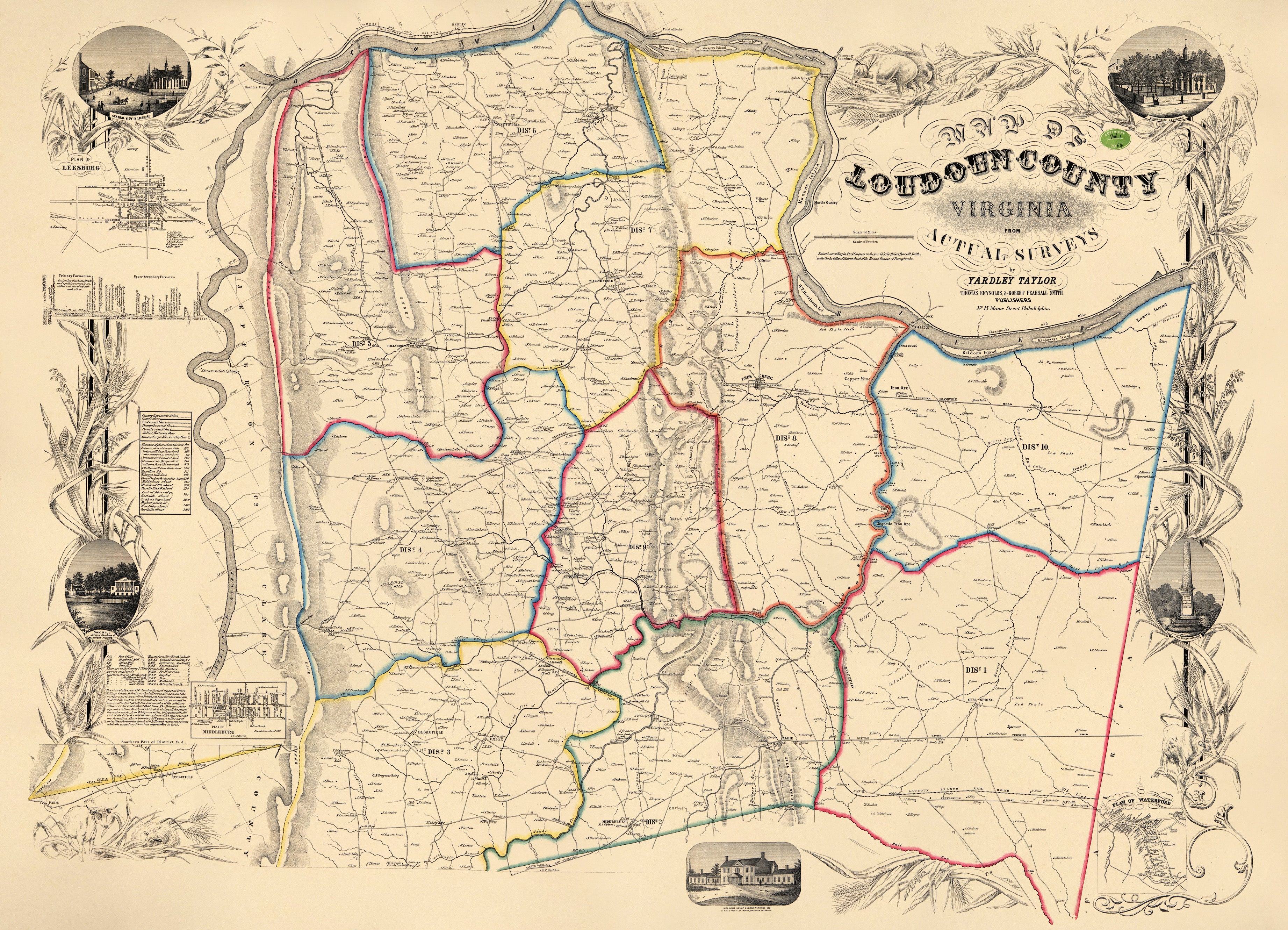
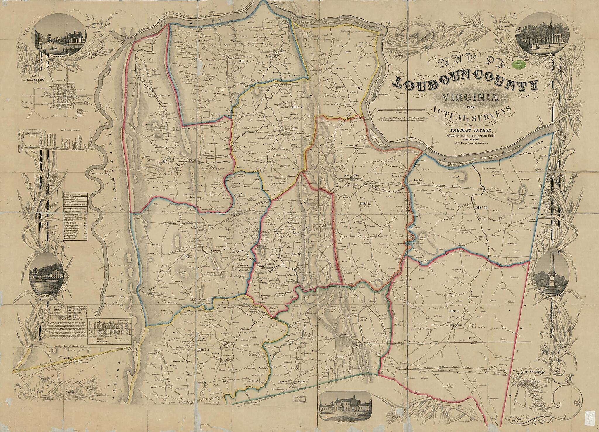
Map of Loudoun County, Virginia in 1854
- Regular price
-
$196.95 - Regular price
-
$191.95 - Sale price
-
$196.95
Buy one map, get any other map in our collection for 50% OFF! Add to cart to see discount.
Couldn't load pickup availability
About This Map
Discover the timeless beauty of our fine art quality printed reproduction of this antique map. Perfect for history enthusiasts, collectors, and interior decorators.
Restored with meticulous attention to detail by our team with over a decade of experience, this stunning reproduction captures the intricate artistry and historical significance of the original map.
Whether you're a collector or seeking a unique decor piece, this archival-quality map reproduction is a timeless addition to any space. Order now to bring history to life!
Old cadastral map of Loudoun County, United States, Virginia.Created by Yardley Taylor, Publishers Thomas Reynolds & Robert Pearsall Smith in 1854.
- Shows magisterial districts and names of some residents.
- Relief shown by hachures.
- "Edition A."
- "Entered according to act of Congress in the year 1853 by Robert Pearsall Smith in the Clerks Office of District Court of the Eastern District Court of Pennsylvania."
- Sheets pasted together in 20 sections, sectioned in 4, and mounted on cloth.
- Land Ownership Map
- Includes text, "Geological profile of Loudoun County," list of elevations, abbreviation list, insets of Leesburg, Middleburg, and Waterford, and col. ill.
- Copy This map has some imperfections: losses along fold lines and torn along edges. We'll do our best to restore the image before printing.
Map Subjects
Cadastral Maps
Geology
Landowners
Loudoun County
Loudoun County (Va.)
Real Property
United States
Virginia
Yardley Taylor
Publishers Thomas Reynolds & Robert Pearsall Smith
1854
- For the best legibility, order your map in the original size or larger. Most maps have intricate detail and small text that is best appreciated when the print size hasn't been reduced.
- Sizes labeled "Fits a Standard Frame" will drop right into any frame that you purchase in that size. The sizes that we offer are commonly available online and at most retail stores.
- Our standard sizes are recommendations based on the aspect ratio of the original map, but still may require some added "white space" in one dimension to fit.
- Non-standard sizes will require custom framing, and we suggest taking your print to the frame shop of your choice after you receive it for the best results.
- Custom sizes are available, simply contact us for a quote.
Below is an approximation of the scale of a few standard sizes, and how they might appear in your space.

