

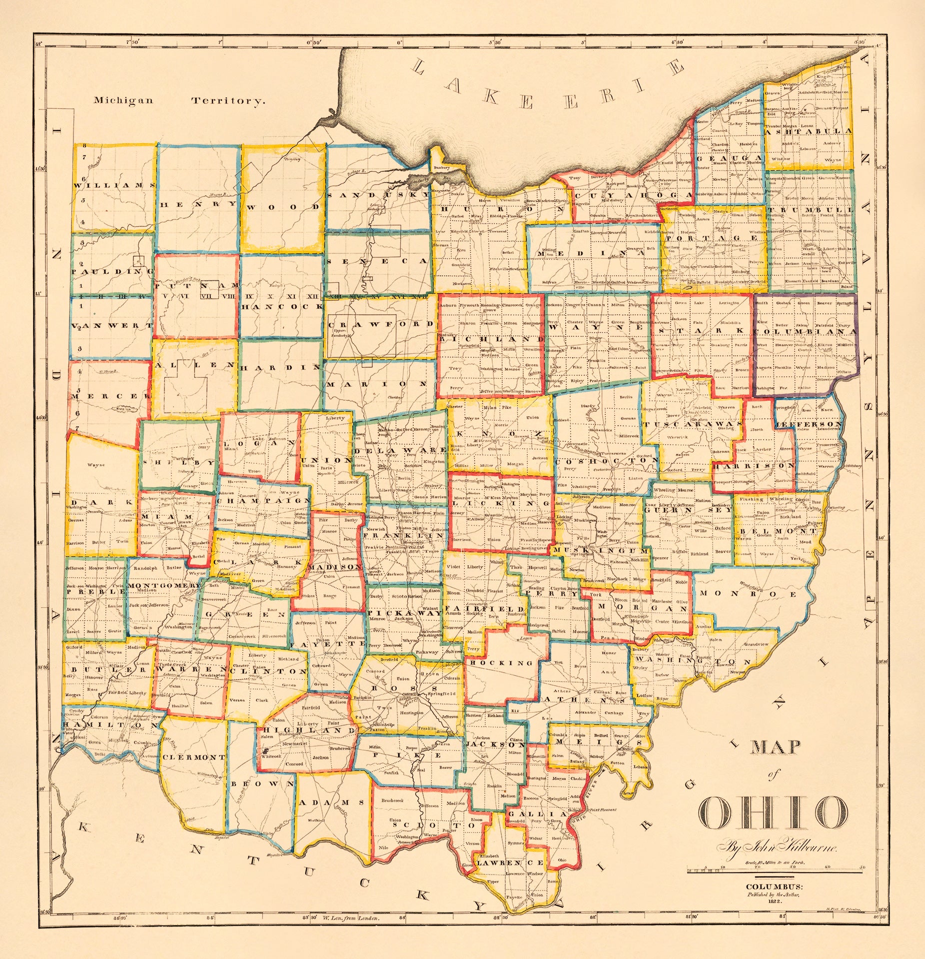
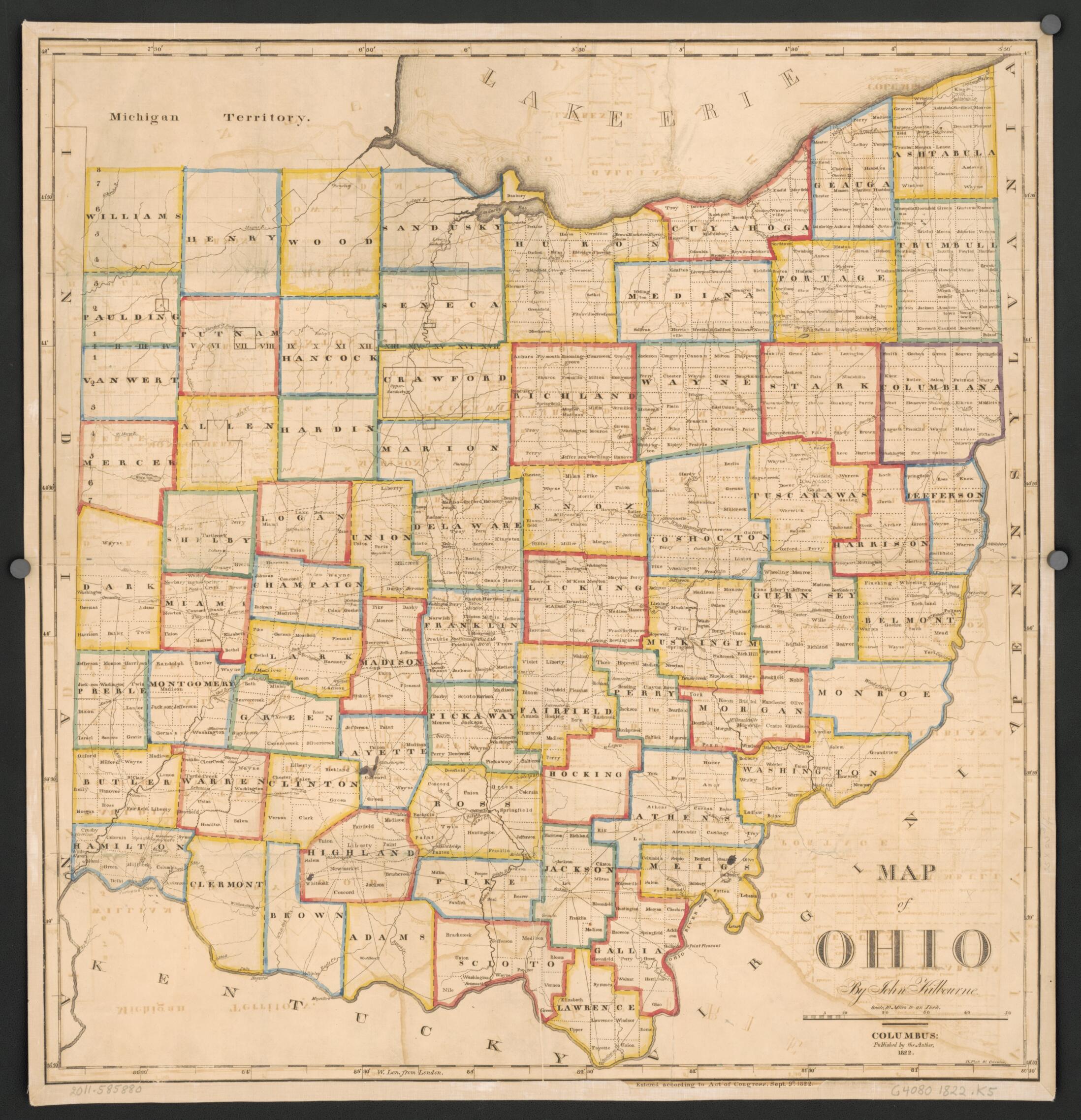
Map of Ohio 1822
- Regular price
-
$79.95 - Regular price
-
$74.95 - Sale price
-
$79.95
Buy one map, get any other map in our collection for 50% OFF! Add to cart to see discount.
Couldn't load pickup availability
About This Map
Map of Ohio 1822, a fine art quality printed reproduction, brings the 1822 Ohio landscape into your space with museum-caliber detail. Restored by our team with over a decade of experience, this archival-quality historical reproduction captures the intricate artistry and historical significance of the original. It's ideal for history enthusiasts, collectors, and interior decorators alike, offering a tangible link to Ohio's past.
Originally created by John Kilbourn in 1822 and published by the American Antiquarian Society, Worcester, this antique map clearly shows counties, major roads, and important settlements—a precise snapshot of early Ohio. Far more than wall decor, it serves as a reference piece that sparks conversations about early American cartography and state development.
- Archival-quality print on durable paper with fade-resistant inks
- Meticulous restoration preserves original lines and textures
- Perfect for framing in living rooms, studies, or offices
- Ideal for collectors of antique maps and Ohio history
- Historical context with period typography and cartographic detail
Ready to add a piece of Ohio history to your collection? Order now to bring history to life in your space.
- For the best legibility, order your map in the original size or larger. Most maps have intricate detail and small text that is best appreciated when the print size hasn't been reduced.
- Sizes labeled "Fits a Standard Frame" will drop right into any frame that you purchase in that size. The sizes that we offer are commonly available online and at most retail stores.
- Our standard sizes are recommendations based on the aspect ratio of the original map, but still may require some added "white space" in one dimension to fit.
- Non-standard sizes will require custom framing, and we suggest taking your print to the frame shop of your choice after you receive it for the best results.
- Custom sizes are available, simply contact us for a quote.
Below is an approximation of the scale of a few standard sizes, and how they might appear in your space.

