
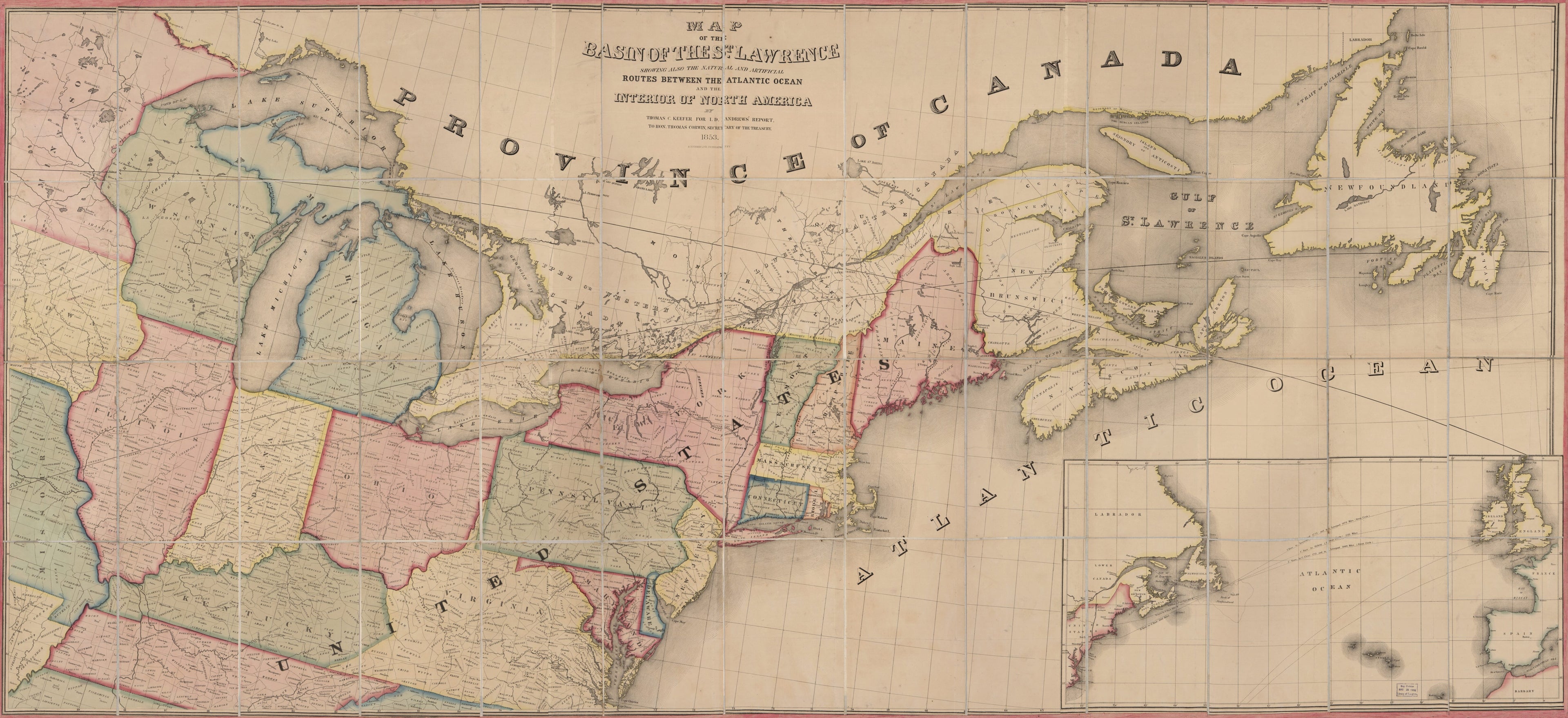
Map of the Basin of the St. Lawrence : Showing Also the Natural and Artificial Routes Between the Atlantic Ocean and the Interior of North America in 1853
- Regular price
-
$243.95 - Regular price
-
$238.95 - Sale price
-
$243.95
Buy one map, get any other map in our collection for 50% OFF! Add to cart to see discount.
Couldn't load pickup availability
About This Map
Discover the timeless beauty of our fine art quality printed reproduction of this antique map. Perfect for history enthusiasts, collectors, and interior decorators.
Restored with meticulous attention to detail by our team with over a decade of experience, this stunning reproduction captures the intricate artistry and historical significance of the original map.
Whether you're a collector or seeking a unique decor piece, this archival-quality map reproduction is a timeless addition to any space. Order now to bring history to life!
Old map of Northeastern States, Saint Lawrence River, Saint Lawrence River Watershed.Created by Ackerman Lithr, Israel D. (Israel Dewolf) Andrews, Thomas C. Keefer in 1853.
- Appears in: Andrew's Communication from the Secretary of the Treasury: Report of Israel D. Andrews on the trade and commerce of the British North American Colonies, and upon the trade of the Great Lakes and rivers. Printed in Senate ex. doc. 112, 1st session, 32nd congress, vol. 2.
- Includes inset: Atlantic Ocean, showing trade routes.
- On tape affixed to verso:St. Lawrence Basin, 1853, no. 119.
- Signed on verso: St. Lawrence Basin, 1852, Millard Fillmore.
- For the best legibility, order your map in the original size or larger. Most maps have intricate detail and small text that is best appreciated when the print size hasn't been reduced.
- Sizes labeled "Fits a Standard Frame" will drop right into any frame that you purchase in that size. The sizes that we offer are commonly available online and at most retail stores.
- Our standard sizes are recommendations based on the aspect ratio of the original map, but still may require some added "white space" in one dimension to fit.
- Non-standard sizes will require custom framing, and we suggest taking your print to the frame shop of your choice after you receive it for the best results.
- Custom sizes are available, simply contact us for a quote.
Below is an approximation of the scale of a few standard sizes, and how they might appear in your space.
