
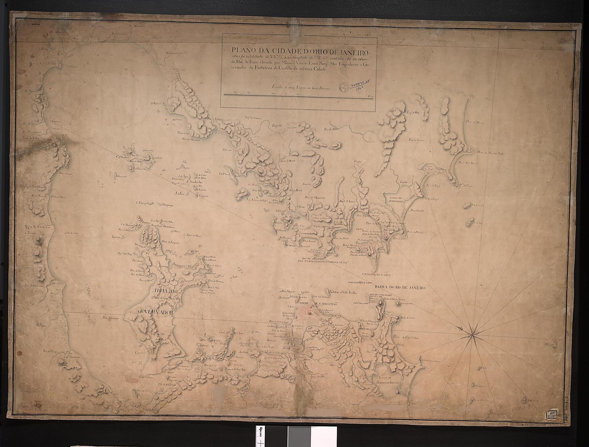
Map of the City of Rio De Janeiro: Situated at Latitude 22 Degrees 54' and Longitude 334 Degrees 53' from the Meridian of the Island of Ferro. (Plano Da Cidade Do Rio De Janeiro: Situado Na Latitude De 22°54', E De Longitude De 334°53' Contados Do M...
- Regular price
-
$88.95 - Regular price
-
$83.95 - Sale price
-
$88.95
Buy one map, get any other map in our collection for 50% OFF! Add to cart to see discount.
Couldn't load pickup availability
About This Map
Discover the timeless beauty of our fine art quality printed reproduction of this antique map. Perfect for history enthusiasts, collectors, and interior decorators.
Restored with meticulous attention to detail by our team with over a decade of experience, this stunning reproduction captures the intricate artistry and historical significance of the original map.
Whether you're a collector or seeking a unique decor piece, this archival-quality map reproduction is a timeless addition to any space. Order now to bring history to life!
Old map of Brazil, Rio De Janeiro.and-ink watercolor map shows the city of Rio de Janeiro and the surrounding coastline around 1770, shortly after it became the colonial capital city of Portuguese Brazil. The map is the work of Manoel Vieira Leão (1727-1803), an assistant to the governor of the city.
Created by Manuel Vieira Lion in 1770.
- Title devised, in English, by Library staff.
- Original resource extent: 1 pen-and-ink and watercolor manuscript map; 70 x 98 centimeters.
- Original resource at: National Library of Brazil.
- Content in Portuguese.
- Description based on data extracted from World Digital Library, which may be extracted from partner institutions.
Map Subjects
Brazil
Guanabara Bay (Brazil)
Manuscript Maps
Rio De Janeiro
Manuel Vieira Lion
1770
- For the best legibility, order your map in the original size or larger. Most maps have intricate detail and small text that is best appreciated when the print size hasn't been reduced.
- Sizes labeled "Fits a Standard Frame" will drop right into any frame that you purchase in that size. The sizes that we offer are commonly available online and at most retail stores.
- Our standard sizes are recommendations based on the aspect ratio of the original map, but still may require some added "white space" in one dimension to fit.
- Non-standard sizes will require custom framing, and we suggest taking your print to the frame shop of your choice after you receive it for the best results.
- Custom sizes are available, simply contact us for a quote.
Below is an approximation of the scale of a few standard sizes, and how they might appear in your space.

