
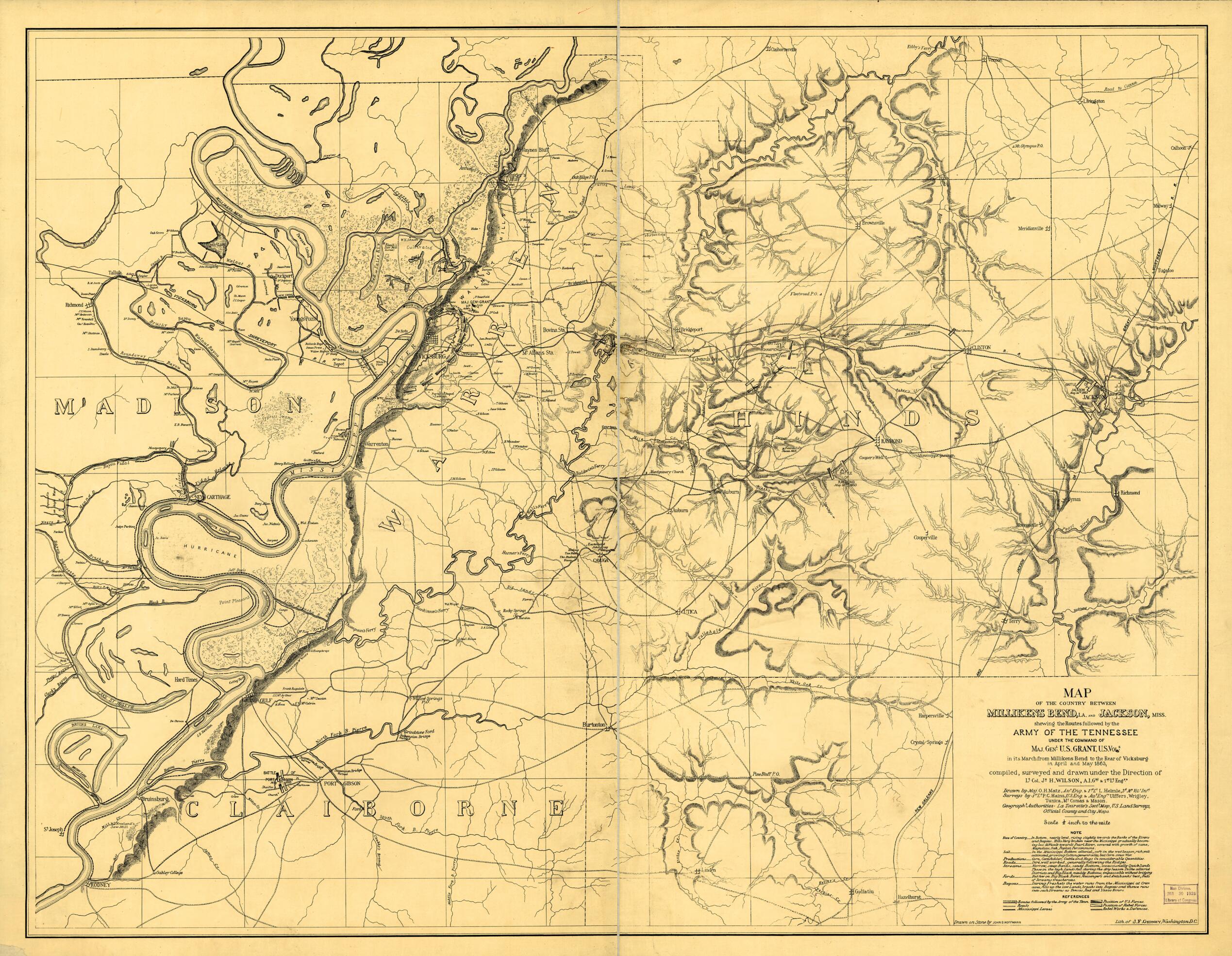
Map of the Country Between Millikens Bend, La. and Jackson, Mississippi Shewing the Routes Followed by the Army of the Tennessee Under the Command of Maj. Genl. U.S. Grant, U.S. Vols. In Its March from Millikens Bend to the Rear of Vicksburg In April ...
- Regular price
-
$106.95 - Regular price
-
$101.95 - Sale price
-
$106.95
Buy one map, get any other map in our collection for 50% OFF! Add to cart to see discount.
Couldn't load pickup availability
About This Map
Discover the timeless beauty of our fine art quality printed reproduction of this antique map. Perfect for history enthusiasts, collectors, and interior decorators.
Restored with meticulous attention to detail by our team with over a decade of experience, this stunning reproduction captures the intricate artistry and historical significance of the original map.
Whether you're a collector or seeking a unique decor piece, this archival-quality map reproduction is a timeless addition to any space. Order now to bring history to life!
Old map of Mississippi, United States.Created by L. Helmle, Otto H. Matz, Js. H. Wilson in 1876.
- Scale 1:126,720.
- Civil War Map
- Another edition.
- Similar to the preceding map but drawn on stone by Hoffmann and lithographed by Gedney instead of Bien. This edition denotes the positions of the Union and Confederate troops by symbols rather than by colors, and the legend lacks the statement "Published by authority of the Hon. the Secretary of War. Office of the Chief of Engineers, U.S. Army. 1876."
- Description derived from published bibliography.
- For the best legibility, order your map in the original size or larger. Most maps have intricate detail and small text that is best appreciated when the print size hasn't been reduced.
- Sizes labeled "Fits a Standard Frame" will drop right into any frame that you purchase in that size. The sizes that we offer are commonly available online and at most retail stores.
- Our standard sizes are recommendations based on the aspect ratio of the original map, but still may require some added "white space" in one dimension to fit.
- Non-standard sizes will require custom framing, and we suggest taking your print to the frame shop of your choice after you receive it for the best results.
- Custom sizes are available, simply contact us for a quote.
Below is an approximation of the scale of a few standard sizes, and how they might appear in your space.

