
Map of the Country Between the York and James Rivers In 1862 and 1863 : Showing the Names of the Owners of the Divisions of Land at That Time
- Regular price
-
$49.95 - Regular price
-
$29.95 - Sale price
-
$49.95
Buy one map, get any other map in our collection for 50% OFF! Add to cart to see discount.
Couldn't load pickup availability
About This Map
Discover the timeless beauty of our fine art quality printed reproduction of this antique map. Perfect for history enthusiasts, collectors, and interior decorators.
Restored with meticulous attention to detail by our team with over a decade of experience, this stunning reproduction captures the intricate artistry and historical significance of the original map.
Whether you're a collector or seeking a unique decor piece, this archival-quality map reproduction is a timeless addition to any space. Order now to bring history to life!
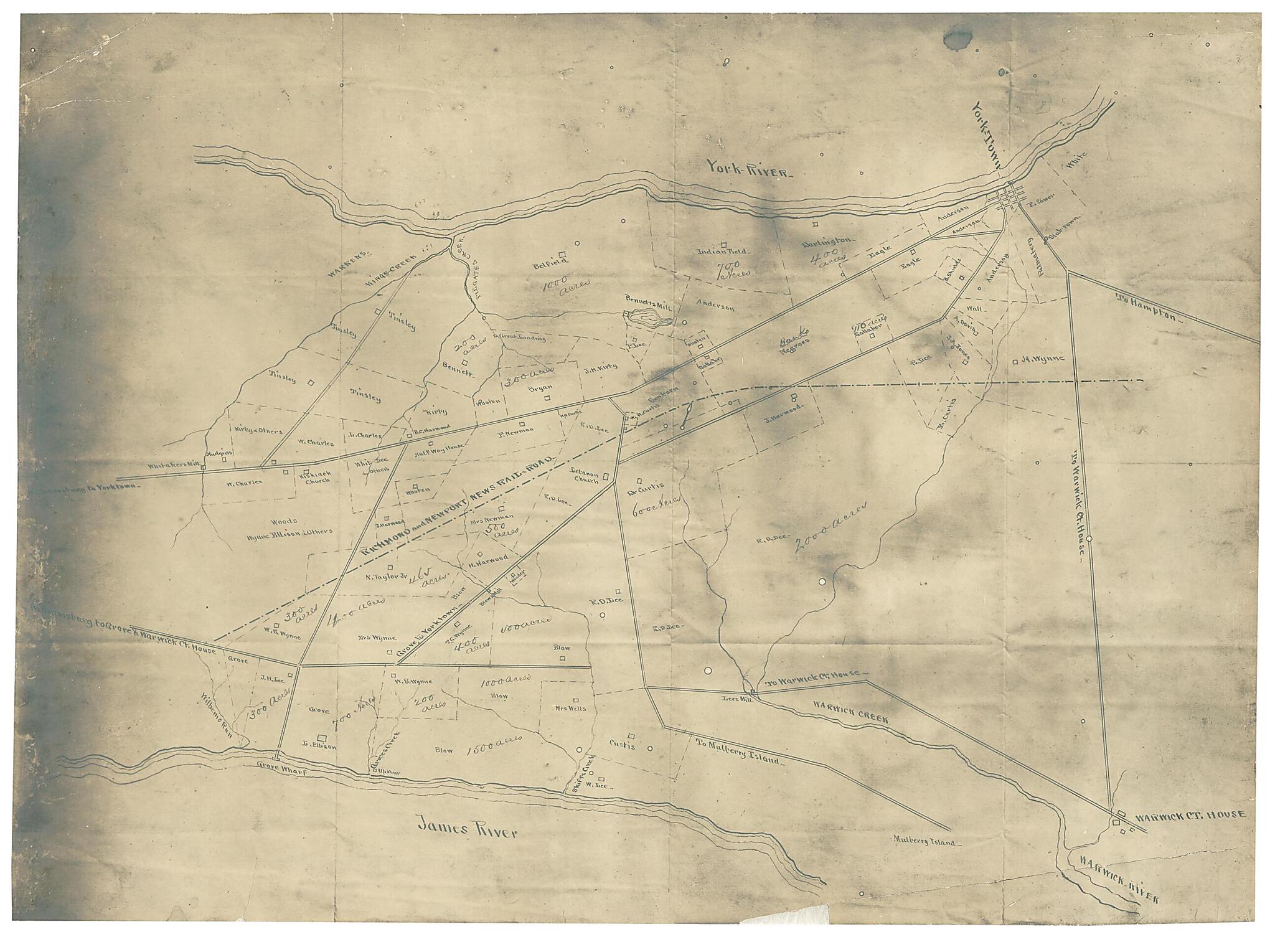
Old map of United States, Virginia, Virginia Peninsula.Created by Eli Thayer in 1863.
- "From a survey made for Hon. Eli Thayer of Massachusetts, who fixed at this point the site of the city he intended to build in connection with his plan for the free-labor colonization of Virginia. Mr. Thayer passed the union lines twice in 1862-3, receiving written authority from Secretary Seward, and with the aid of a surveyor was able to complete this map."--verso.
- Show rivers, railroads, roads, towns and houses with names of the owners.
- Sun print.
- This item is in the Map Collection of the Library of Virginia; please contact the Library's Archives Research Services department for more information.
- Title from verso of map.
- Swem, E.G. Maps relating to Virginia, 1041
- C. 1, May 1904, Franklin P. Rice, gift; c. 2 1974 photocopy, LVA; c. 3 photocopy, LVA; Feb. 2004, Map Cataloging Team.
- Civil War project no.: lva00180.
- Digital image available: 11.75 x 16 in.
- Previously filed as: 755.4 S8 1863.
Map Subjects
Civil War
History
United States
Virginia
Virginia Peninsula
Virginia Peninsula (Va.)
Eli Thayer
1863
- For the best legibility, order your map in the original size or larger. Most maps have intricate detail and small text that is best appreciated when the print size hasn't been reduced.
- Sizes labeled "Fits a Standard Frame" will drop right into any frame that you purchase in that size. The sizes that we offer are commonly available online and at most retail stores.
- Our standard sizes are recommendations based on the aspect ratio of the original map, but still may require some added "white space" in one dimension to fit.
- Non-standard sizes will require custom framing, and we suggest taking your print to the frame shop of your choice after you receive it for the best results.
- Custom sizes are available, simply contact us for a quote.
Below is an approximation of the scale of a few standard sizes, and how they might appear in your space.

