

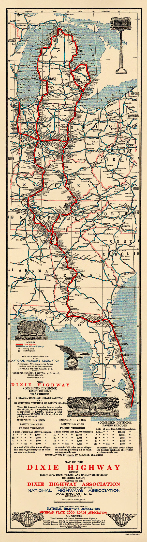
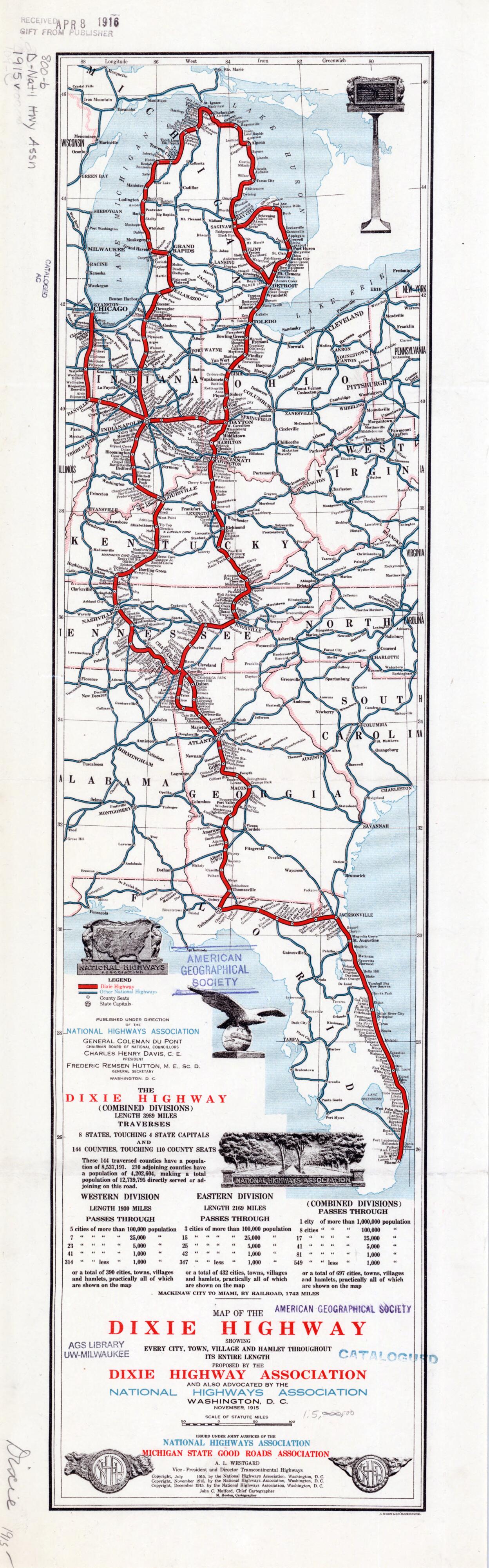
Map of the Dixie Highway. (Map of the Dixie Highway: Showing Every City, Town, Village and Hamlet Throughout Its Entire Length) 1915
- Regular price
-
$49.95 - Regular price
-
$34.95 - Sale price
-
$49.95
Buy one map, get any other map in our collection for 50% OFF! Add to cart to see discount.
Couldn't load pickup availability
About This Map
Step back to the golden age of American road trips with this detailed 1915 Map of the Dixie Highway from Relic Map Co. Charting every city, town, village, and hamlet along this iconic route, this reproduction map invites you to trace the evolving story of the open road—from Florida’s coastlines through the heartland to Michigan’s lakes. Whether you’re a history enthusiast, map collector, or simply captivated by vintage Americana, this piece brings character and conversation to your space. Rediscover the ambition behind early national highways as you admire a map that once helped shape travel dreams and connect communities. Perfect for study walls, living rooms, or wherever your wanderlust lives, this map is a reminder of journeys past and the enduring allure of the road less traveled. Let this historical gem inspire your own adventures—no passport required.
Created by A. Hoen and Company, Dixie Highway Association, M. Hooton, Michigan State Good Roads Association, John C. Mulford, National Highways Association in 1915.
- For the best legibility, order your map in the original size or larger. Most maps have intricate detail and small text that is best appreciated when the print size hasn't been reduced.
- Sizes labeled "Fits a Standard Frame" will drop right into any frame that you purchase in that size. The sizes that we offer are commonly available online and at most retail stores.
- Our standard sizes are recommendations based on the aspect ratio of the original map, but still may require some added "white space" in one dimension to fit.
- Non-standard sizes will require custom framing, and we suggest taking your print to the frame shop of your choice after you receive it for the best results.
- Custom sizes are available, simply contact us for a quote.
Below is an approximation of the scale of a few standard sizes, and how they might appear in your space.

