
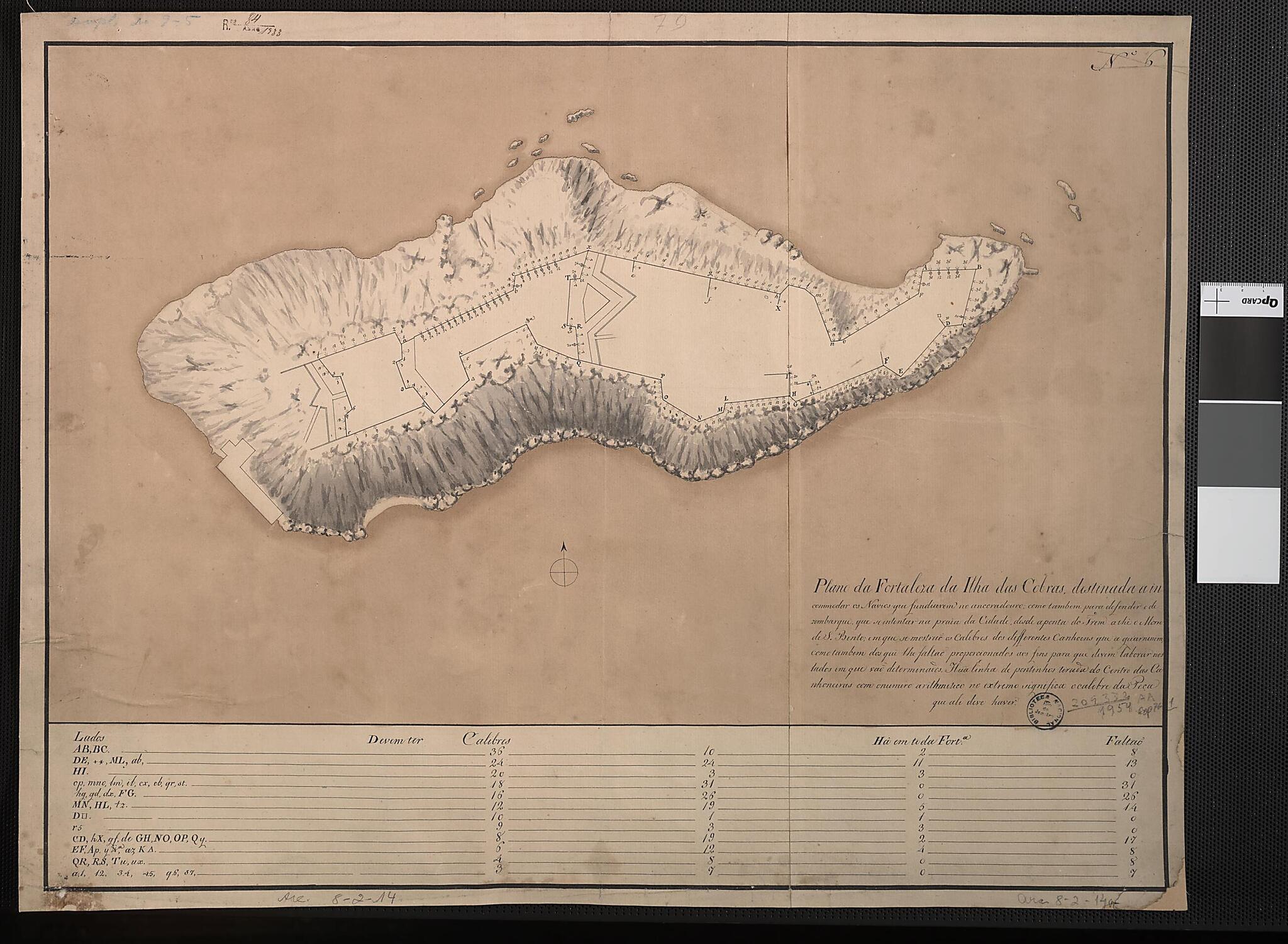
Map of the Fortress of Cobras Island Built to Harass Ships That Anchor In the Harbor. (Plano Da Fortaleza Da Ilha Das Cobras Destinada a Incomodar Os Navios Que Fundiarem No Ancoradouro) 1789
- Regular price
-
$54.95 - Regular price
-
$30.95 - Sale price
-
$54.95
Buy one map, get any other map in our collection for 50% OFF! Add to cart to see discount.
Couldn't load pickup availability
About This Map
Discover the timeless beauty of our fine art quality printed reproduction of this antique map. Perfect for history enthusiasts, collectors, and interior decorators.
Restored with meticulous attention to detail by our team with over a decade of experience, this stunning reproduction captures the intricate artistry and historical significance of the original map.
Whether you're a collector or seeking a unique decor piece, this archival-quality map reproduction is a timeless addition to any space. Order now to bring history to life!
Old map of Brazil.-"Map of the Fortress of Cobras Island Built to Harass Ships that Anchor in the Harbor"--is taken from the note in the lower right, and indicates the role that the fort played in defending the harbor. The first fort was erected on the island in the 1620s, when Portugal's Brazilian holdings were under threat from the Dutch as well as from the French and the English. Over the next century, the fort was rebuilt and expanded, and eventually included a house for the fort commander, a chapel, barracks, and storehouses for supplies.
Created by José Correia Rangel De Bulhões in 1789.
- Title devised, in English, by Library staff.
- Original resource extent: 1 manuscript map ; 41 x 54 centimeters.
- Original resource at: National Library of Brazil.
- Content in Portuguese.
- Description based on data extracted from World Digital Library, which may be extracted from partner institutions.
Map Subjects
Brazil
Cobras Island
Forts And Fortifications
Manuscript Maps
José Correia Rangel De Bulhões
1789
- For the best legibility, order your map in the original size or larger. Most maps have intricate detail and small text that is best appreciated when the print size hasn't been reduced.
- Sizes labeled "Fits a Standard Frame" will drop right into any frame that you purchase in that size. The sizes that we offer are commonly available online and at most retail stores.
- Our standard sizes are recommendations based on the aspect ratio of the original map, but still may require some added "white space" in one dimension to fit.
- Non-standard sizes will require custom framing, and we suggest taking your print to the frame shop of your choice after you receive it for the best results.
- Custom sizes are available, simply contact us for a quote.
Below is an approximation of the scale of a few standard sizes, and how they might appear in your space.

