
1
/
of
1
Map of the Logan County Coal Field In West Virginia 1915
- Regular price
-
$153.95 - Regular price
-
$215.95 - Sale price
-
$153.95
Couldn't load pickup availability
Ready to Frame and Gift
Matte finish, Heavy archival paper, Fade-resistant inks
Professionally Restored
For the best presentation, your map will be carefully retouched by our experienced team
Free Shipping & Free Returns
Orders of $75 or more ship for free and arrive in 3-5 business days
Map Description
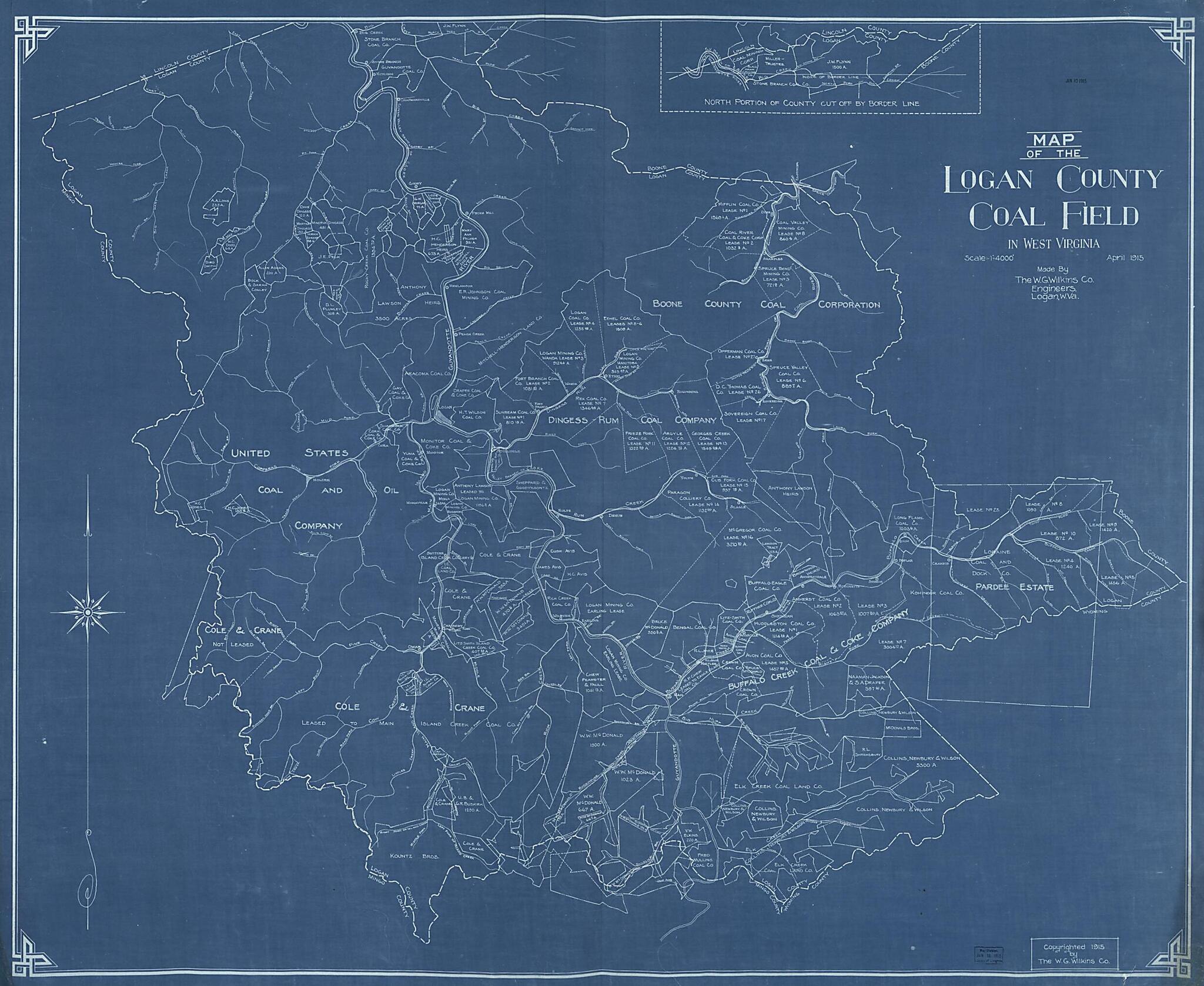
Old map of Logan County, United States, West Virginia.
Created by W. G. Co Wilkins in 1915.
Created by W. G. Co Wilkins in 1915.
- Shows coal company boundaries.
- Blue-line print.
- Includes inset of northern portion of county.
Map Subjects
Coal
Coal Mines And Mining
Logan County
Logan County (W. Va.)
United States
West Virginia
W. G. Co Wilkins
1915
Map Tags
1915
Coal
Coal Mines And Mining
Logan County
Logan County (W. Va.)
Map
Maps
United States
W. G. Co Wilkins
West Virginia
Customer Testimonials
No matching reviews
Secure Checkout
Lifetime Warranty
Money-Back Guarantee
Map Sizing Information
- For the best legibility, order your map in the original size or larger. Most maps have intricate detail and small text that is best appreciated when the print size hasn't been reduced.
- Sizes labeled "Fits a Standard Frame" will drop right into any frame that you purchase in that size. The sizes that we offer are commonly available online and at most retail stores.
- Our standard sizes are recommendations based on the aspect ratio of the original map, but still may require some added "white space" in one dimension to fit.
- Non-standard sizes will require custom framing, and we suggest taking your print to the frame shop of your choice after you receive it for the best results.
- Custom sizes are available, simply contact us for a quote.
Below is an approximation of the scale of a few standard sizes, and how they might appear in your space.
