
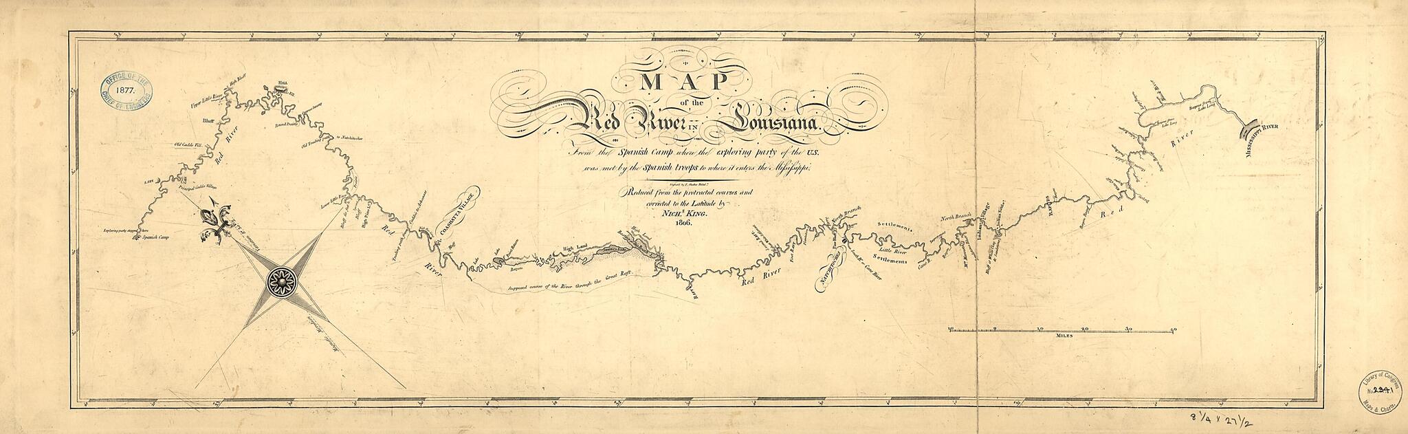
Map of the Red River In Louisiana from the Spanish Camp Where the Exploring Party of the U.S. Was Met by the Spanish Troops to Where It Enters the Mississippi, Reduced from the Protracted Courses and Corrected to the Latitude 1806
- Regular price
-
$54.95 - Regular price
-
$31.95 - Sale price
-
$54.95
Buy one map, get any other map in our collection for 50% OFF! Add to cart to see discount.
Couldn't load pickup availability
About This Map
Discover the timeless beauty of our fine art quality printed reproduction of this antique map. Perfect for history enthusiasts, collectors, and interior decorators.
Restored with meticulous attention to detail by our team with over a decade of experience, this stunning reproduction captures the intricate artistry and historical significance of the original map.
Whether you're a collector or seeking a unique decor piece, this archival-quality map reproduction is a timeless addition to any space. Order now to bring history to life!
Old map of Louisiana, Red River, Texas, United States.Created by N. (Nicholas) King, Francis Shallus in 1806.
- Also shows cities and towns, Indian settlements, and features in the region along the Red River.
- King's final work based on the Freeman-Curtis expedition of 1806.
- Oriented with north toward the upper left.
- Copy annotated in pencil in lower right corner
- Copy This map has some imperfections: taped on upper left portion and fold line completely torn to separate right portion of map. We'll do our best to restore the image before printing.
Map Subjects
Louisiana
Red River
La.)
Texas
United States
N. (Nicholas) King
Francis Shallus
1806
- For the best legibility, order your map in the original size or larger. Most maps have intricate detail and small text that is best appreciated when the print size hasn't been reduced.
- Sizes labeled "Fits a Standard Frame" will drop right into any frame that you purchase in that size. The sizes that we offer are commonly available online and at most retail stores.
- Our standard sizes are recommendations based on the aspect ratio of the original map, but still may require some added "white space" in one dimension to fit.
- Non-standard sizes will require custom framing, and we suggest taking your print to the frame shop of your choice after you receive it for the best results.
- Custom sizes are available, simply contact us for a quote.
Below is an approximation of the scale of a few standard sizes, and how they might appear in your space.
