
Map of the Seat of War In the Northern Part of Europe in 1812
- Regular price
-
$216.95 - Regular price
-
$211.95 - Sale price
-
$216.95
Buy one map, get any other map in our collection for 50% OFF! Add to cart to see discount.
Couldn't load pickup availability
About This Map
Discover the timeless beauty of our fine art quality printed reproduction of this antique map. Perfect for history enthusiasts, collectors, and interior decorators.
Restored with meticulous attention to detail by our team with over a decade of experience, this stunning reproduction captures the intricate artistry and historical significance of the original map.
Whether you're a collector or seeking a unique decor piece, this archival-quality map reproduction is a timeless addition to any space. Order now to bring history to life!
Old map of Europe.Created by John Stockdale in 1812.
- General-content map of the countries of Europe (northern, central, and eastern) in which the Napoleonic Wars were taking place.
- Does not show war-related features.
- Relief shown pictorially.
- Handwritten Millard Fillmore signature is not present on any of the sheets.
- Hand colored to emphasize country and empire boundaries.
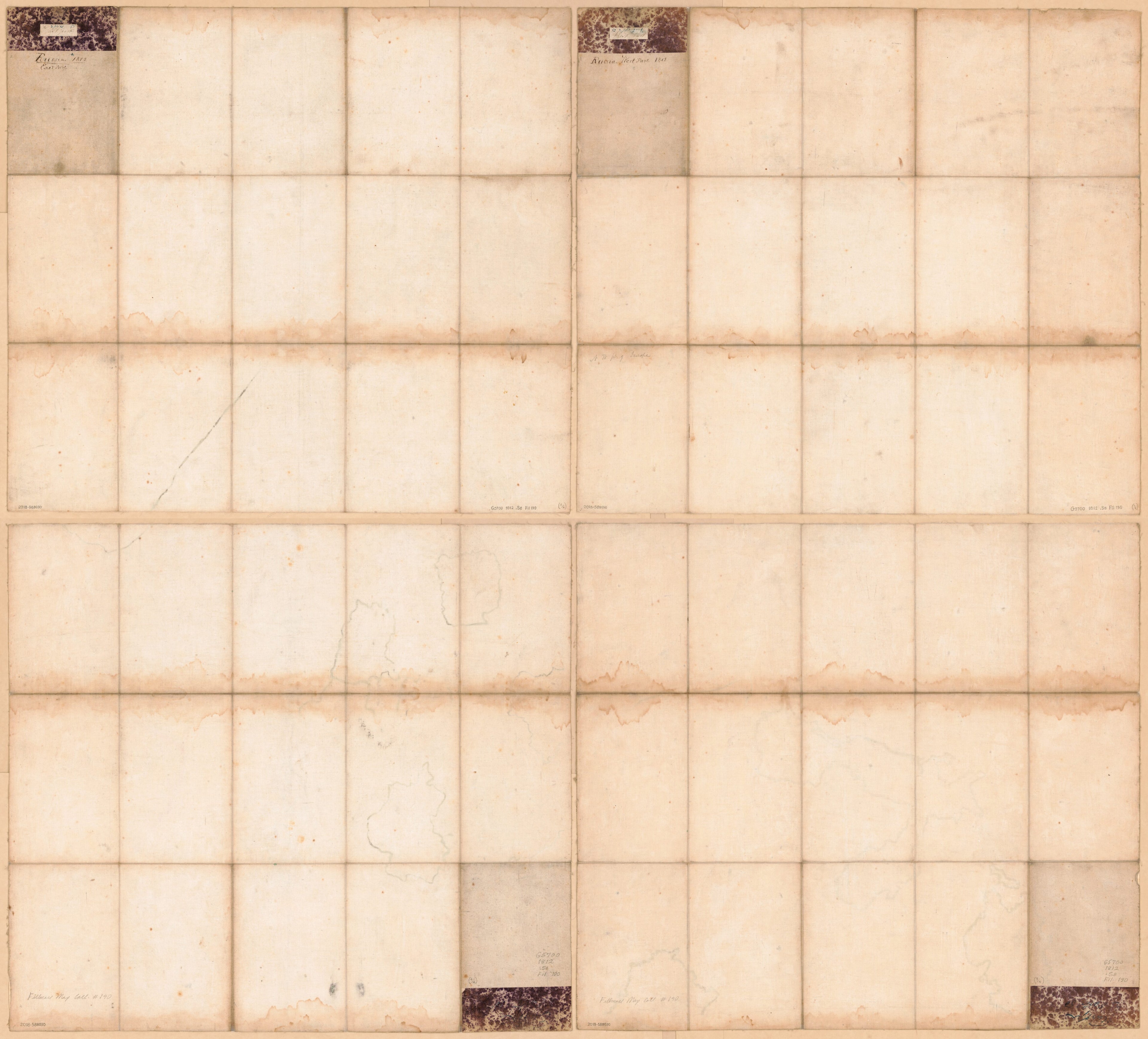
- When affixed to the cloth backing each map sheet was sectioned to 15 panels.
- Printed in 4 segments (sheets--NW/NE/SW/SE).
- Includes text on northeastern sheet titled: Changes in the geographical divisions of Europe since 1779.
- Sheets annotated on verso in ink handwriting on cloth backing or on affixed marbled paper slip to identify sheet coverage.
- For the best legibility, order your map in the original size or larger. Most maps have intricate detail and small text that is best appreciated when the print size hasn't been reduced.
- Sizes labeled "Fits a Standard Frame" will drop right into any frame that you purchase in that size. The sizes that we offer are commonly available online and at most retail stores.
- Our standard sizes are recommendations based on the aspect ratio of the original map, but still may require some added "white space" in one dimension to fit.
- Non-standard sizes will require custom framing, and we suggest taking your print to the frame shop of your choice after you receive it for the best results.
- Custom sizes are available, simply contact us for a quote.
Below is an approximation of the scale of a few standard sizes, and how they might appear in your space.

