
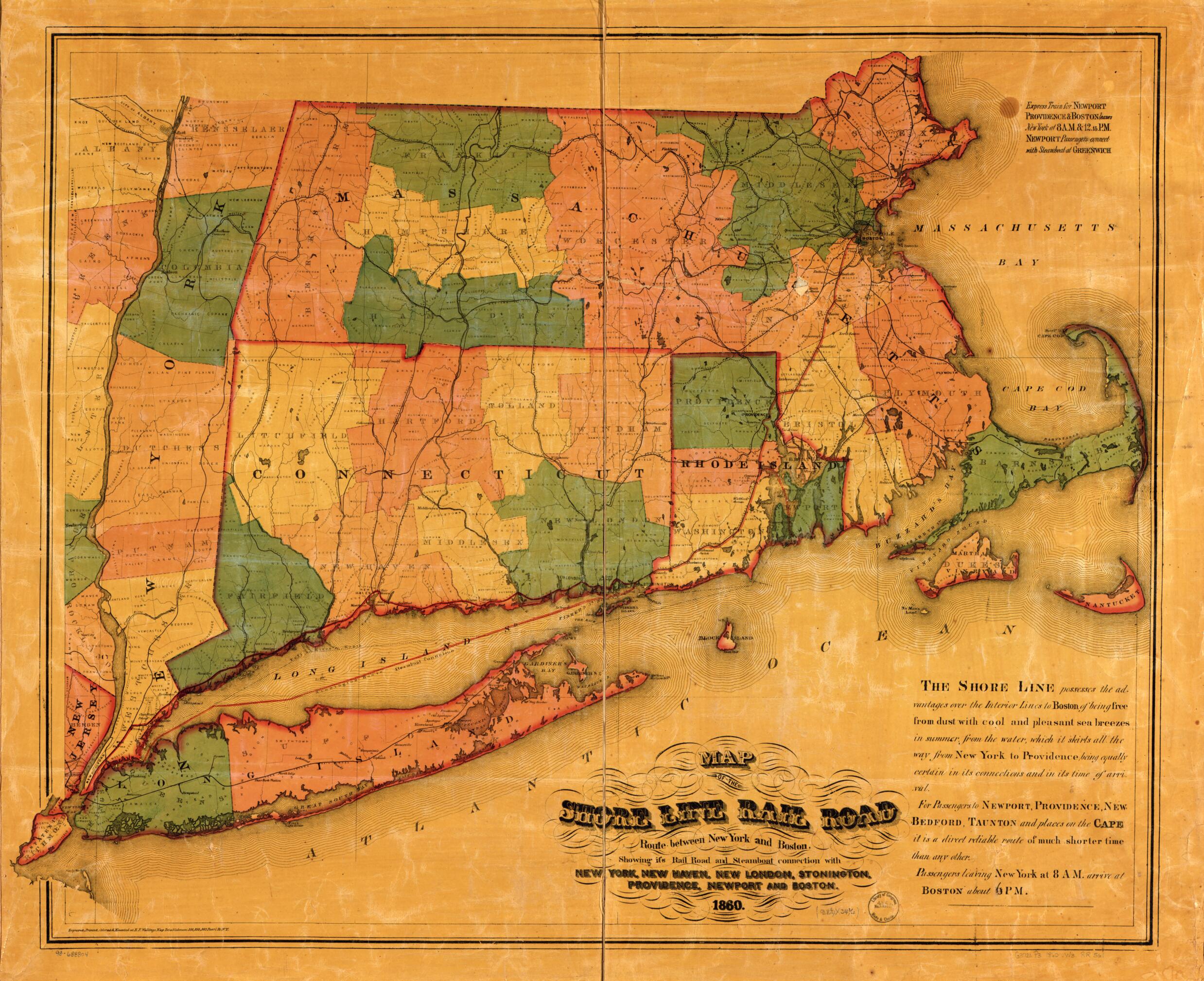
Map of the Shore Line Rail Road Route Between New York and Boston, Showing Its Rail Road and Steamboat Connection With New York, New Haven, New London, Stonington, Providence, Newport, and Boston 1860
- Regular price
-
$121.95 - Regular price
-
$116.95 - Sale price
-
$121.95
Buy one map, get any other map in our collection for 50% OFF! Add to cart to see discount.
Couldn't load pickup availability
About This Map
Discover the timeless beauty of our fine art quality printed reproduction of this antique map. Perfect for history enthusiasts, collectors, and interior decorators.
Restored with meticulous attention to detail by our team with over a decade of experience, this stunning reproduction captures the intricate artistry and historical significance of the original map.
Whether you're a collector or seeking a unique decor piece, this archival-quality map reproduction is a timeless addition to any space. Order now to bring history to life!
Old map of New England, United States.Detailed map of lower New England states and part of New York indicating drainage, cities and towns, state boundaries, township lines, and the railroad network.
Created by H.F. Wallings Map Establishment, Shore Line Railroad, Henry Francis Walling in 1860.
- Scale ca. 1:420,000.
- "The Shore Line possesses the advantages over the interior lines to Boston of being free from dust with cool and pleasant sea breezes in summer, from the water, which it skirts all the way from New York to Providence, being equally certain in its connections and its time of arrival. For passengers to Newport, Providence, New Bedford, Taunton and places on the Cape it is a direct reliable route of much shorter time than any other. Passengers leaving New York at 8 AM. arrive at Boston about 6 PM."
- Description derived from published bibliography.
- For the best legibility, order your map in the original size or larger. Most maps have intricate detail and small text that is best appreciated when the print size hasn't been reduced.
- Sizes labeled "Fits a Standard Frame" will drop right into any frame that you purchase in that size. The sizes that we offer are commonly available online and at most retail stores.
- Our standard sizes are recommendations based on the aspect ratio of the original map, but still may require some added "white space" in one dimension to fit.
- Non-standard sizes will require custom framing, and we suggest taking your print to the frame shop of your choice after you receive it for the best results.
- Custom sizes are available, simply contact us for a quote.
Below is an approximation of the scale of a few standard sizes, and how they might appear in your space.

