
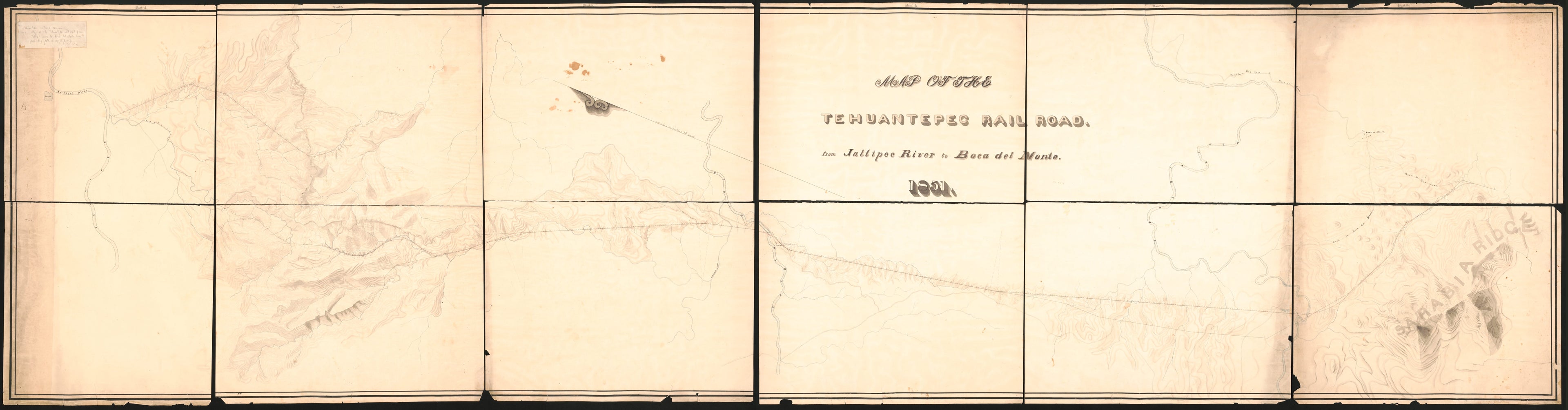
Map of the Tehuantepec Railroad : from Jaltipec River to Boca Del Monte (Tehuantepec Railroad, from Jaltipec River to Boca Del Monte) 1851
- Regular price
-
$369.95 - Regular price
-
$364.95 - Sale price
-
$369.95
Buy one map, get any other map in our collection for 50% OFF! Add to cart to see discount.
Couldn't load pickup availability
About This Map
Discover the timeless beauty of our fine art quality printed reproduction of this antique map. Perfect for history enthusiasts, collectors, and interior decorators.
Restored with meticulous attention to detail by our team with over a decade of experience, this stunning reproduction captures the intricate artistry and historical significance of the original map.
Whether you're a collector or seeking a unique decor piece, this archival-quality map reproduction is a timeless addition to any space. Order now to bring history to life!
Old manuscript map of Isthmus of, Mexico, Tehuantepec, Tehuantepec, Isthmus of.Created by Tehuantepec Railway Company in 1851.
- A proposed railroad route across the Isthmus of Tehuantepec.
- Also shows alternative routes, roads, streams, and settlements.
- Relief shown pictorially and by contours and spot heights.
- Manuscript: Pencil, pen-and-ink (black and red) and watercolors.
- Handwritten note attached on looseleaf paper In top left corner: Tehuantepec Railway Company. Map of the Tehuantepec Railroad from Jaltipec river to Boca del Monte, 1851. [anon. Ms.] fold. 35 x 139, [n.p. 1851].
- Accompanied by six manuscript sheets of an unidentified sketch map of a segment related to the railroad showing a large stream containing what appear to be soundings. Sketch map contains information relevant to the river portion of the proposed combined rail-water route across the Isthmus of Tehuantepec, filed separately G4412.T2
- This map has some imperfections: fragile, discoloration, staining, and torn at sheet edges. We'll do our best to restore the image before printing.
- For the best legibility, order your map in the original size or larger. Most maps have intricate detail and small text that is best appreciated when the print size hasn't been reduced.
- Sizes labeled "Fits a Standard Frame" will drop right into any frame that you purchase in that size. The sizes that we offer are commonly available online and at most retail stores.
- Our standard sizes are recommendations based on the aspect ratio of the original map, but still may require some added "white space" in one dimension to fit.
- Non-standard sizes will require custom framing, and we suggest taking your print to the frame shop of your choice after you receive it for the best results.
- Custom sizes are available, simply contact us for a quote.
Below is an approximation of the scale of a few standard sizes, and how they might appear in your space.
