
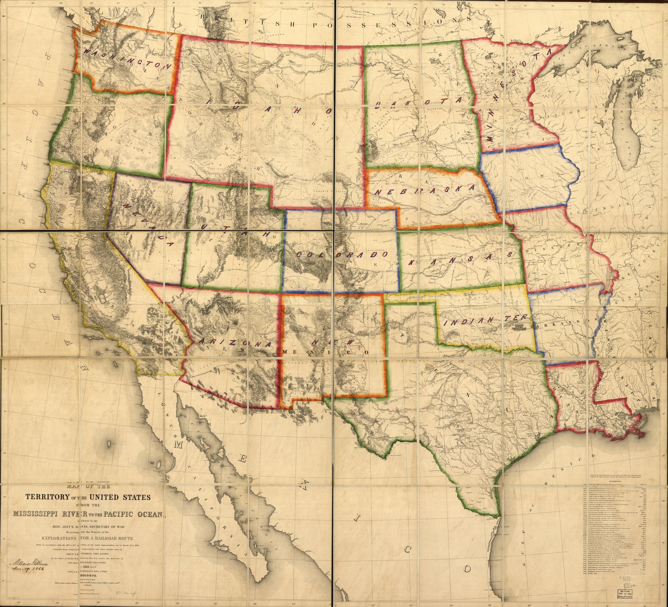
Map of the Territory of the United States From the Mississippi River to the Pacific Ocean : Ordered by Jeff' Davis, Secretary of War to Accompany the Reports of the Explorations for a Railroad Route in 1858
- Regular price
-
$208.95 - Regular price
-
$203.95 - Sale price
-
$208.95
Buy one map, get any other map in our collection for 50% OFF! Add to cart to see discount.
Couldn't load pickup availability
About This Map
Discover the timeless beauty of our fine art quality printed reproduction of this antique map. Perfect for history enthusiasts, collectors, and interior decorators.
Restored with meticulous attention to detail by our team with over a decade of experience, this stunning reproduction captures the intricate artistry and historical significance of the original map.
Whether you're a collector or seeking a unique decor piece, this archival-quality map reproduction is a timeless addition to any space. Order now to bring history to life!
Old map of United States, West.Very detailed map of the United States west of the Mississippi River indicating drainage, relief by hachures, cities and towns, forts, trails, wagon roads, and routes of exploration. An important map of western expansion, it utilized and lists 45 major exploration and mapping reports from the Lewis & Clark to the U.S. General Land Office Surveys.
Created by Julius Bien, Millard Fillmore, Edward Freyhold, United States. War Department, G. K. (Gouverneur Kemble) Warren in 1858.
- Shows Indian tribal locations, military posts, and routes and dates of expeditions and surveys.
- Published to accompany Lt. G. K. Warren's memoir to accompany the map of the territory of the United States from the Mississippi River to the Pacific Ocean and was included in the volume XI of the Pacific Railroad Reports; with this map the work of the Bureau of Topographical Engineers on the preliminary Pacific surveys came to a conclusion.
- Sectioned and mounted on cloth backing.
- Description derived from published bibliography.
- Signed: Millard Fillmore, Dec. 19, 1863.
- Includes "Authorities."
- Annotated on verso: No. 250. Territories of the U.S. 1863. Millard Fillmore Jany. 18, 1864.
- For the best legibility, order your map in the original size or larger. Most maps have intricate detail and small text that is best appreciated when the print size hasn't been reduced.
- Sizes labeled "Fits a Standard Frame" will drop right into any frame that you purchase in that size. The sizes that we offer are commonly available online and at most retail stores.
- Our standard sizes are recommendations based on the aspect ratio of the original map, but still may require some added "white space" in one dimension to fit.
- Non-standard sizes will require custom framing, and we suggest taking your print to the frame shop of your choice after you receive it for the best results.
- Custom sizes are available, simply contact us for a quote.
Below is an approximation of the scale of a few standard sizes, and how they might appear in your space.

