
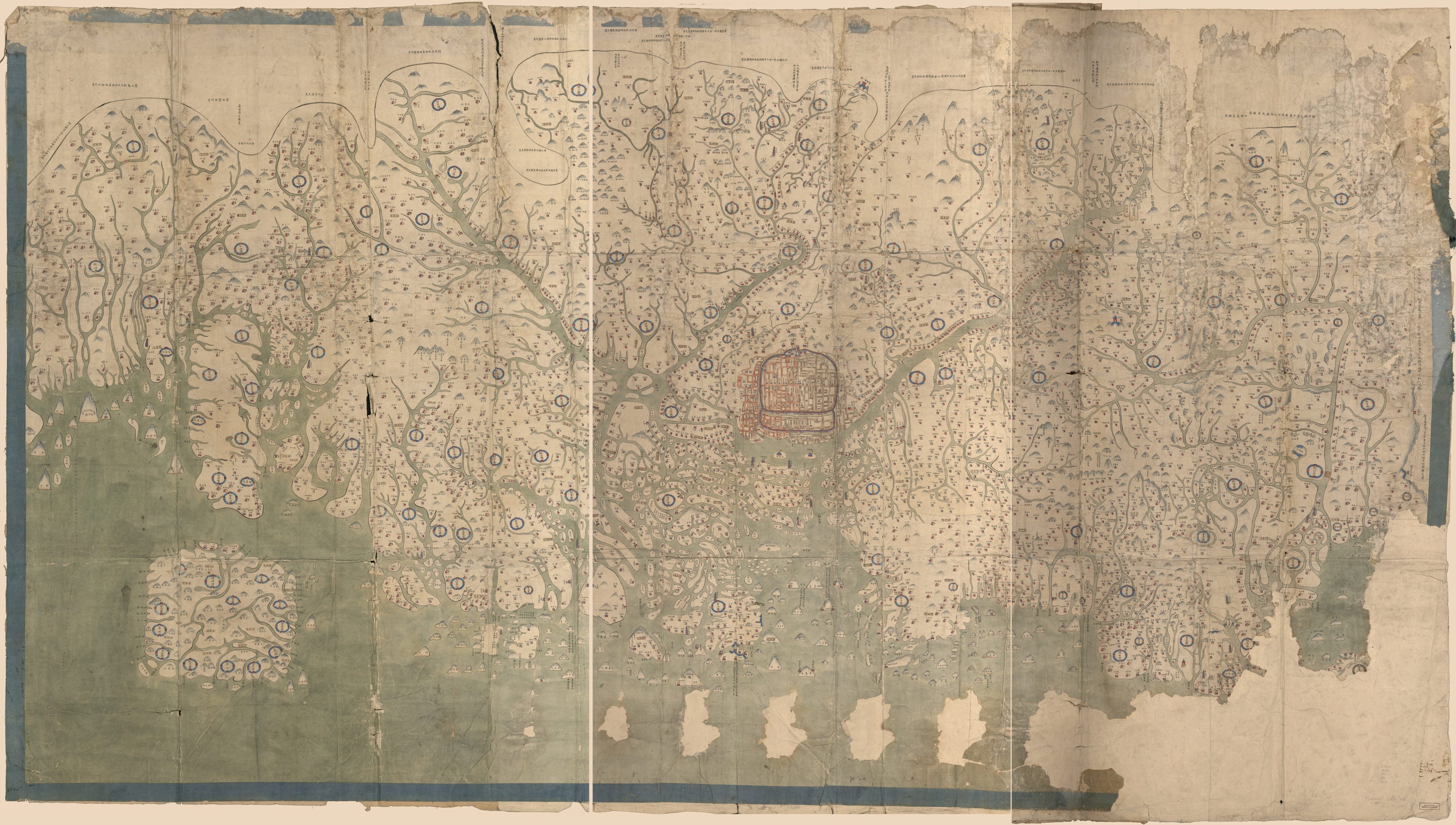
廣東通省水道圖, Map of the Waterways In Guangdong Province in 1815
- Regular price
-
$323.95 - Regular price
-
$318.95 - Sale price
-
$323.95
Shipping calculated at checkout.
Buy one map, get any other map in our collection for 50% OFF! Add to cart to see discount.
Couldn't load pickup availability
About This Map
Old map of China, Guangdong Sheng.
Created by Arthur W. (Arthur William) Hummel in 1815.
Created by Arthur W. (Arthur William) Hummel in 1815.
- Scale ca. 1:200,000.
- Shows mountains, rivers, coasts, islands, towns, villages, roads, passes, drainage, and settlement patterns of Guangdong Province including the Leizhou Peninsula and the Hainan Island.
- Relief shown pictorially.
- Pictorial map.
- Pen-and-ink and watercolor.
- Title supplied.
- Copy This map has some imperfections: portions of right side of map missing. We'll do our best to restore the image before printing.
- Hummel purchase 1930, no. 11.
- Previous call number: G7823.G8A5 1817 .G8 Vault Oversize
Map Sizing Information
- For the best legibility, order your map in the original size or larger. Most maps have intricate detail and small text that is best appreciated when the print size hasn't been reduced.
- Sizes labeled "Fits a Standard Frame" will drop right into any frame that you purchase in that size. The sizes that we offer are commonly available online and at most retail stores.
- Our standard sizes are recommendations based on the aspect ratio of the original map, but still may require some added "white space" in one dimension to fit.
- Non-standard sizes will require custom framing, and we suggest taking your print to the frame shop of your choice after you receive it for the best results.
- Custom sizes are available, simply contact us for a quote.
Below is an approximation of the scale of a few standard sizes, and how they might appear in your space.
