

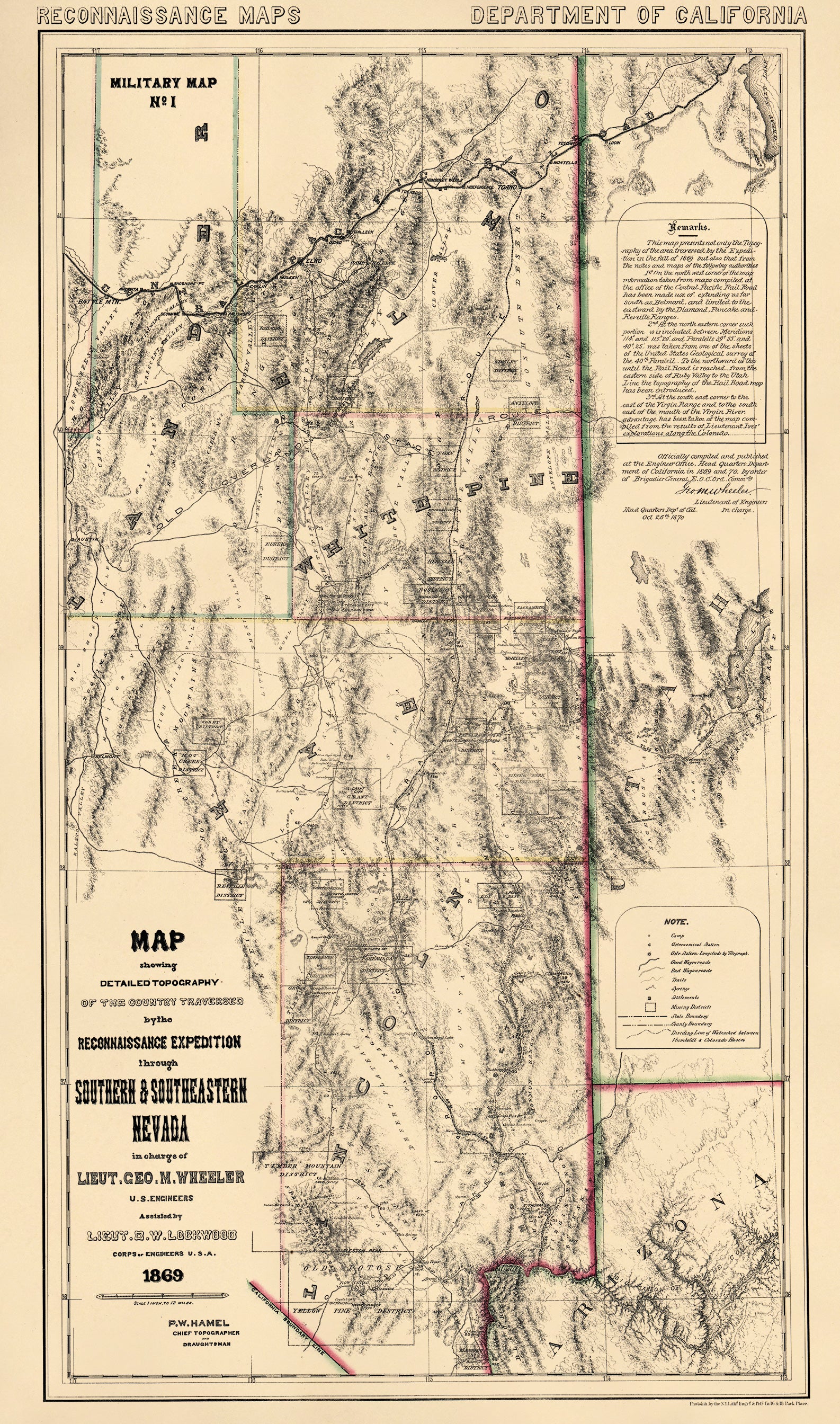
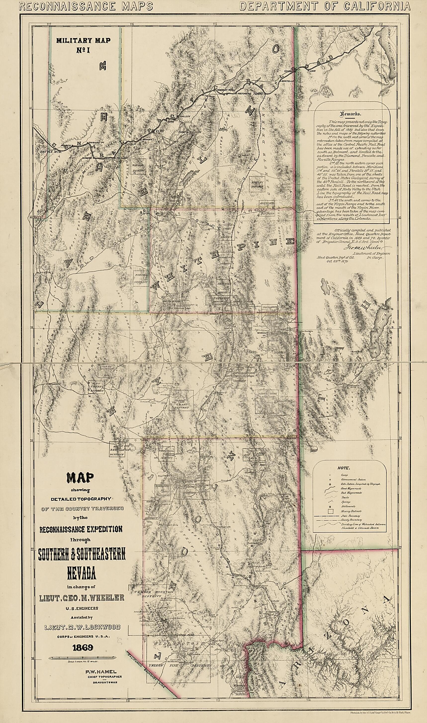
Map Showing Detailed Topography of the Country Traversed by the Reconnaissance Expedition Through Southern and Southeastern Nevada (Reconnaissance Maps : Department of California, Military Map No. 1) 1870
- Regular price
-
$86.95 - Regular price
-
$81.95 - Sale price
-
$86.95
Buy one map, get any other map in our collection for 50% OFF! Add to cart to see discount.
Couldn't load pickup availability
About This Map
Discover the timeless beauty of our fine art quality printed reproduction of this antique map. Perfect for history enthusiasts, collectors, and interior decorators.
Restored with meticulous attention to detail by our team with over a decade of experience, this stunning reproduction captures the intricate artistry and historical significance of the original map.
Whether you're a collector or seeking a unique decor piece, this archival-quality map reproduction is a timeless addition to any space. Order now to bring history to life!
Old topographic map of Nevada, United States.Created by P. W. Hamel, D. W. (Daniel Wright) Lockwood, George M. (George Montague) Wheeler in 1870.
- Covers Elko, White Pine, Lander, Nye, and Lincoln counties in Nevada.
- Relief shown by hachures and spot heights.
- Gift; Miss Eleanor Sherman Fitch; July 7, 1942.
- "Officially compiled and published at the Engineer Office, Head Quarters Department of California in 1869 and 70, by order of Brigadier General E. O. C. Ord, Commdg. [signed in facsimile] Geo. M. Wheeler, Lieutenant of Engineers in charge. Head Quarters Dept. of Cal., Oct. 26th 1870."
- Civil War Map
- Copy This map has some imperfections: holes and losses along top and bottom edges repaired with tape. We'll do our best to restore the image before printing.
- Includes text.
- In red on verso: 23.
Map Subjects
Military Topography
Nevada
Topographic Maps
United States
Topographic Maps
P. W. Hamel
D. W. (Daniel Wright) Lockwood
George M. (George Montague) Wheeler
1870
- For the best legibility, order your map in the original size or larger. Most maps have intricate detail and small text that is best appreciated when the print size hasn't been reduced.
- Sizes labeled "Fits a Standard Frame" will drop right into any frame that you purchase in that size. The sizes that we offer are commonly available online and at most retail stores.
- Our standard sizes are recommendations based on the aspect ratio of the original map, but still may require some added "white space" in one dimension to fit.
- Non-standard sizes will require custom framing, and we suggest taking your print to the frame shop of your choice after you receive it for the best results.
- Custom sizes are available, simply contact us for a quote.
Below is an approximation of the scale of a few standard sizes, and how they might appear in your space.

