
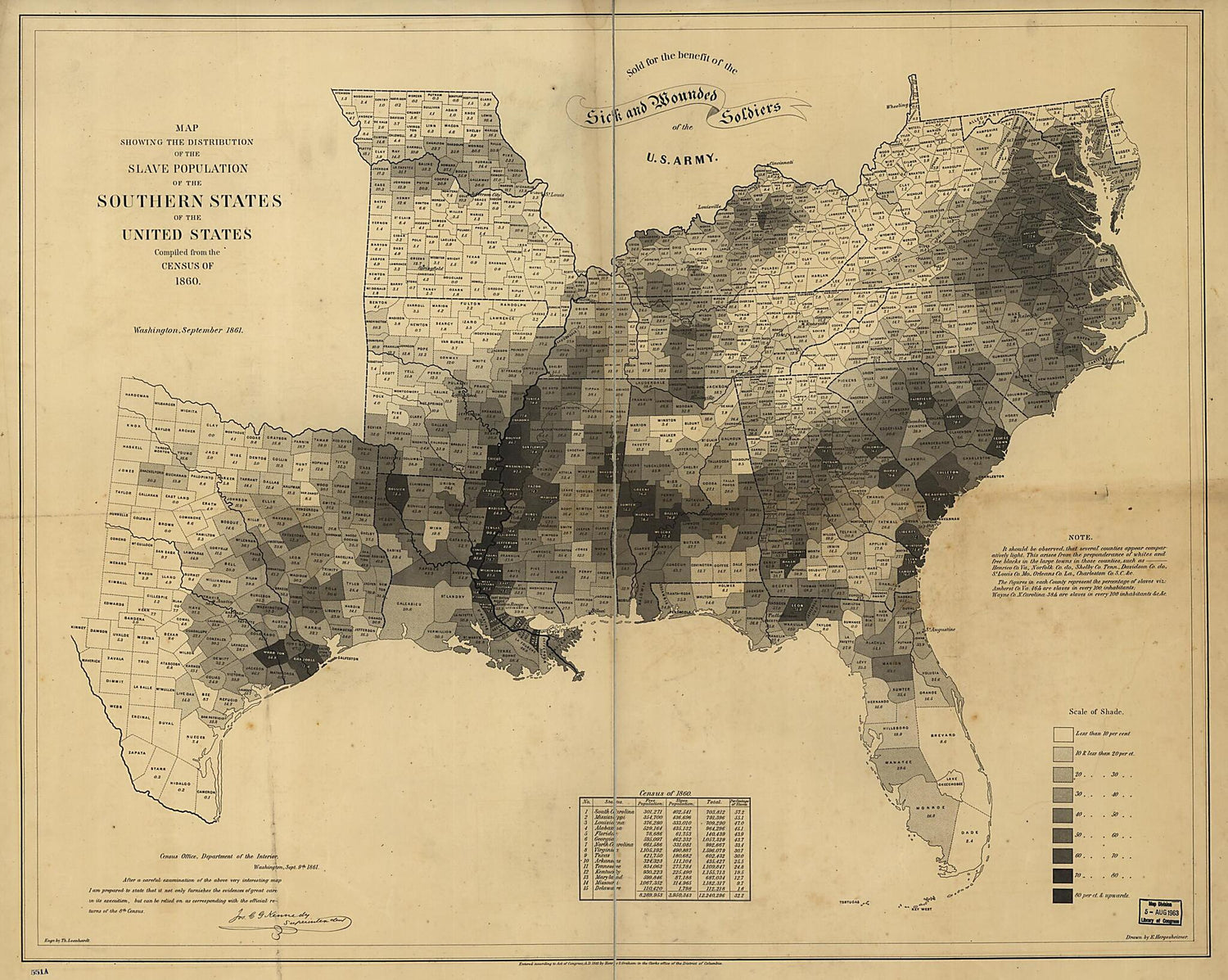
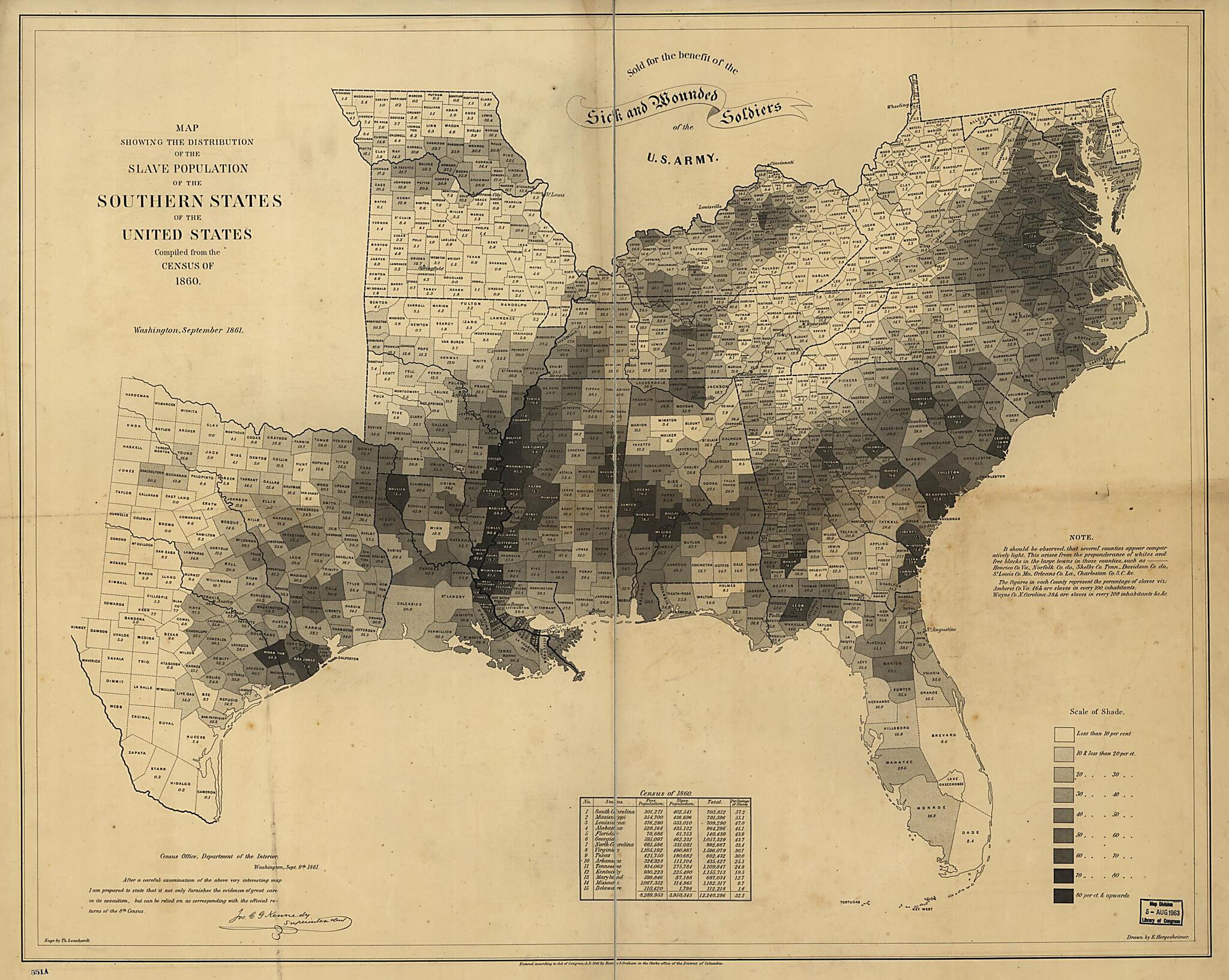
Map Showing the Distribution of the Slave Population of the Southern States of the United States. Compiled from the Census of 1860 1861
- Regular price
-
$101.95 - Regular price
-
$96.95 - Sale price
-
$101.95
Buy one map, get any other map in our collection for 50% OFF! Add to cart to see discount.
Couldn't load pickup availability
About This Map
Discover the timeless beauty of our fine art quality printed reproduction of this antique map. Perfect for history enthusiasts, collectors, and interior decorators.
Restored with meticulous attention to detail by our team with over a decade of experience, this stunning reproduction captures the intricate artistry and historical significance of the original map.
Whether you're a collector or seeking a unique decor piece, this archival-quality map reproduction is a timeless addition to any space. Order now to bring history to life!
Old map of Southern States, United States.Created by E. (Edwin) Hergesheimer in 1861.
- Scale ca. 1:3,000,000.
- Civil War Map
- "Entered according to Act of Congress, A.D. 1861 by Henry S. Graham."
- "Sold for the benefit of the sick and wounded soldiers of the U.S. Army."
- "Census Office, Department of the Interior, Washington, Sept. 9th, 1861. After a careful examination of the above very interesting map I am prepared to state that it not only furnishes the evidences of great care in its execution, but can be relied on as corresponding with the official returns of the 8th Census. [Signed in facsimile] Jos. C. G. Kennedy, Superintendent."
- Map indicates by gray patterns, the percentage of slaves in each county. "It should be observed, that several counties appear comparatively light. This arises from the preponderance of whites and free blacks in the large towns in those counties. . . The figures in each county represent the percentage of slaves. . ."
- "Scale of shade" printed in lower right corner.
- Includes population table based on census of 1860.
- Description derived from published bibliography.
Map Subjects
Slavery
Southern States
United States
E. (Edwin) Hergesheimer
1861

- For the best legibility, order your map in the original size or larger. Most maps have intricate detail and small text that is best appreciated when the print size hasn't been reduced.
- Sizes labeled "Fits a Standard Frame" will drop right into any frame that you purchase in that size. The sizes that we offer are commonly available online and at most retail stores.
- Our standard sizes are recommendations based on the aspect ratio of the original map, but still may require some added "white space" in one dimension to fit.
- Non-standard sizes will require custom framing, and we suggest taking your print to the frame shop of your choice after you receive it for the best results.
- Custom sizes are available, simply contact us for a quote.
Below is an approximation of the scale of a few standard sizes, and how they might appear in your space.

