
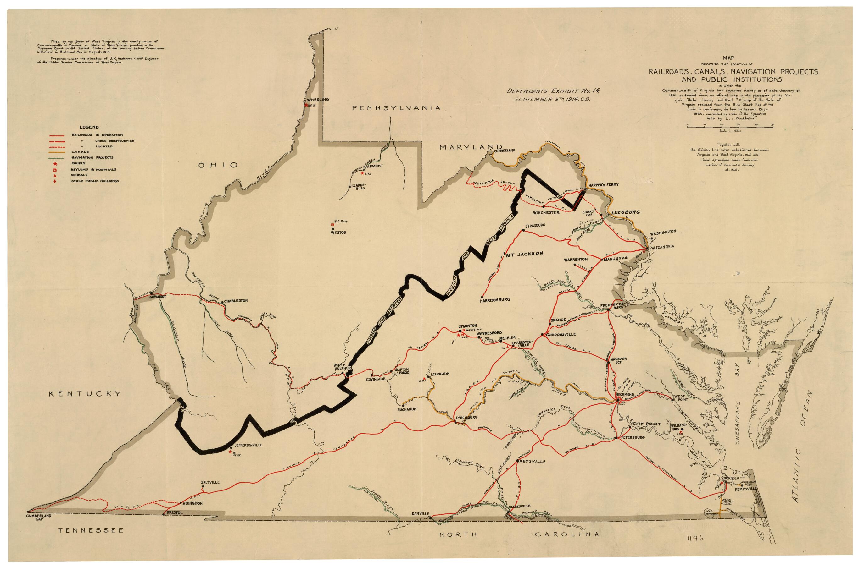
Map Showing the Location of Railroads, Canals, Navigation Projects and Public Institutions In Which the Commonwealth of Virginia Had Invested Money As of Date January 1st. 1861 : As Traced from an Official Map In the Possession of the Virginia State L...
- Regular price
-
$58.95 - Regular price
-
$41.95 - Sale price
-
$58.95
Buy one map, get any other map in our collection for 50% OFF! Add to cart to see discount.
Couldn't load pickup availability
About This Map
Discover the timeless beauty of our fine art quality printed reproduction of this antique map. Perfect for history enthusiasts, collectors, and interior decorators.
Restored with meticulous attention to detail by our team with over a decade of experience, this stunning reproduction captures the intricate artistry and historical significance of the original map.
Whether you're a collector or seeking a unique decor piece, this archival-quality map reproduction is a timeless addition to any space. Order now to bring history to life!
Old map of United States, Virginia, West Virginia.Created by J. K. Anderson, Herman Boye, L. V. (Lewis Von) Buchholtz, West Virginia. Public Service Commission in 1914.
- "Defendants Exhibit No. 14 September 9th, 1914, C.B."
- "Filed by the State of West Virginia in the equity cause of Commonwealth of Virginia vs. State of West Virginia pending in the Supreme Court of the United States, at the hearing before Commissioner Littlefield in Richmond, Va., in August, 1914."
- "Prepared under the direction of J.K. Anderson, Chief Engineer of the Public Service Commission of West Virginia."
- This item is in the Map Collection of the Library of Virginia; please contact the Library's Archives Research Services department for more information.
- C. 1, Dec. 2002, J.K. Anderson, gift (1914), Map Cataloging Team; c. 2, photocopy, LVA.
- C. 1, map accession no. 1146 (1914); c. 2 2357 (1966)(negative photostat, on sheet 43 x 64 cm.).
- Civil War Map Proj. no.: lva00078.
- Conservation: Etherington Conservation Center, July 2002.
- Digital image available: 16 x 24.5 in.
- Previously filed as: 755 1861 1914.
- For the best legibility, order your map in the original size or larger. Most maps have intricate detail and small text that is best appreciated when the print size hasn't been reduced.
- Sizes labeled "Fits a Standard Frame" will drop right into any frame that you purchase in that size. The sizes that we offer are commonly available online and at most retail stores.
- Our standard sizes are recommendations based on the aspect ratio of the original map, but still may require some added "white space" in one dimension to fit.
- Non-standard sizes will require custom framing, and we suggest taking your print to the frame shop of your choice after you receive it for the best results.
- Custom sizes are available, simply contact us for a quote.
Below is an approximation of the scale of a few standard sizes, and how they might appear in your space.
