Skip to product information
1 of 1

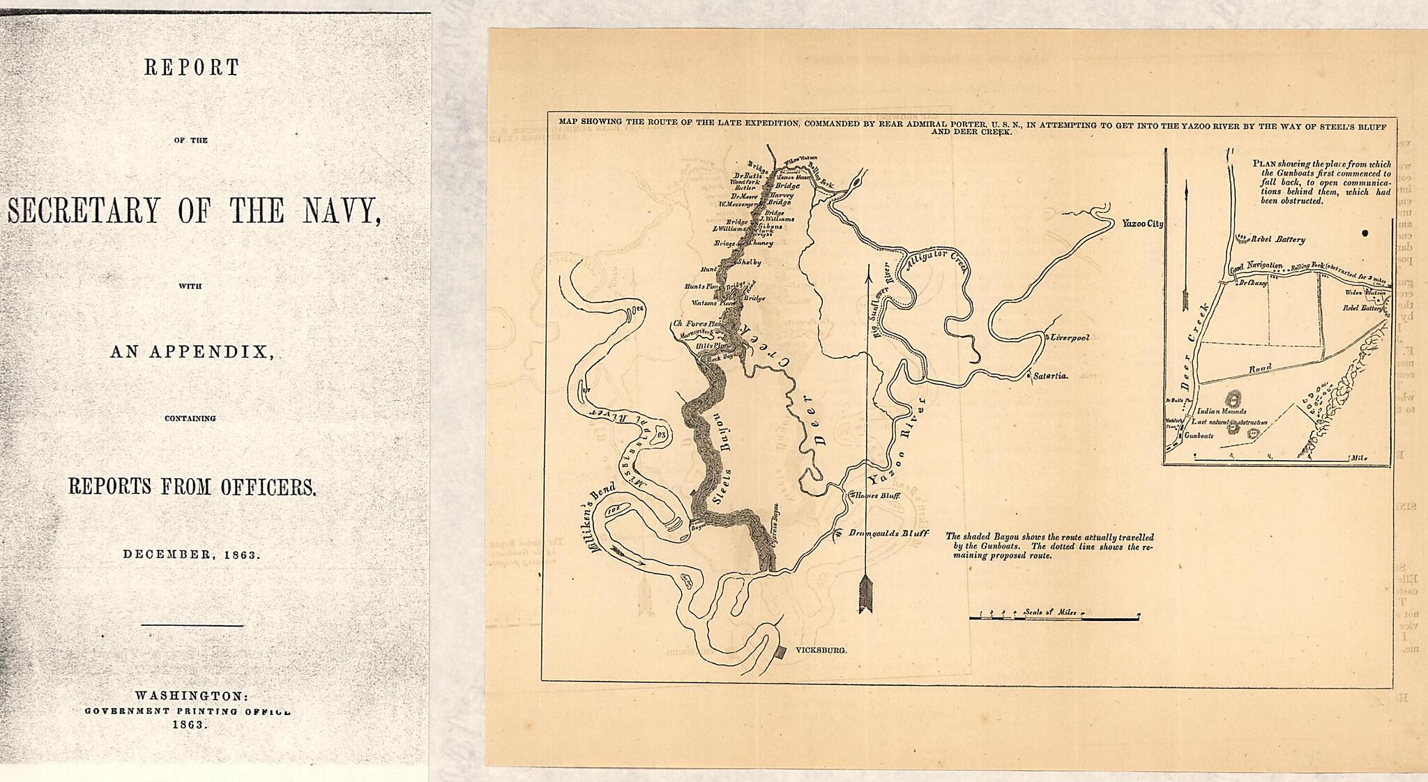
Map Showing the Route of the Late Expedition, Commanded by Rear Admiral Porter, U.S.N., In Attempting to Get Into the Yazoo River by the Way of Steel's Bluff i.e., Bayou and Deer Creek 1863

Regular price
$15.95
Regular price
$24.95
Sale price
$15.95
Map Description
Old map of Mississippi, United States, Yazoo River.

Created by United States. Navy in 1863.
  • Scale ca. 1:500,000.
  • Civil War Map
  • From Report of the Secretary of the Navy, with an appendix, containing reports from officers. December, 1863 (Washington, Government Printing Office, 1863). opp. p. 455.
  • Inset: Plan showing the place from which Gunboats first commenced to fall back, to open communications behind them, which had been obstructed. Scale ca. 1:36,000. 10 x 7 cm.
  • Map is similar in content to the map drawn by A. Strausz, U.S. Coast Survey (entry no. 295)
  • Description derived from published bibliography.

Map Subjects

Civil War

History

Mississippi

United States

Yazoo River

Yazoo River (Miss.)

United States. Navy

1863

Map Tags

1863

Civil War

History

Map

Maps

Mississippi

United States

United States. Navy

Yazoo River

Yazoo River (Miss.)

Fine Art Quality Printed on heavyweight (230 gsm) archival paper with a classic matte finish
Professionally Restored For the best presentation, your map will be carefully retouched by our experienced team
Free Shipping Orders of $75 or more ship for free and arrive in 3-5 business days
Proudly Made in the USA All of our maps are custom printed to order in Portland, Maine
Help with Choosing a Map Size
Secure Checkout
Lifetime Warranty
Money-Back Guarantee
This old map of Map Showing the Route of the Late Expedition, Commanded by Rear Admiral Porter, U.S.N., In Attempting to Get Into the Yazoo River by the Way of Steel&