
Map of the Dominican Republic. (Mapa De La República Dominicana) 1910
- Regular price
-
$63.95 - Regular price
-
$58.95 - Sale price
-
$63.95
Buy one map, get any other map in our collection for 50% OFF! Add to cart to see discount.
Couldn't load pickup availability
About This Map
Discover the timeless beauty of our fine art quality printed reproduction of this antique map. Perfect for history enthusiasts, collectors, and interior decorators.
Restored with meticulous attention to detail by our team with over a decade of experience, this stunning reproduction captures the intricate artistry and historical significance of the original map.
Whether you're a collector or seeking a unique decor piece, this archival-quality map reproduction is a timeless addition to any space. Order now to bring history to life!
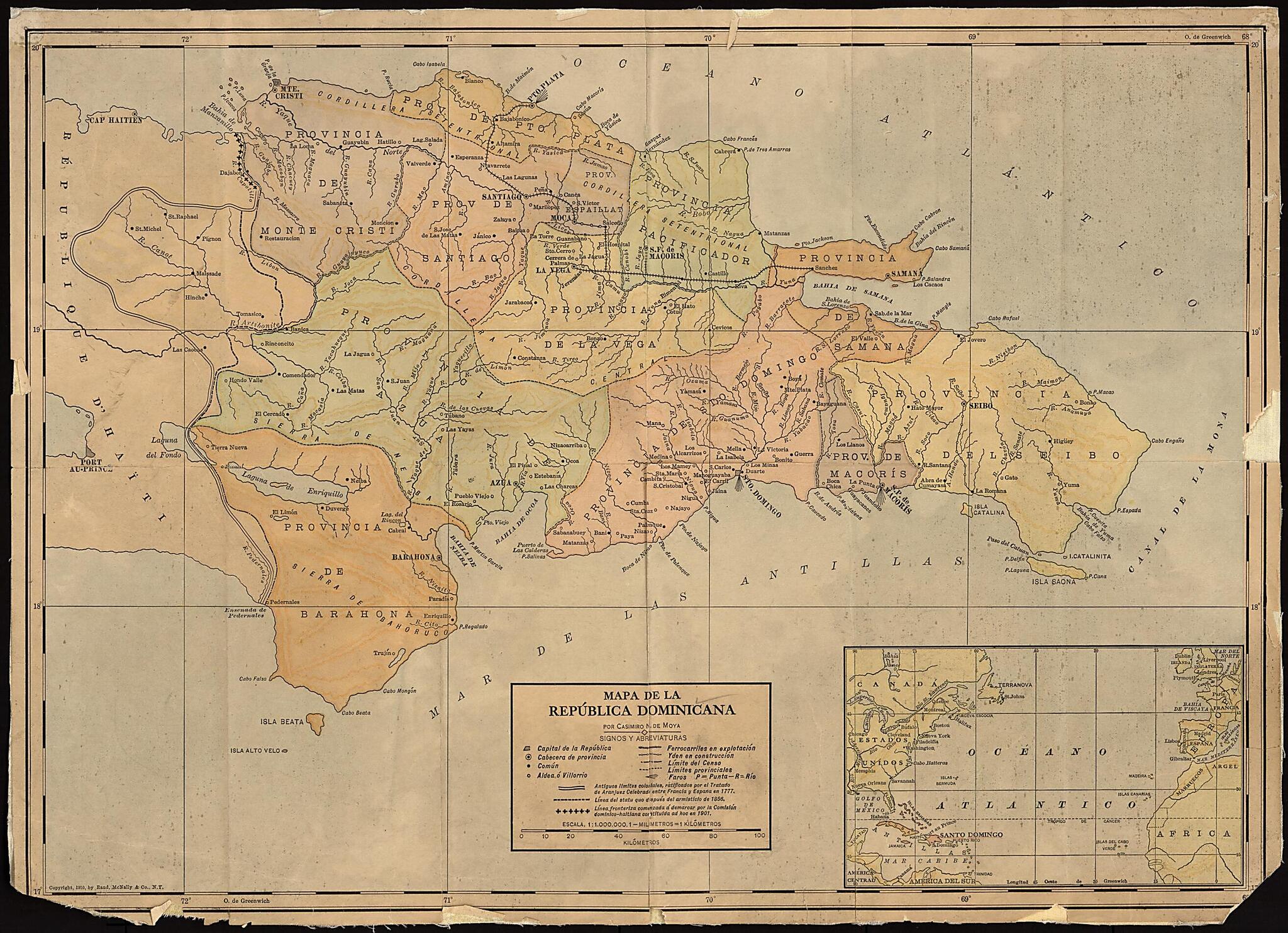
Old map of Dominican Republic.speaking Dominican Republic and French-speaking Haiti goes back to the Treaty of Ryswick of 1697, under which Spain transferred the western third of what was then the Spanish colony of Santo Domingo to France. In the Treaty of Aranjuez of 1777, the French and Spanish empires defined precisely the border between their respective territories on the island. Part of the present-day border between Haiti and the Dominican Republic still follows the line negotiated in 1777, but adjustments to the border were made in the 20th century. This map of the Dominican Republic by Casimiro Nemesio de Moya shows the original colonial border of 1777 and changes made by the two republics up to 1910. Also shown are provincial borders and capitals, major towns and cities, railroads (both operational and planned), and physical features. An inset map at the lower right shows the northern part of the Atlantic Ocean and the location of the Dominican Republic in relation to the continents of North and South America, Europe, and Africa.
Created by Casimiro N. De Moya in 1910.
- Title devised, in English, by Library staff.
- "Scale 1:1,000,000. 1 millimeter equals 1 kilometer."--Note extracted from World Digital Library.
- Original resource extent: 2 maps on 1 sheet : mounted on linen, color ; 36 x 50 centimeters.
- Original resource at: Columbus Memorial Library, Organization of American States.
- Content in Spanish.
- Description based on data extracted from World Digital Library, which may be extracted from partner institutions.
Map Subjects
Dominican Republic
Hispaniola
Casimiro N. De Moya
1910
- For the best legibility, order your map in the original size or larger. Most maps have intricate detail and small text that is best appreciated when the print size hasn't been reduced.
- Sizes labeled "Fits a Standard Frame" will drop right into any frame that you purchase in that size. The sizes that we offer are commonly available online and at most retail stores.
- Our standard sizes are recommendations based on the aspect ratio of the original map, but still may require some added "white space" in one dimension to fit.
- Non-standard sizes will require custom framing, and we suggest taking your print to the frame shop of your choice after you receive it for the best results.
- Custom sizes are available, simply contact us for a quote.
Below is an approximation of the scale of a few standard sizes, and how they might appear in your space.

