
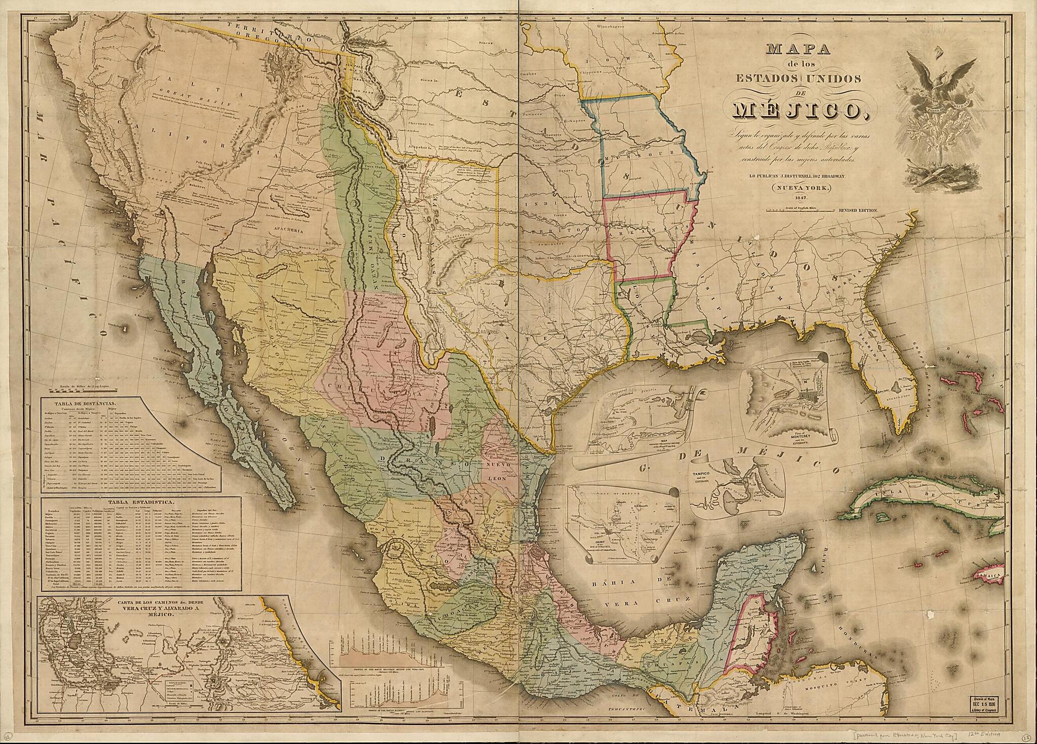
Mapa De Los Estados Unidos De Méjico : Segun Lo Organizado Y Definido Por Las Varias Actas Del Congreso De Dicha Républica Y Construido Por Las Mejores Autoridades 1847
- Regular price
-
$136.95 - Regular price
-
$131.95 - Sale price
-
$136.95
Buy one map, get any other map in our collection for 50% OFF! Add to cart to see discount.
Couldn't load pickup availability
About This Map
Discover the timeless beauty of our fine art quality printed reproduction of this antique map. Perfect for history enthusiasts, collectors, and interior decorators.
Restored with meticulous attention to detail by our team with over a decade of experience, this stunning reproduction captures the intricate artistry and historical significance of the original map.
Whether you're a collector or seeking a unique decor piece, this archival-quality map reproduction is a timeless addition to any space. Order now to bring history to life!
Old map of Mexico, United States.Created by John Disturnell in 1847.
- Covers the United States southwest of Georgia and Iowa, and south of Oregon Territory.
- Notes within map describe historical events, including those of the Mexican War.
- Relief shown by hachures.
- Notes in Spanish and English.
- Prime meridian: Washington, D.C.
- Insets: Carta de los caminos &c. desde Vera Cruz y Alvarado a Méjico. [Scale 1:1,267,200] -- Map showing the battlegrounds of the 8th and the 9th, May 1846 / by J.H. Eaton 3d. Iny. -- Plan of Monterey and its environs -- Chart of the Bay of Vera Cruz / drawn by order of V. Admiral Baudin -- Tampico and its environs.
- Includes distance and statistical tables, profiles of the route between Mexico and Vera Cruz and the route between Mexico and Acapulco, and ill.
Map Subjects
Historical Geography
Mexican War
Mexico
United States
John Disturnell
1847
- For the best legibility, order your map in the original size or larger. Most maps have intricate detail and small text that is best appreciated when the print size hasn't been reduced.
- Sizes labeled "Fits a Standard Frame" will drop right into any frame that you purchase in that size. The sizes that we offer are commonly available online and at most retail stores.
- Our standard sizes are recommendations based on the aspect ratio of the original map, but still may require some added "white space" in one dimension to fit.
- Non-standard sizes will require custom framing, and we suggest taking your print to the frame shop of your choice after you receive it for the best results.
- Custom sizes are available, simply contact us for a quote.
Below is an approximation of the scale of a few standard sizes, and how they might appear in your space.

