
Mapa Del Golfo Y Costa De La Nueva España : Desde El Río De Panuco Hasta El Cabo De Santa Elena ... 1572
- Regular price
-
$49.95 - Regular price
-
$34.95 - Sale price
-
$49.95
Buy one map, get any other map in our collection for 50% OFF! Add to cart to see discount.
Couldn't load pickup availability
About This Map
Discover the timeless beauty of our fine art quality printed reproduction of this antique map. Perfect for history enthusiasts, collectors, and interior decorators.
Restored with meticulous attention to detail by our team with over a decade of experience, this stunning reproduction captures the intricate artistry and historical significance of the original map.
Whether you're a collector or seeking a unique decor piece, this archival-quality map reproduction is a timeless addition to any space. Order now to bring history to life!
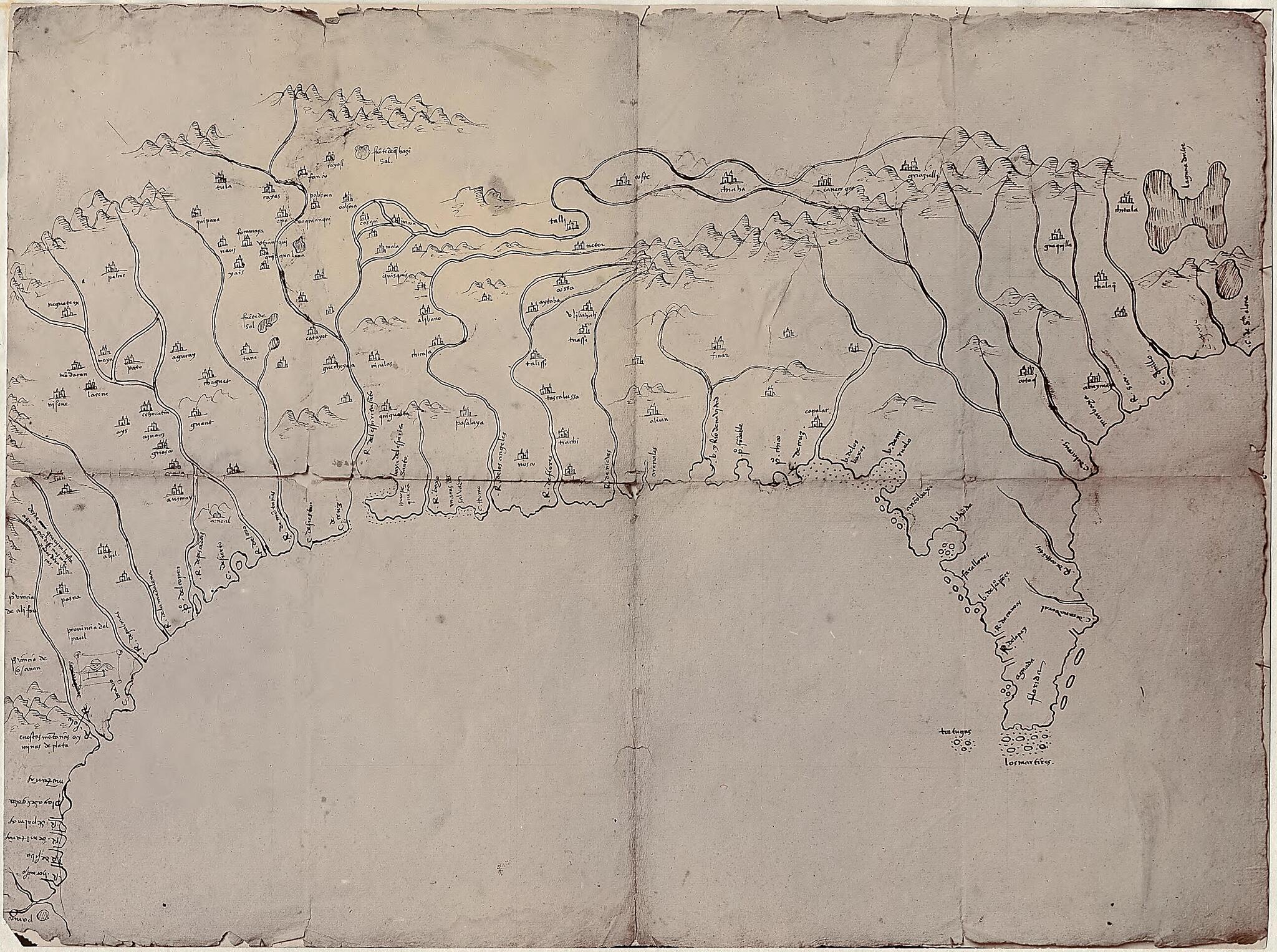
Old map of Southern States, United States.Created by Archivo General De Indias, Alonso De Santa Cruz in 1572.
- Relief shown pictorially.
- Shows the coast from the vicinity of the Cape Fear River in North Carolina of the United States, location of Indian settlements, and lakes and rivers in the region to the Pánuco River in Mexico; the interior is as far north as the latitude of the Tennessee River.
- Photocopy. [Sevilla : Archivo General de Indias, 1977?] 1 map ; 18 x 23 cm.
- Photograph of a ms. map without name, title or date. Original in Arch. de las Ind. Sevilla.
- Title from P. Torres Lanzas' Relación descriptiva de los mapas, planos &c. de México y Floridas ... 1900, no. 1.
- Includes annotations in black ink and pencil.
Map Subjects
Early Works To 1800
Facsimiles
Indians Of North America
Rivers
Southern States
United States
Archivo General De Indias
Alonso De Santa Cruz
1572
- For the best legibility, order your map in the original size or larger. Most maps have intricate detail and small text that is best appreciated when the print size hasn't been reduced.
- Sizes labeled "Fits a Standard Frame" will drop right into any frame that you purchase in that size. The sizes that we offer are commonly available online and at most retail stores.
- Our standard sizes are recommendations based on the aspect ratio of the original map, but still may require some added "white space" in one dimension to fit.
- Non-standard sizes will require custom framing, and we suggest taking your print to the frame shop of your choice after you receive it for the best results.
- Custom sizes are available, simply contact us for a quote.
Below is an approximation of the scale of a few standard sizes, and how they might appear in your space.

