
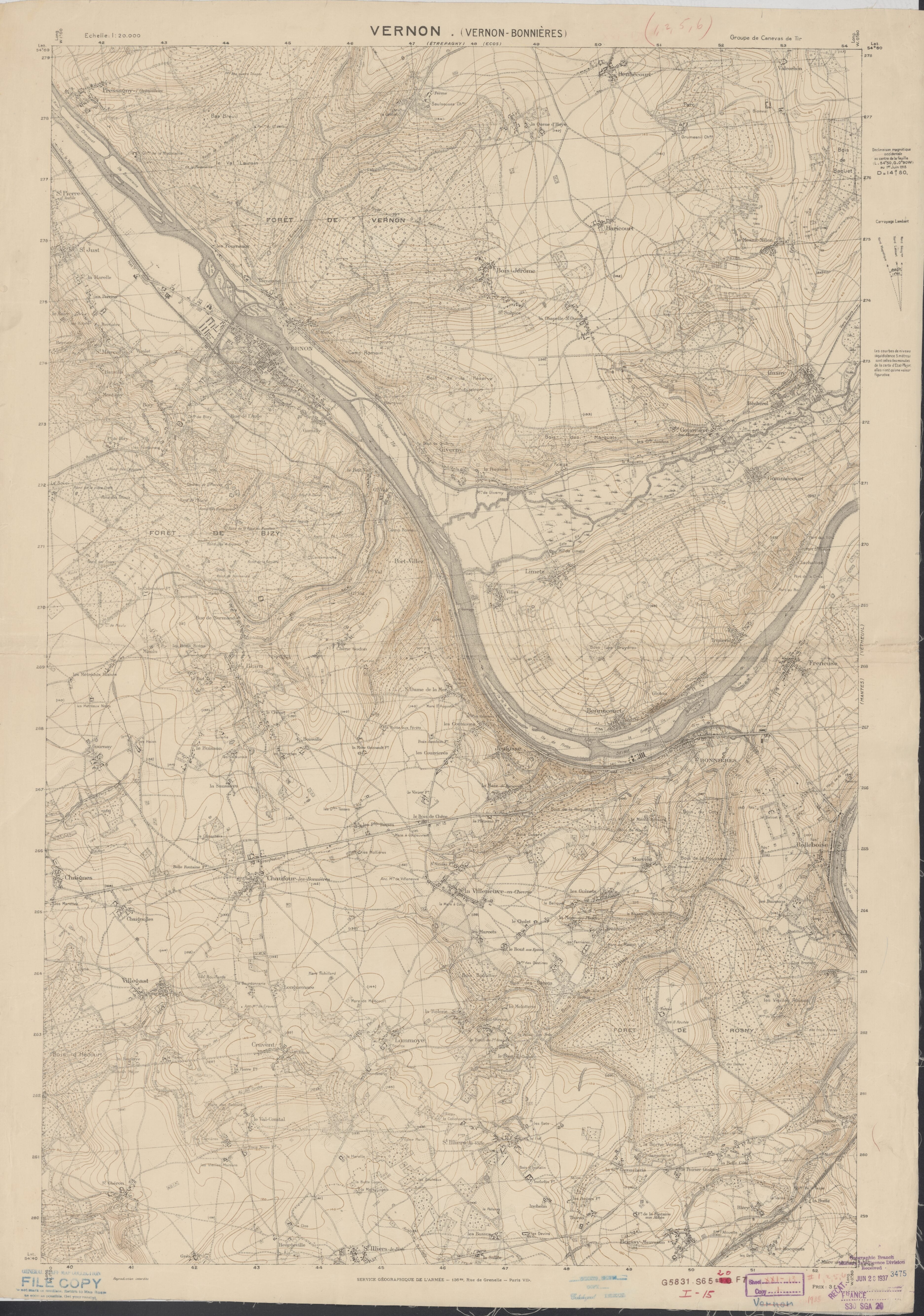
Maps Showing Entrenchments In France During World War I at a Scale of 1:20,000 in 1915
- Regular price
-
$205.95 - Regular price
-
$200.95 - Sale price
-
$205.95
Buy one map, get any other map in our collection for 50% OFF! Add to cart to see discount.
Couldn't load pickup availability
About This Map
Discover the timeless beauty of our fine art quality printed reproduction of this antique map. Perfect for history enthusiasts, collectors, and interior decorators.
Restored with meticulous attention to detail by our team with over a decade of experience, this stunning reproduction captures the intricate artistry and historical significance of the original map.
Whether you're a collector or seeking a unique decor piece, this archival-quality map reproduction is a timeless addition to any space. Order now to bring history to life!
Old topographic map of Belgium, France.The collection consists of 477 maps from World War I created by American and French forces that show trenches and related military information in France and Belgium.
Created by France. Armée. Service Géographique, Charles Pelot Summerall, United States. Army in 1915.
- Relief shown by contours and spot heights.
- Title supplied by cataloger.
- In upper left or right margin of some sheets: Groupe des canevas de tir; Canevas de tir; Plan directeur.
- On verso of 1 sheet: Carte de France à 1/200.000. Aix-la-Chapelle.
- Includes various issues of some sheets.
- One sheet printed on both sides.
- Some sheets include index to adjoining sheets and boundary diagram.
- On some sheets: Secret.
- Some sheets stamped Summerall Papers.
- Some sheets stamped G-2-C, indicating that the U.S. Army printed the map.
- Some sheets cover Belgium.
- Trenches and other military positions are illustrated in red, blue or both.
- An index map is stored with the collection.
- Finding aid available in the Geography and Map Reading Room and at http://hdl.loc.gov/loc.gmd/eadgmd.gm019004
- For the best legibility, order your map in the original size or larger. Most maps have intricate detail and small text that is best appreciated when the print size hasn't been reduced.
- Sizes labeled "Fits a Standard Frame" will drop right into any frame that you purchase in that size. The sizes that we offer are commonly available online and at most retail stores.
- Our standard sizes are recommendations based on the aspect ratio of the original map, but still may require some added "white space" in one dimension to fit.
- Non-standard sizes will require custom framing, and we suggest taking your print to the frame shop of your choice after you receive it for the best results.
- Custom sizes are available, simply contact us for a quote.
Below is an approximation of the scale of a few standard sizes, and how they might appear in your space.

