
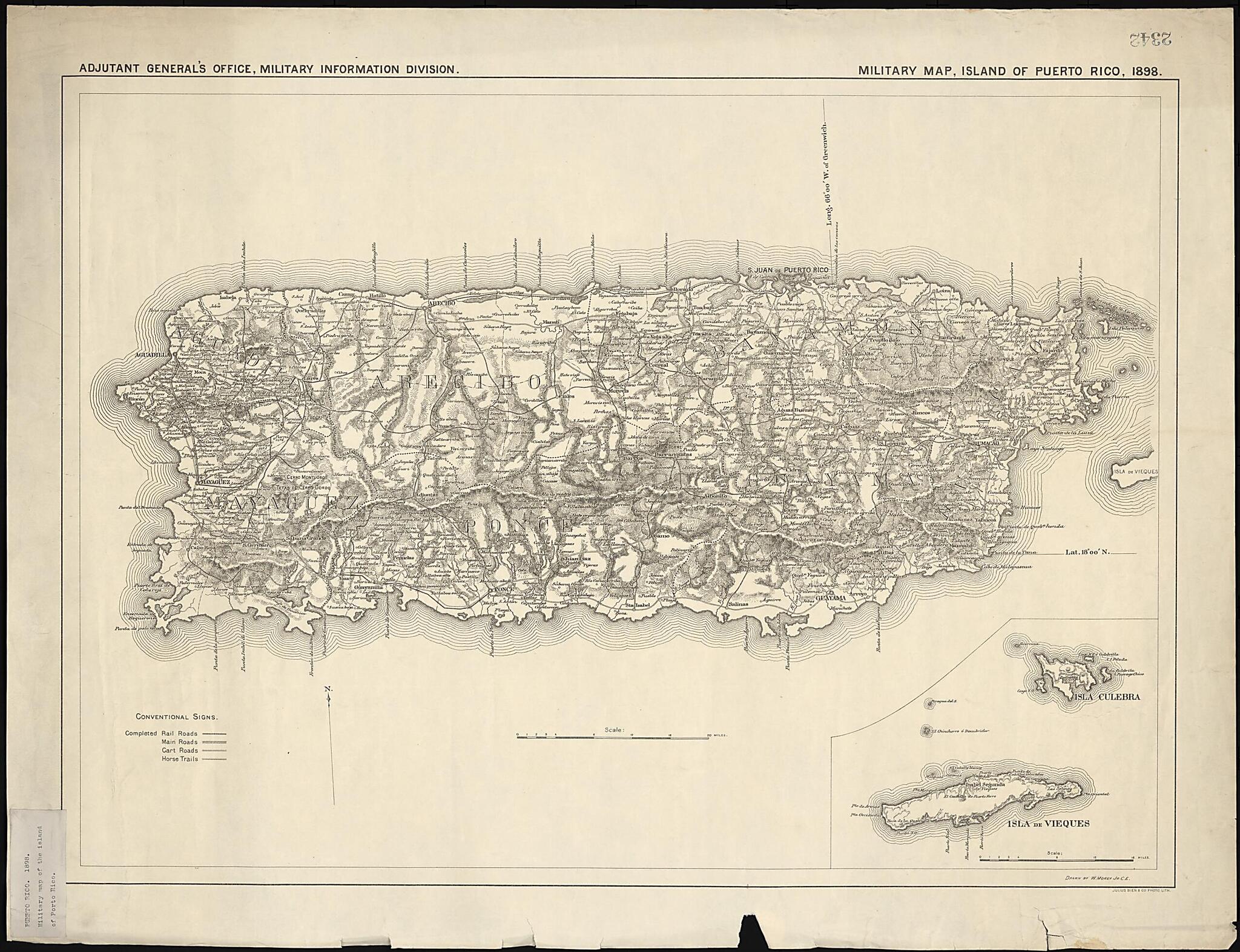
Military Map, Island of Puerto Rico 1898
- Regular price
-
$147.95 - Regular price
-
$142.95 - Sale price
-
$147.95
Buy one map, get any other map in our collection for 50% OFF! Add to cart to see discount.
Couldn't load pickup availability
About This Map
Discover the timeless beauty of our fine art quality printed reproduction of this antique map. Perfect for history enthusiasts, collectors, and interior decorators.
Restored with meticulous attention to detail by our team with over a decade of experience, this stunning reproduction captures the intricate artistry and historical significance of the original map.
Whether you're a collector or seeking a unique decor piece, this archival-quality map reproduction is a timeless addition to any space. Order now to bring history to life!
Old map of Puerto Rico, United States of America.American War, seized the island from Spain. Hostilities began on May 12 with a blockade and bombardment of the city of San Juan by the U.S. Navy. This was followed with the landing off the coast of Guánica on July 12 of a force of 1,300 U.S. soldiers. In the peace treaty that was signed in Paris on December 10, 1898, the United States formally acquired Puerto Rico from Spain, along with Guam and the Philippines. Issued by the Military Information Division of the Adjutant General's Office of the U.S. Army, the map is by W. Morey of the U.S. Army Corps of Engineers. The emphasis is on transportation, with railroads, main roads, cart trails, and horse trails shown. The scale is in miles (1 mile = 1.61 kilometers). An inset map at the lower right shows Vieques, Culebra, and several smaller islands belonging to Puerto Rico.
Created by Julius Bien and Company, W. Morey in 1898.
- Title devised, in English, by Library staff.
- Original resource extent: 74.5 x 53.5 centimeters.
- Original resource at: Columbus Memorial Library, Organization of American States.
- Content in English.
- Description based on data extracted from World Digital Library, which may be extracted from partner institutions.
Map Subjects
Military Maps
Puerto Rico
American War
United States Of America
Julius Bien And Company
W. Morey
1898
- For the best legibility, order your map in the original size or larger. Most maps have intricate detail and small text that is best appreciated when the print size hasn't been reduced.
- Sizes labeled "Fits a Standard Frame" will drop right into any frame that you purchase in that size. The sizes that we offer are commonly available online and at most retail stores.
- Our standard sizes are recommendations based on the aspect ratio of the original map, but still may require some added "white space" in one dimension to fit.
- Non-standard sizes will require custom framing, and we suggest taking your print to the frame shop of your choice after you receive it for the best results.
- Custom sizes are available, simply contact us for a quote.
Below is an approximation of the scale of a few standard sizes, and how they might appear in your space.

